featuresOctober 7, 2007
Fantastic rocks
Remember the Road Runner cartoons? Wile E. Coyote always found himself in the middle of a ridiculous landscape of arches, spires and cliffs that defied gravity. Missouri has something like that, but on a much smaller scale. Pickle Springs Natural Area in Ste. Genevieve County features peculiar rock formations that could easily form the backdrop of a cartoon...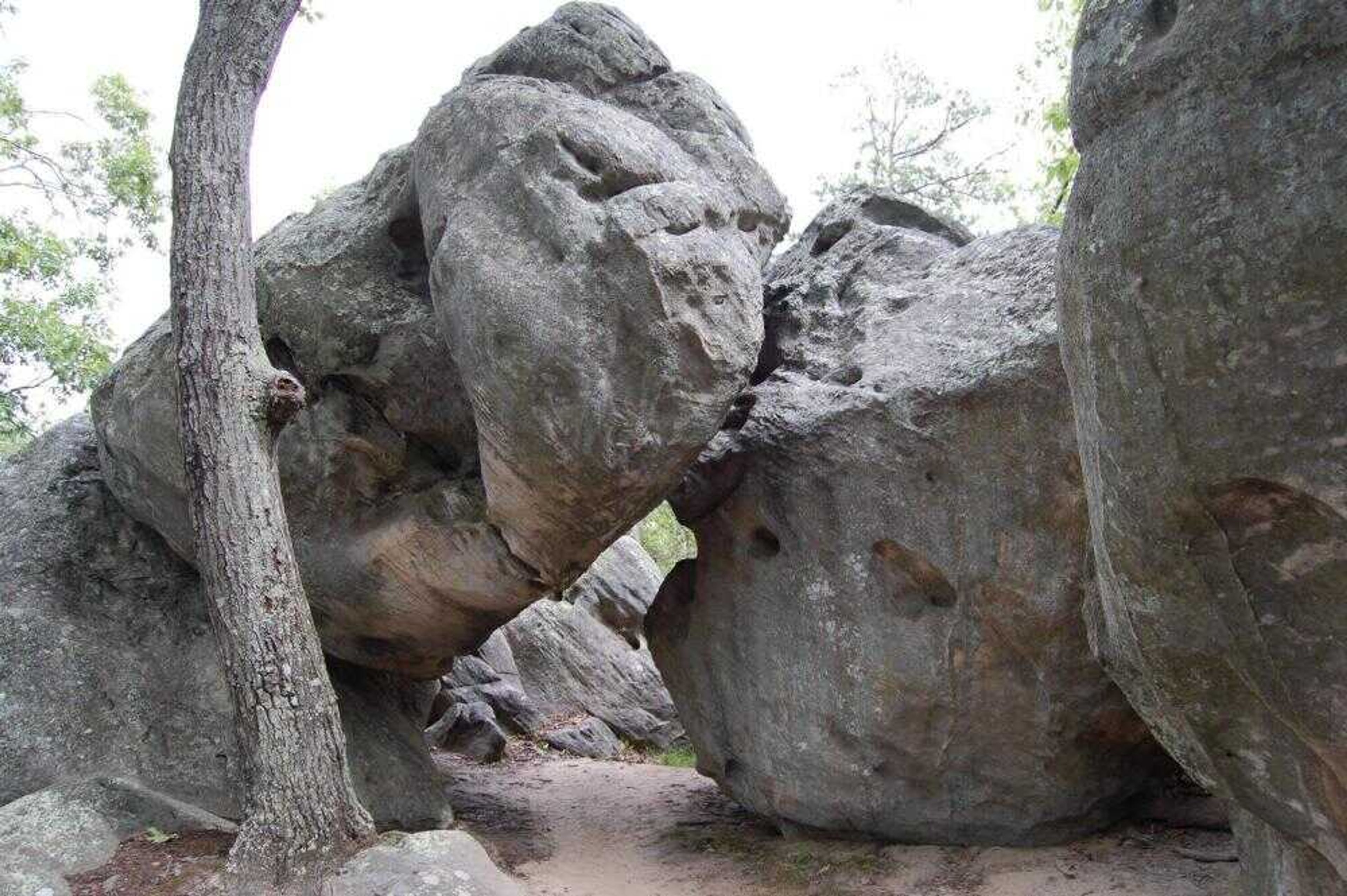
Remember the Road Runner cartoons? Wile E. Coyote always found himself in the middle of a ridiculous landscape of arches, spires and cliffs that defied gravity.
Missouri has something like that, but on a much smaller scale. Pickle Springs Natural Area in Ste. Genevieve County features peculiar rock formations that could easily form the backdrop of a cartoon.
A two-mile trail loops through the natural area, passing curiosities with names like the Keyhole and Terrapin Rock. The trail is a moderate hike and can be done in an hour at a leisurely pace, but will take longer because the natural rock formations and scenery beg to be admired.
Not far from the parking lot, the trail makes a grand entrance through the Slot, a long crevice only a few feet wide.
Soon after, the trail encounters Double Arch, arguably the most photographic feature at Pickle Springs. Two slender columns support a rock ledge. This, in turn, supports an elephant-sized boulder standing precariously on two tiny feet. The scene will make you wonder how the formation is still standing.
Around the corner, two rocks lean against each other to form a narrow arch under which the trail passes. This is the Keyhole. On the other side of the passage, a pair of trees has been uprooted and are now resting lazily against a rock.
Next, the trail skirts around a boulder called Terrapin Rock. Terrapin is an old word for turtle, and this rock does, indeed, look like a turtle from a certain angle.
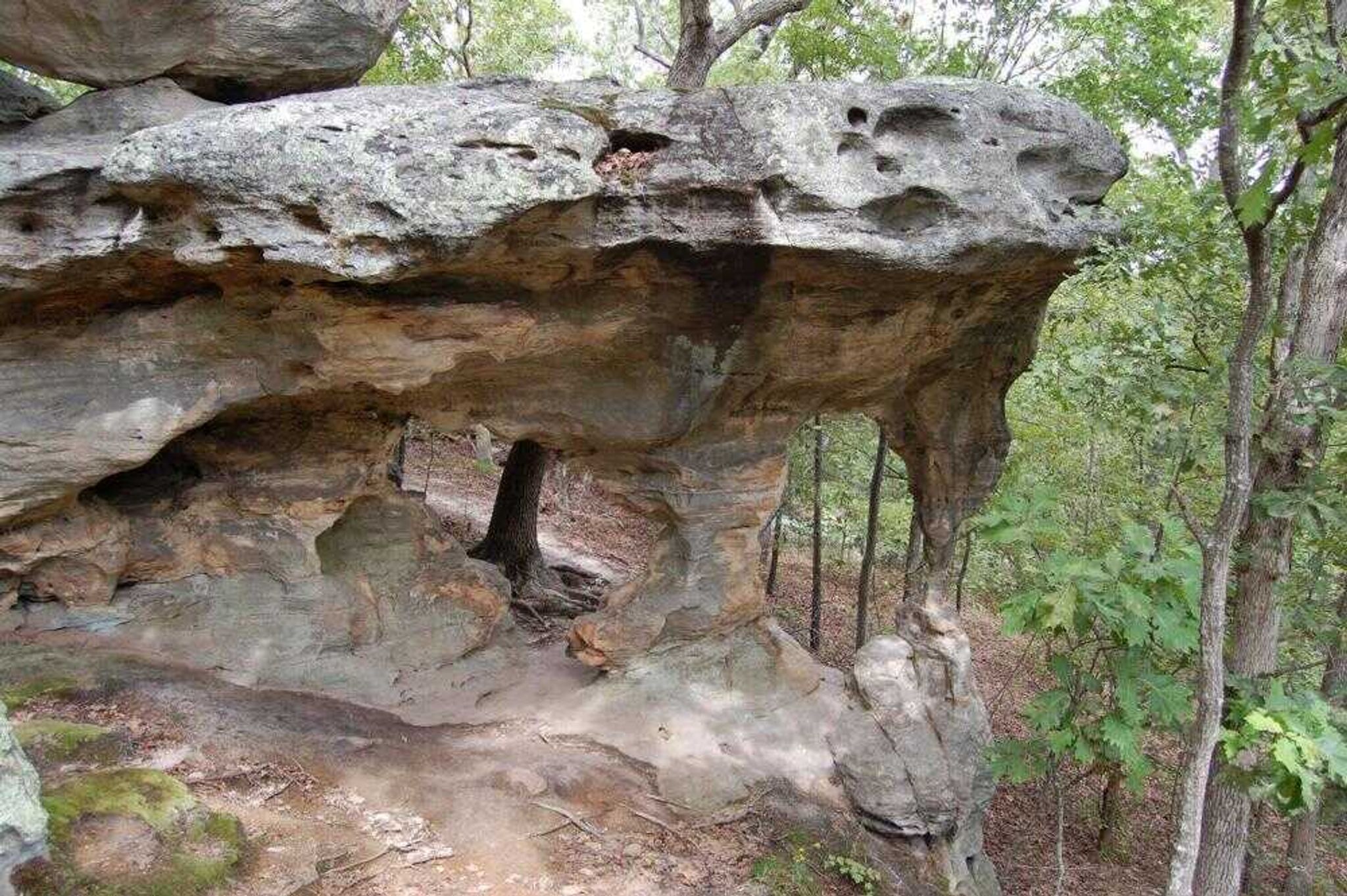
The trail meanders across a series of hills and creeks before reaching Spirit Canyon, a horseshoe-shaped valley lined with rock bluffs. A sandstone shelter along one side is just big enough to provide protection from the rain.
Receive Daily Headlines FREESign up today!
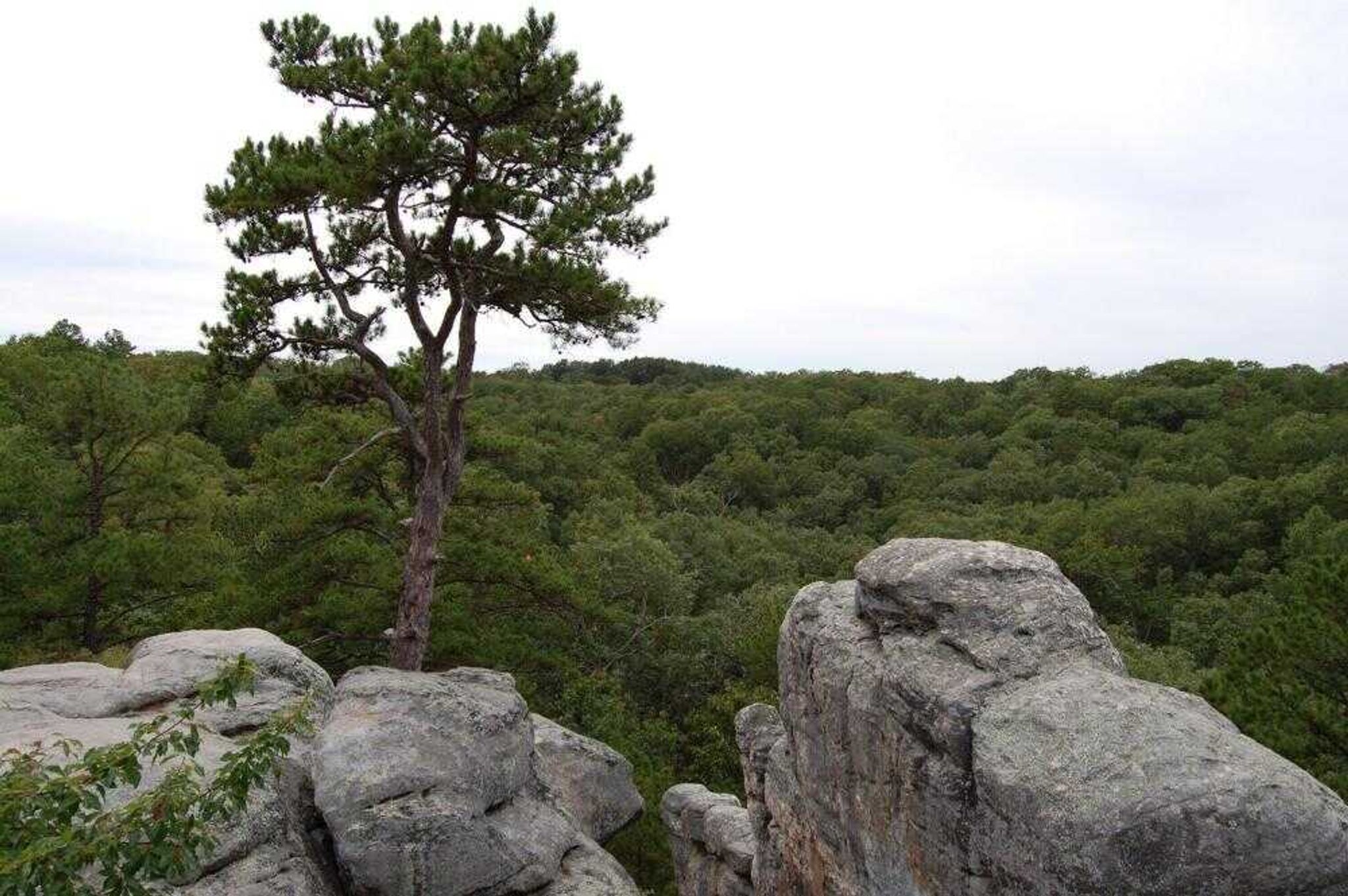
After climbing out of Spirit Canyon, the trail opens suddenly into a clearing, Dome Rock, that provides a panoramic view of the Pickle Creek valley. After hiking for over a mile in dense woods, the view at Dome Rock is unexpected, and it takes few moments to adjust to the bright sunlight.
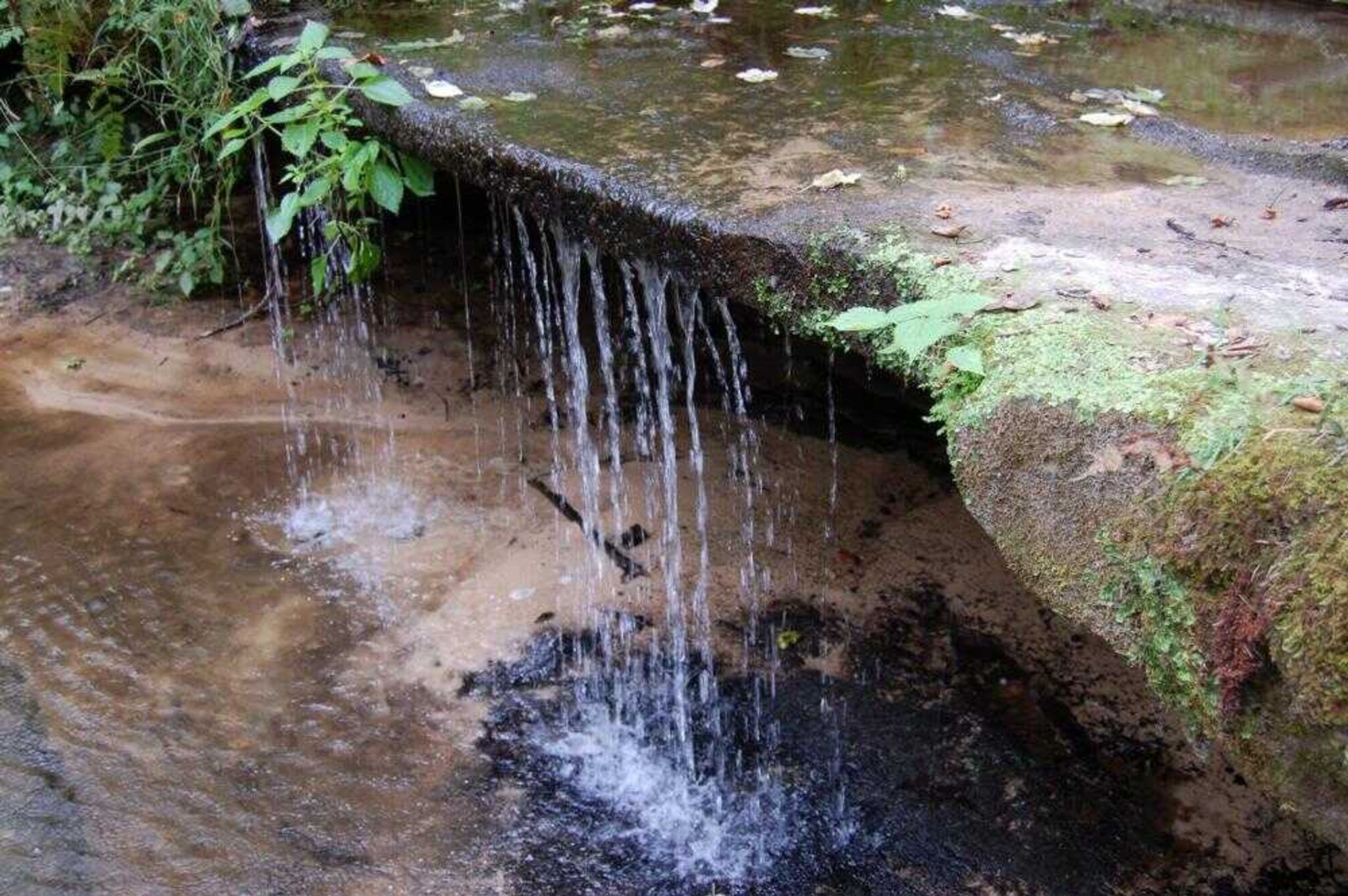
Leaving the hills, the trail drops down into the valley and reaches the namesake Pickle Springs, where the headwaters of Pickle Creek trickle across a low waterfall. The creek was reportedly named for William Pickles, an early landowner who was killed during the Civil War.
Finally, the trail enters one more canyon, Rockpile Canyon, filled with a haphazard collection of boulders that have tumbled from the cliffs above. It's hard to resist the temptation to scramble across the rocks for a better look. The rocks are fairly stable. The trail has warning signs to adhere to, but this pile is unmarked.
It's also hard to leave Rockpile Canyon, knowing that the parking lot is only a short distance away. However, a sign at the end of the trail provides driving directions to another nearby natural area, Hickory Canyons, that includes even more rock formations that Wile E. Coyote could call home.
jbaughn@semissourian.com
335-6611, extension 212
---
Driving directions:
From Cape Girardeau, take Interstate 55 north to the Highway 32 interchange at Ste. Genevieve (Exit 150). Turn left and take Highway 32 west for 16 miles to the junction with Route AA. Follow AA for three-quarters of a mile and make a sharp left on Dorlac Road. A short distance on this gravel road, look for the Pickle Springs parking area on the right.
Story Tags
Advertisement
Connect with the Southeast Missourian Newsroom:
For corrections to this story or other insights for the editor, click here. To submit a letter to the editor, click here. To learn about the Southeast Missourian’s AI Policy, click here.
Related


Advertisement
Receive Daily Headlines FREESign up today!
