NewsApril 25, 2011
Flash flooding, river flooding cause concern in region
With the ground sodden and waterways swollen across Southeast Missouri, the National Weather Service warned that more heavy rain is on the way.Staff and wire reports
ST. LOUIS -- With the ground sodden and waterways swollen across Southeast Missouri, the National Weather Service warned that more heavy rain is on the way.
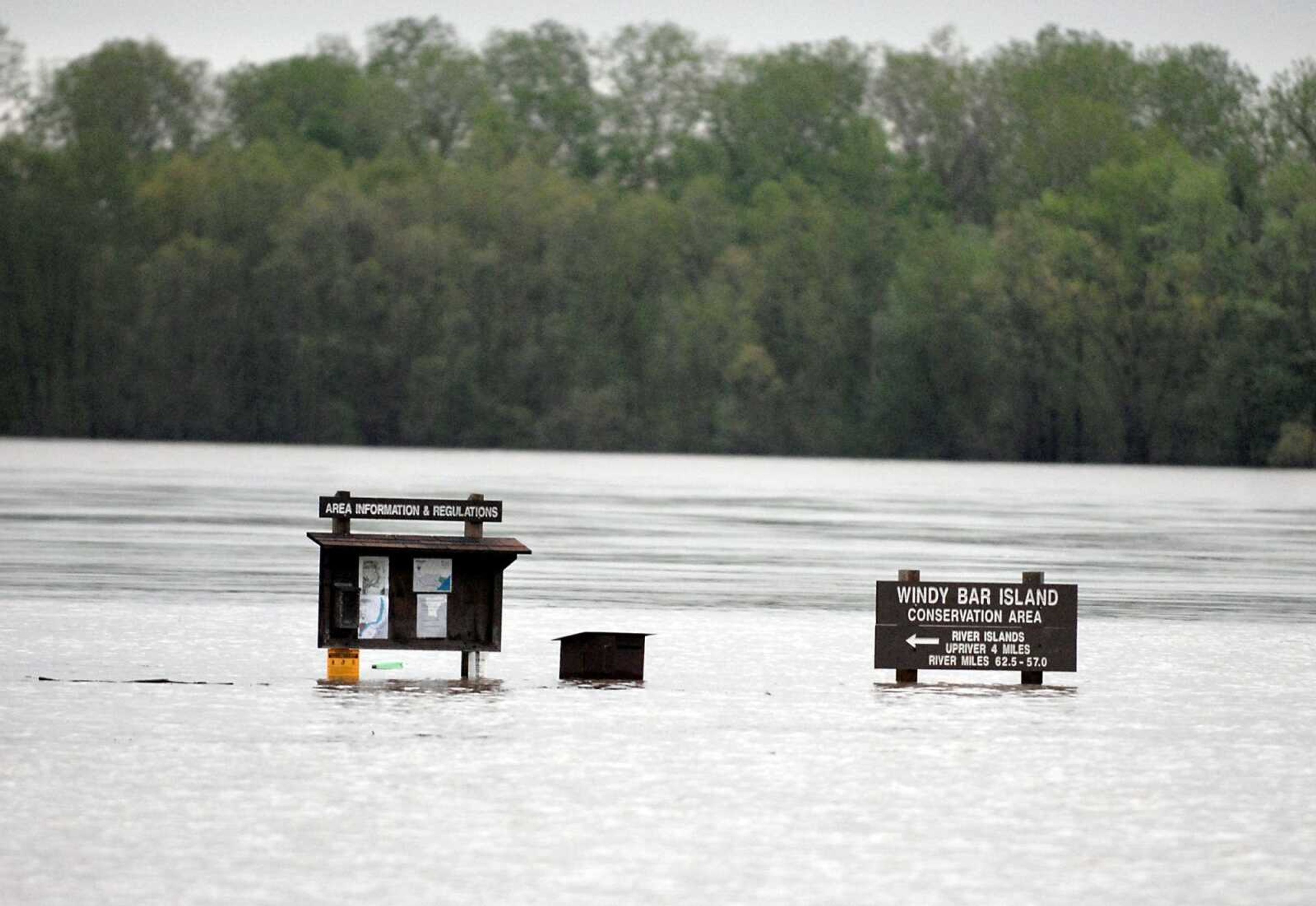
In addition to the threat of flash flooding -- the area is under a flash flood watch until Tuesday -- the Mississippi River is expected to crest at nearly 6 feet above flood stage in St. Louis by midweek, and nearly 10 feet above flood stage in Cape Girardeau on Thursday.
Crest predictions could rise even higher, the weather service said, as parts of eastern Missouri south of St. Louis could get up to 9 additional inches of rain through Wednesday.
Early Sunday, the U.S. Army Corps of Engineers Memphis District increased its flood fighting activities, stationing more staff at levees and other floodworks along the Ohio and Mississippi rivers. The Ohio River stage at Cairo, Ill., topped 50 feet Sunday and is expected to crest at 60 feet May 3. In Cape Girardeau on the Mississippi, river stage reached 38 feet Sunday and is forecast to crest at 44.5 feet Thursday. Flood stage is 32 feet.
The Missouri River also was flooding, and many tributaries were rising.
Receive Daily Headlines FREESign up today!
"We kind of remain locked in this wet weather pattern with no big change in sight through early next week," meteorologist Scott Truett said. "The concern is kind of becoming that with additional heavy rainfall, flash flooding is going to occur more rapidly because of the saturated ground conditions."
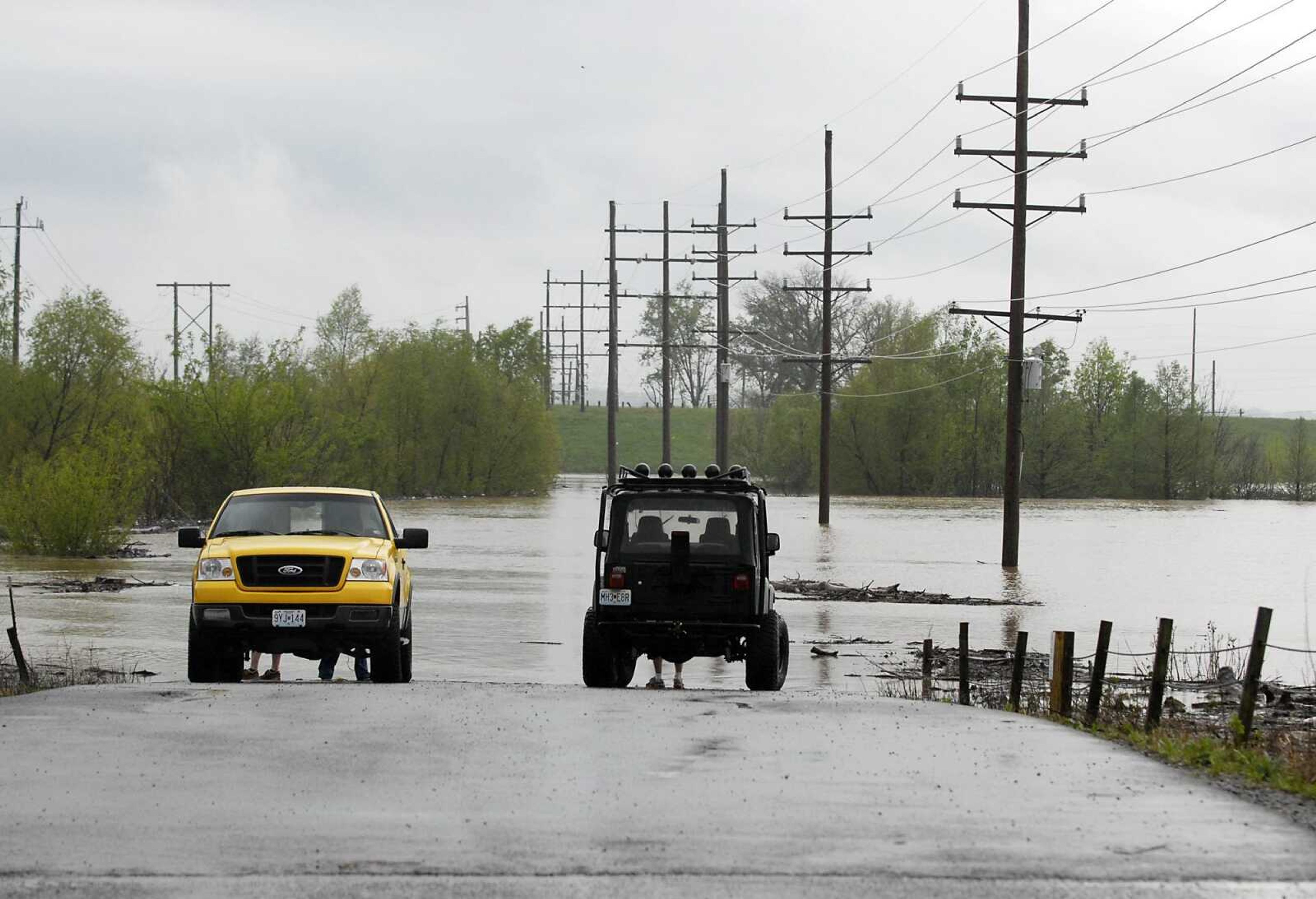
Among the hardest hit areas so far is St. Francois County, about 70 miles northwest of Cape Girardeau. In Farmington, Mo., fire crews have had to rescue several people from homes and cars over the past few days due to flash flooding. High water damaged a couple of apartment complexes, forcing residents to temporarily relocate.
The weather service also was concerned about flash flooding in Southeast Missouri, where heavy rainfall is expected through midweek.
In a news conference Sunday, Rick Shanklin with the National Weather Service said there is "great concern for level for flash flooding, and eventually major river flooding, that is rarely seen in our region."
Areas not typically prone to flooding could be affected, Shanklin said, because of the heavy rainfall the region has already received with more storms forecast through Wednesday.
Shanklin warned about the dangers of driving through flooded roads or playing in floodwaters or drainage ditches, saying they are the common cause of fatalities in flash flooding.
As of 6 p.m. Sunday, MoDOT closed Route H in Bollinger County, Route OO, from Route Z to Route 34, Route A, and Route U in Cape Girardeau County and Route A in Perry County. The department also closed Route EE, from Delta to Chaffee, Mo., in Scott County.
Story Tags
Advertisement
Connect with the Southeast Missourian Newsroom:
For corrections to this story or other insights for the editor, click here. To submit a letter to the editor, click here. To learn about the Southeast Missourian’s AI Policy, click here.


Advertisement
Receive Daily Headlines FREESign up today!
