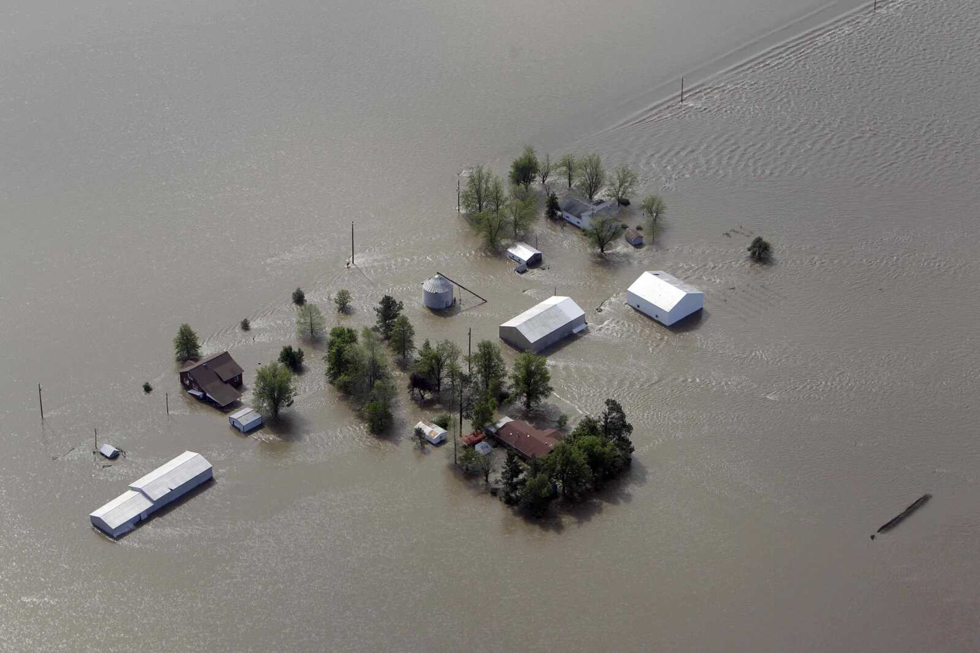
Corps: Damage from 2011 floods could mean more danger in 2012
NEW ORLEANS -- Damage from last year's record spring floods could leave many people along the Mississippi River in even more danger this year, the U.S. Army Corps of Engineers said Thursday. It says it's assessing the damage to levees, structures and navigation channels, and will begin notifying affected communities in February...
NEW ORLEANS -- Damage from last year's record spring floods could leave many people along the Mississippi River in even more danger this year, the U.S. Army Corps of Engineers said Thursday.
It says it's assessing the damage to levees, structures and navigation channels, and will begin notifying affected communities in February.
"We want to identify every place where we have problem areas. Once we have those identified, we get to those as quickly as we can before the next big flood. Hopefully, it doesn't come this year," corps spokesman Bob Anderson said. "If it does come this year, that's when those communities in the areas of greater risk would need to be notified."
Congress gave the corps $802 million in December to fix levees up and down the river.
Identifying the weakest points and letting people know where they are is part of that, said Anderson, a spokesman for the corps' Vicksburg Division.
Assessments began as soon as the floodwaters went down, he said, and repairs are underway in parts of Missouri and some areas north of Vicksburg, Miss.
"Each damaged location has been characterized by its likelihood of failure and potential consequences if there is a failure," said Scott Whitney, regional flood risk manager for the Mississippi Valley Division. He said the corps will use a web-based application called CorpsMap and information papers to send out the information.
The Corps said in December that there was a significant risk of more flooding along the Birds Point Floodway, where it blew three holes in a levee to relieve pressure as floods threatened nearby Cairo, Ill. The floodway levee is designed to be breached in cases of extreme flooding.
It has been rebuilt to 55 feet, but still needs to be raised to 62.5 feet, he said.
"A couple more areas that we haven't fixed but know where they are, are where the river tried to change course," Anderson said.
He said the biggest of those was just north of Tiptonville, Tenn. Another, less seriously damaged area is north of Louisiana's Old River Control Structure built in 1962 to keep the Atchafalaya River from capturing the Mississippi.
The bank there had been covered with concrete mats tied together with steel wire to keep the current from scouring out the riverbank. "The force of the river was so strong along that bend that it tore up some of those revetments and gouged out a large section of the bank," Anderson said.
Other Corps divisions are in charge of repairs along the Ohio and Missouri rivers.
Most of the damage along the Mississippi River is from St. Louis south, he said.
By and large, the levees and other structures did what they were supposed to, he said. "The river was constantly attacking, it pummeled the system itself, but it never did knock it down."
Connect with the Southeast Missourian Newsroom:
For corrections to this story or other insights for the editor, click here. To submit a letter to the editor, click here. To learn about the Southeast Missourian’s AI Policy, click here.


