

Pavement Ends
James Baughn was the webmaster of seMissourian.com and its sister newspapers for 20 years. On the side, he maintained even more sites, including Bridgehunter.com, LandmarkHunter.com, TheCapeRock.com, and Humorix. Baughn passed away in 2020 while doing one of the things he loved most: hiking in Southeast Missouri. Here is an archive of his writing about hiking and nature in our area.
- Email link
- Read comments (1)
- Share:


Visit a swamp in the mountains
Posted Friday, August 15, 2008, at 3:49 PM
Cupola Pond in Ripley County might be one of the most bizarre natural places in Missouri. Somehow, a piece of "Swampeast Missouri" has been transplanted into the Ozark Mountains.

This small pond is filled with tupelo gum trees, usually only associated with swampland in the Missouri Bootheel or in the Deep South. It's an alien environment for the tupelo, sitting at an elevation of 800 feet above sea level, much higher than the level of the lowlands.
So how did the trees get here? It's a mystery. According to the book "This Land: A Guide to Central National Forests" (2006), researchers found that the sediment at the bottom of the pond is 23,000 years old, and they believe that the tupelos were here for most of that time.

Cupola Pond sits in a sinkhole, formed when the roof of a limestone cave collapsed, creating a round basin with a permanent source of water. So it provides a nice habitat for the estimated 500 tupelo trees that stand here. But that still doesn't explain how the trees could cover the 40-mile distance from the tupelo's native habitat in the swamps near Poplar Bluff.

The pond's water level varies throughout the year. When I visited last week, the open water covered only a small area, while the rest of Cupola Pond featured a carpet of mud and old leaves. It didn't look safe to walk across at first, but the ground was (mostly) firm when I carefully tested it.

A trail forms a loop around the pond, allowing a close-up look at the tupelo trees without getting your feet wet, and without getting caught in a bunch of weeds. While difficult to reach, Cupola Pond is one of the crown jewels of the Missouri Ozarks and an excellent place to visit if you like bizarre mysteries.
Driving directions
Brace yourself, because these driving directions are even more difficult than usual for this blog. [Google map]
1. Take your favorite route to Van Buren. As I explained in my blog about Falling Spring, the fastest route is I-55 south to Sikeston and then west on US 60, but Highway 34 through Marble Hill and Piedmont is more scenic.
2. Continue on Highway 60 past Van Buren, enjoying the new four-lane highway.
3. Turn left on Route J before reaching Fremont.

4. Here's the hard part: you want to go south on Route J for 13.9 miles and turn left on Forest Road 3224. This turnoff is very difficult to find; don't feel bad if you miss it. You'll want to keep a sharp lookout after passing the junction with Route K to Wilderness.
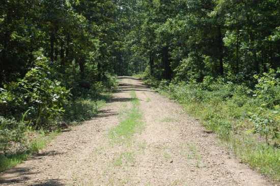
5. Take FR 3224 east for 1.3 miles. At about the 1 mile mark, you will cross into Ripley County, where the road widens but the gravel gets rougher (at least when I visited).
6. When the road curves sharply to the right, look for the turnoff on the left for Forest Road 4822 (also called County Road C-7AB). This probably won't be marked.
7. Follow this gravel lane for nearly 2 miles until it abruptly ends at the Cupola Pond trailhead. This is a decent road suitable for passenger cars in good weather, but it certainly is narrow and might be a bit scary if this is your first "Pavement Ends" trip.
8. From the parking area, it's only a short distance along the trail to the pond.

Warning: The DeLorme Atlas & Gazetteer of Missouri shows Cupola Pond in the wrong location, an error that thwarted my first attempt to find this place.
Facts
Name: Cupola Pond
What: Natural pond featuring tupelo gum trees
Claim to fame: Isolated stand of swamp trees somehow brought to the Ozark Mountains
Where: Ripley County, southwest of Van Buren
Owner: Mark Twain National Forest
Designation: National Natural Landmark (1974); Missouri Natural Area (1981)
GPS coordinates: 36.79922, -91.08957
Topographic map: Handy
- Email link
- Read comments (1)
- Share:
Trip Planner

Respond to this blog
Posting a comment requires a subscription.