NewsApril 12, 2005
Severe storm strikes Cape Girardeau County
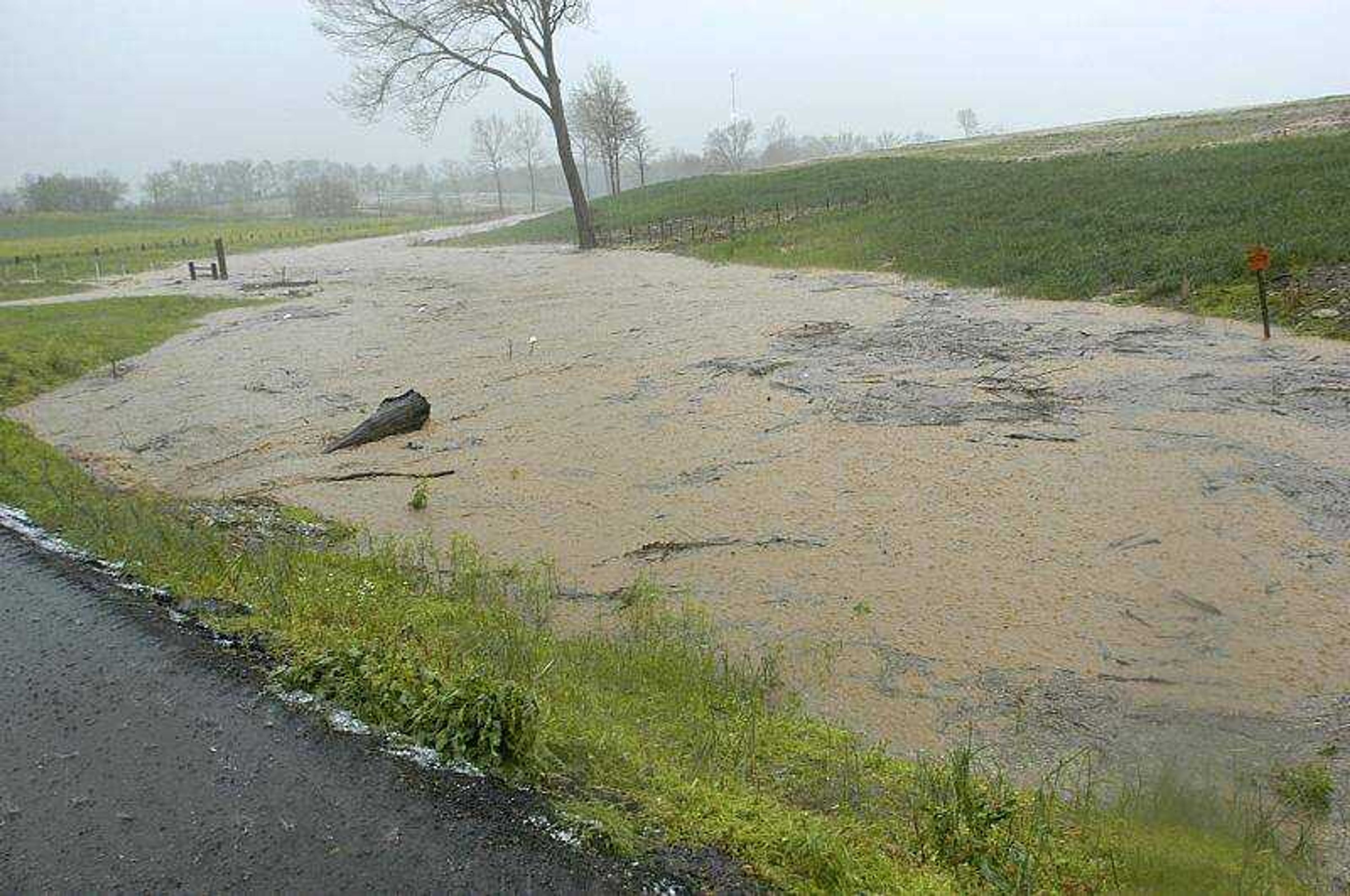
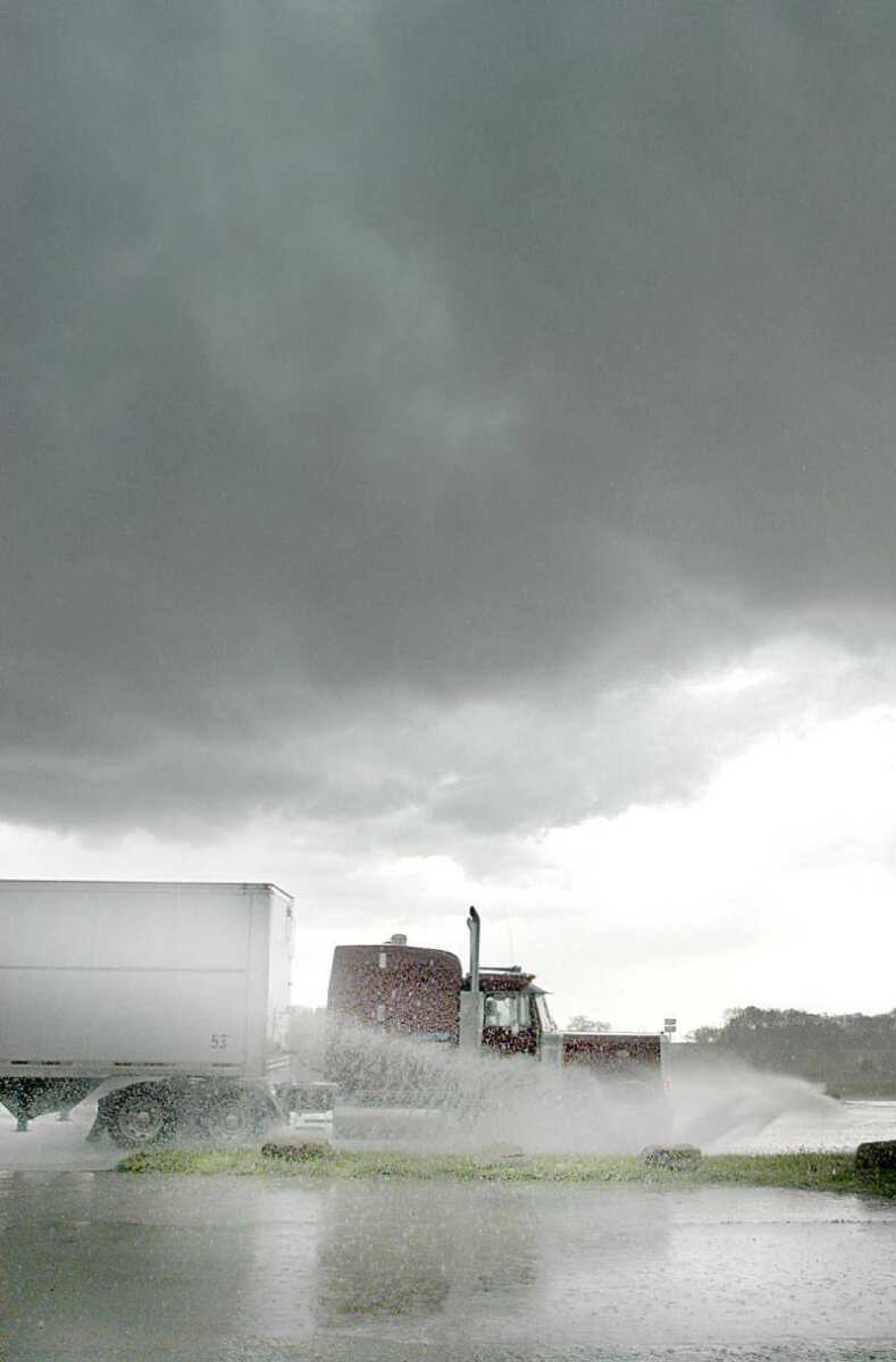
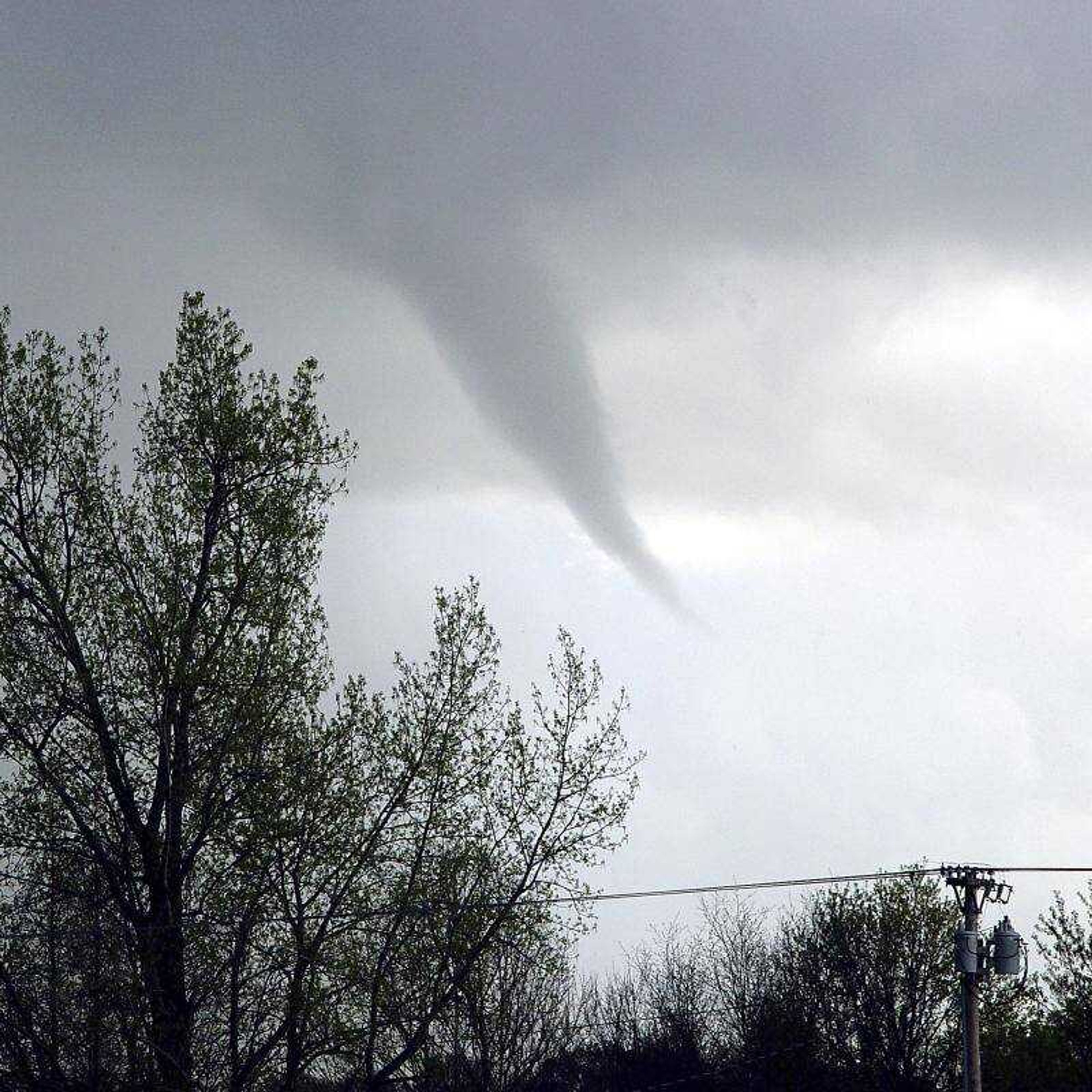
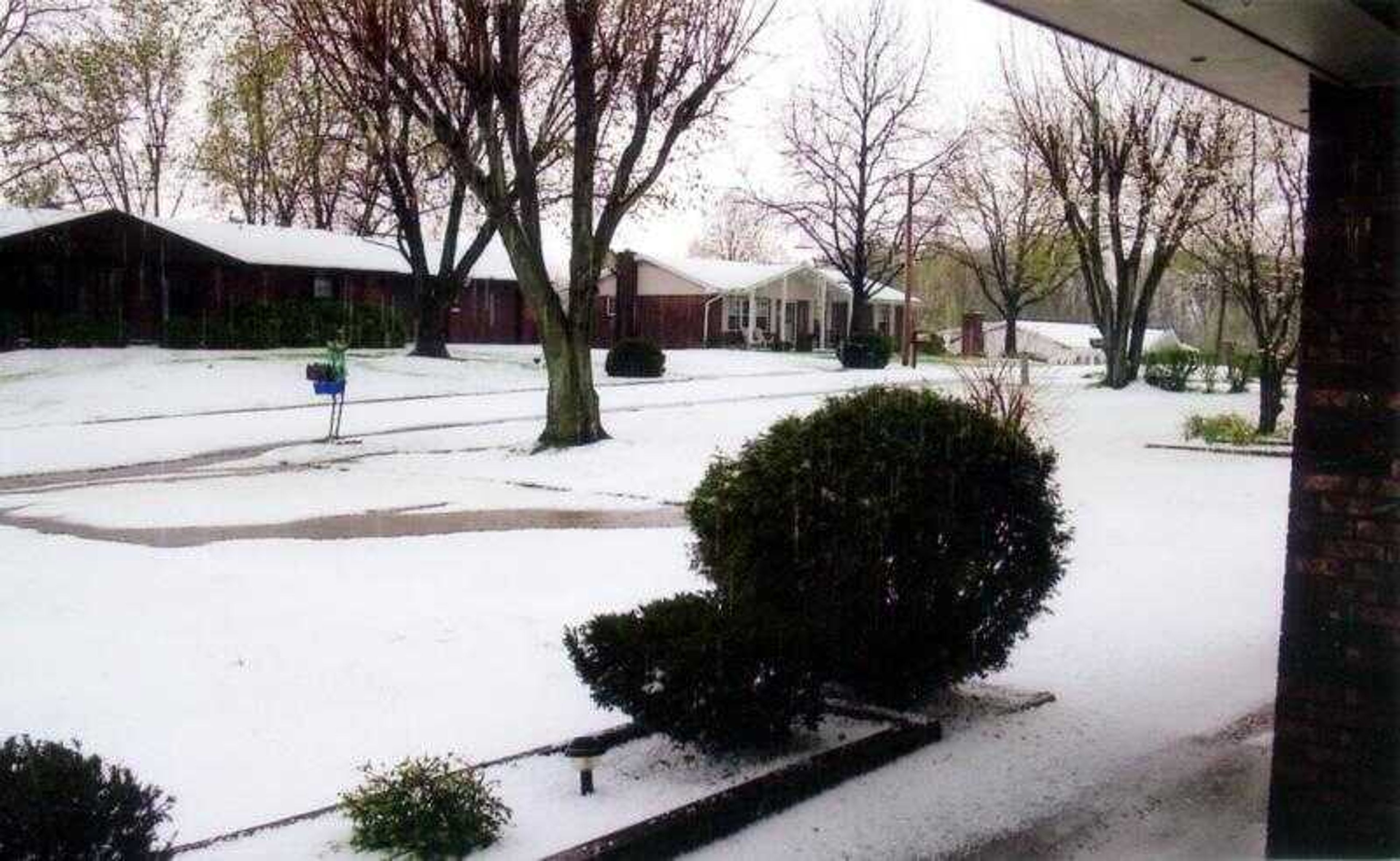
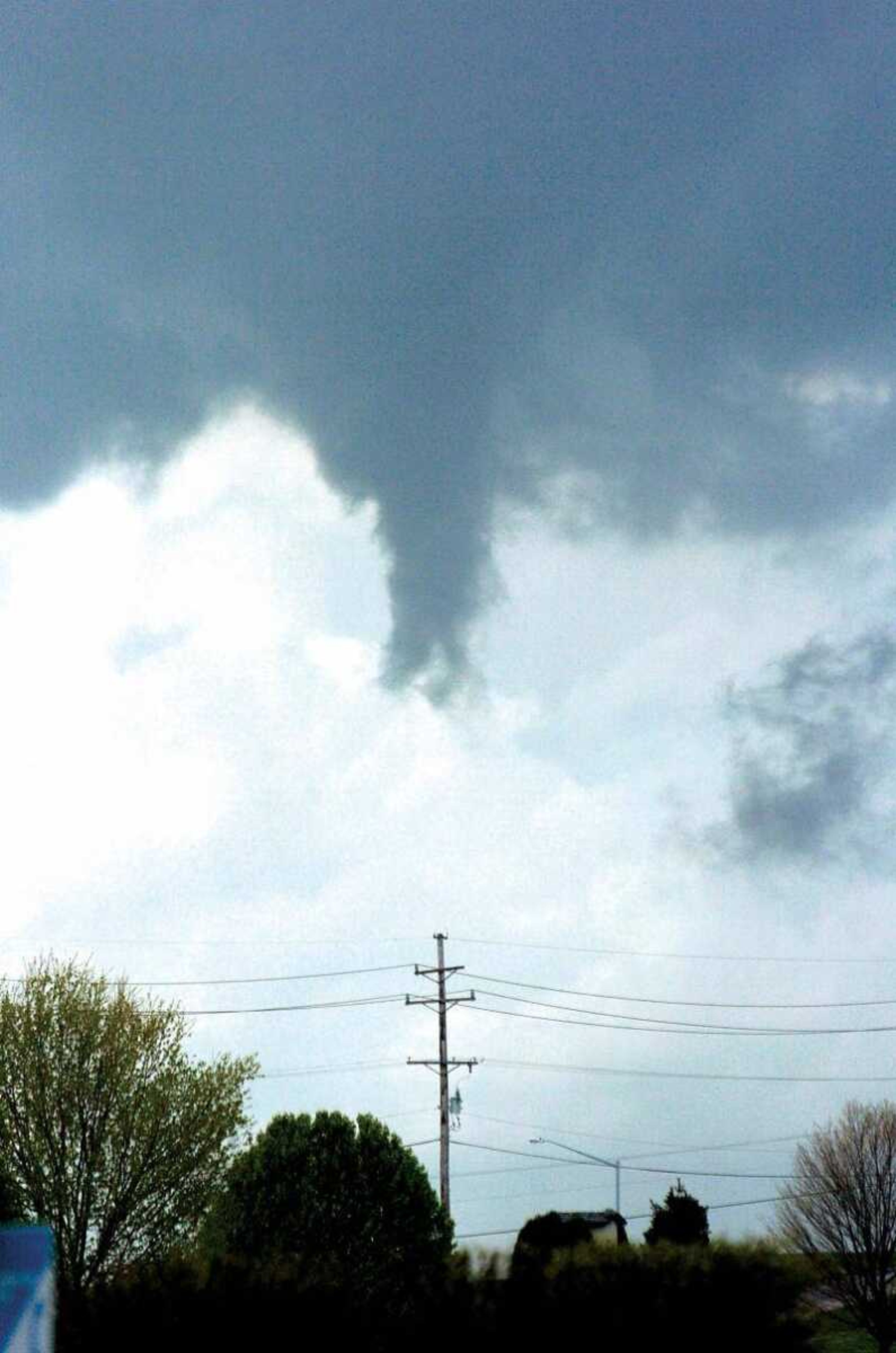
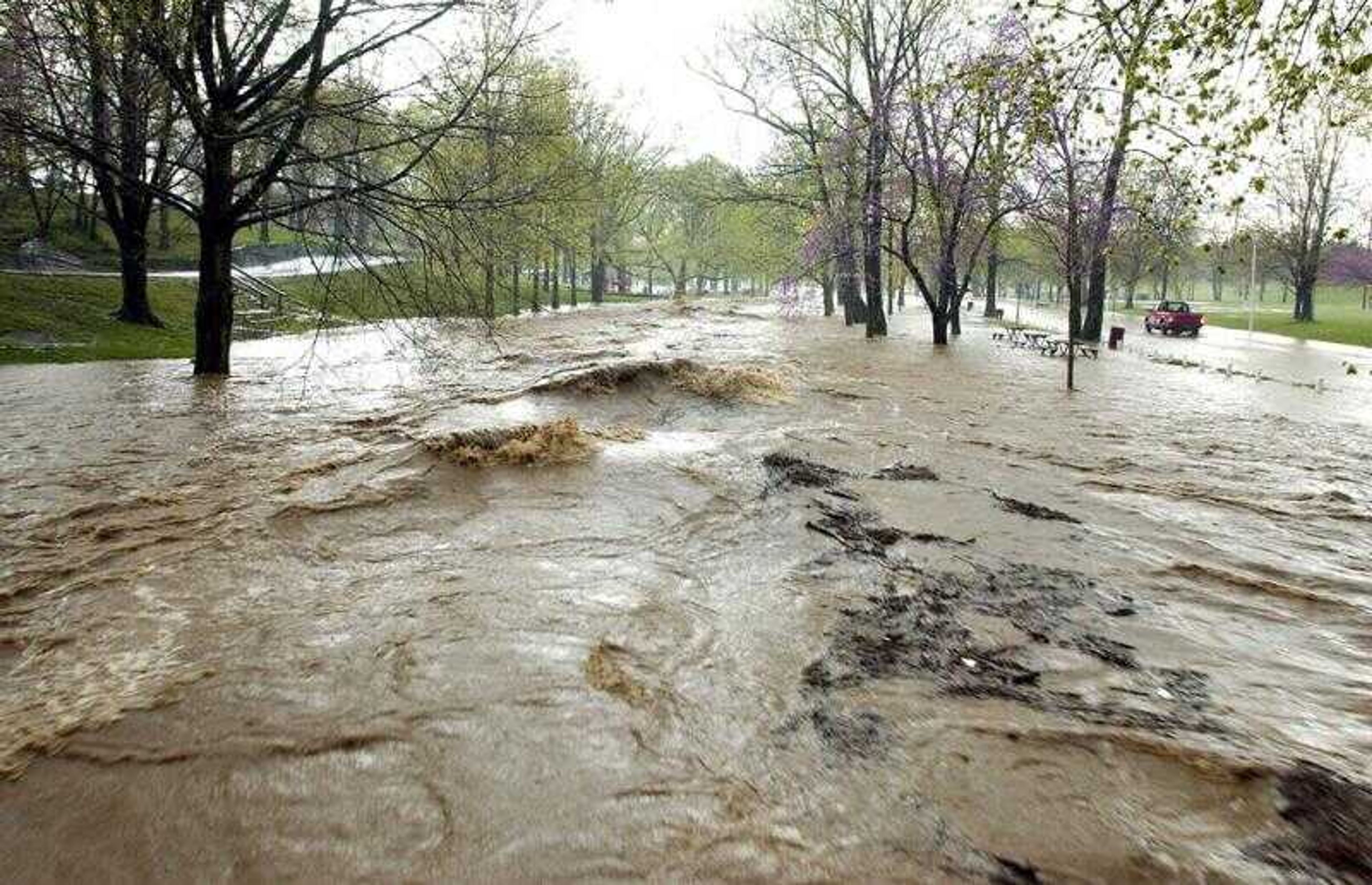
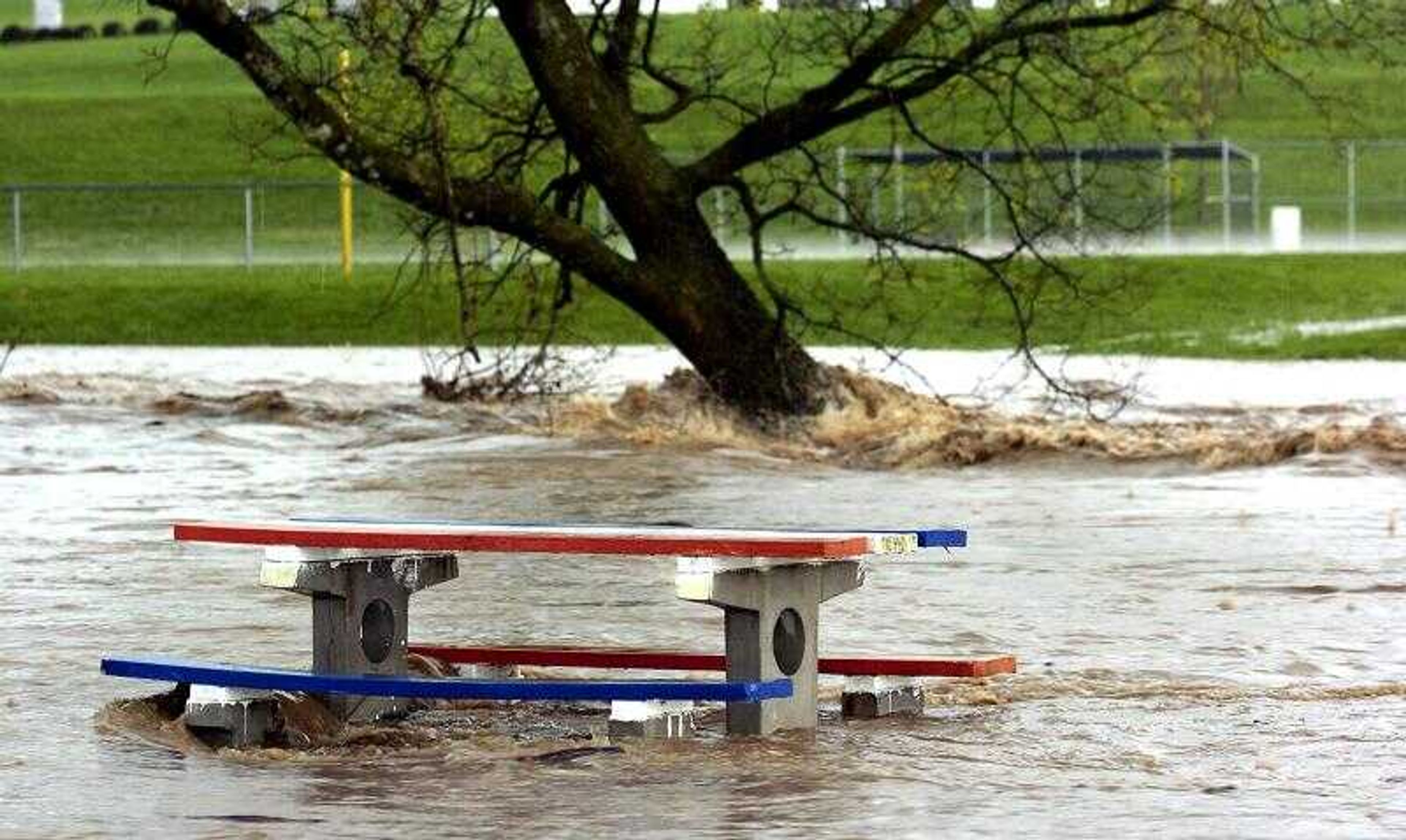
The weather turned ugly in a hurry over portions of Cape Girardeau County as a slow-moving storm produced
funnel clouds, large hail, and flash flooding during the afternoon of Tuesday, April 12, 2005.


Receive Daily Headlines FREESign up today!
The weather turned ugly in a hurry over portions of Cape Girardeau County as a slow-moving storm produced funnel clouds, large hail, and flash flooding during the afternoon of Tuesday, April 12, 2005.
Story Tags
Connect with the Southeast Missourian Newsroom:
For corrections to this story or other insights for the editor, click here. To submit a letter to the editor, click here. To learn about the Southeast Missourian’s AI Policy, click here.


Advertisement
Receive Daily Headlines FREESign up today!
