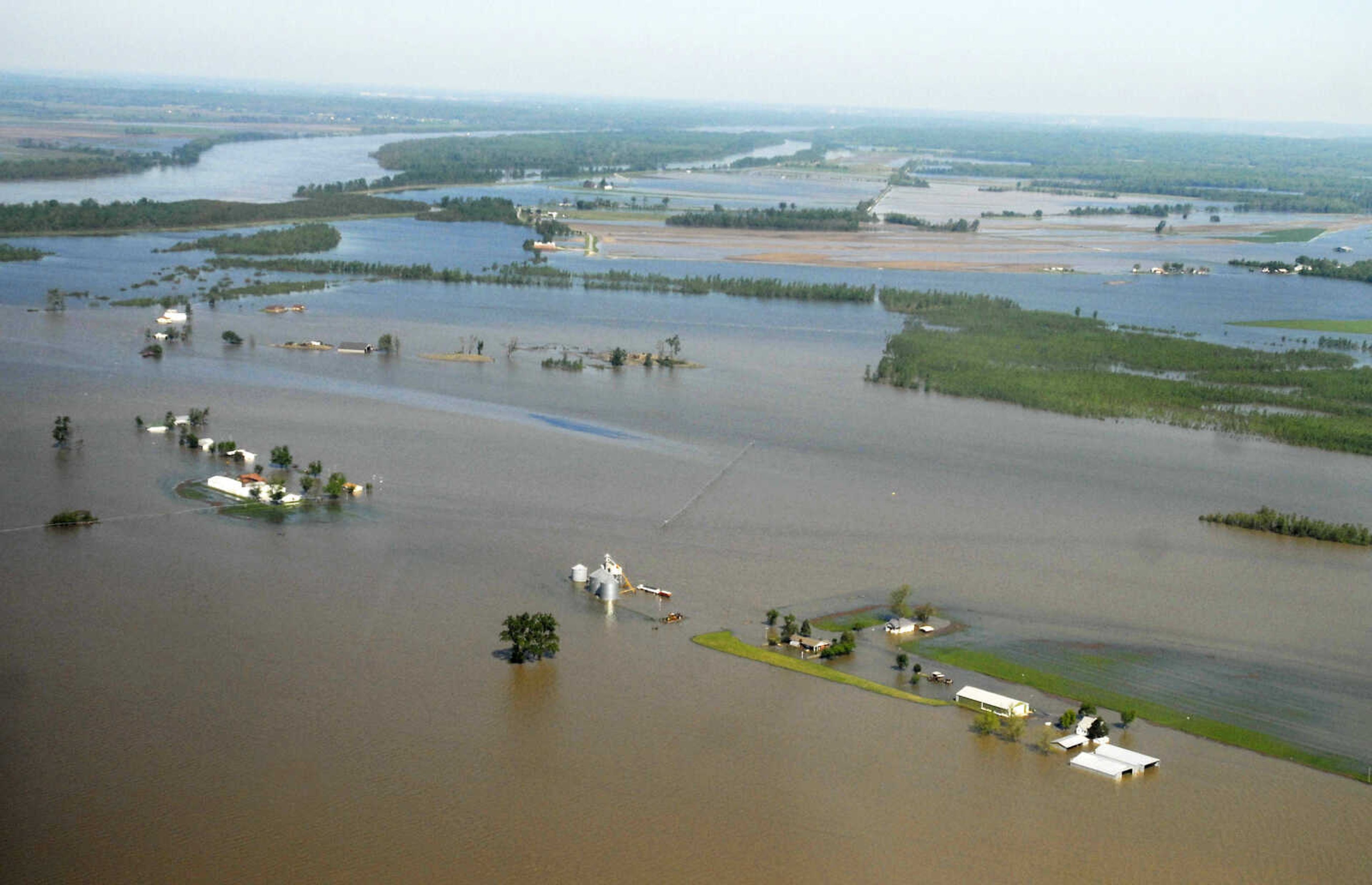
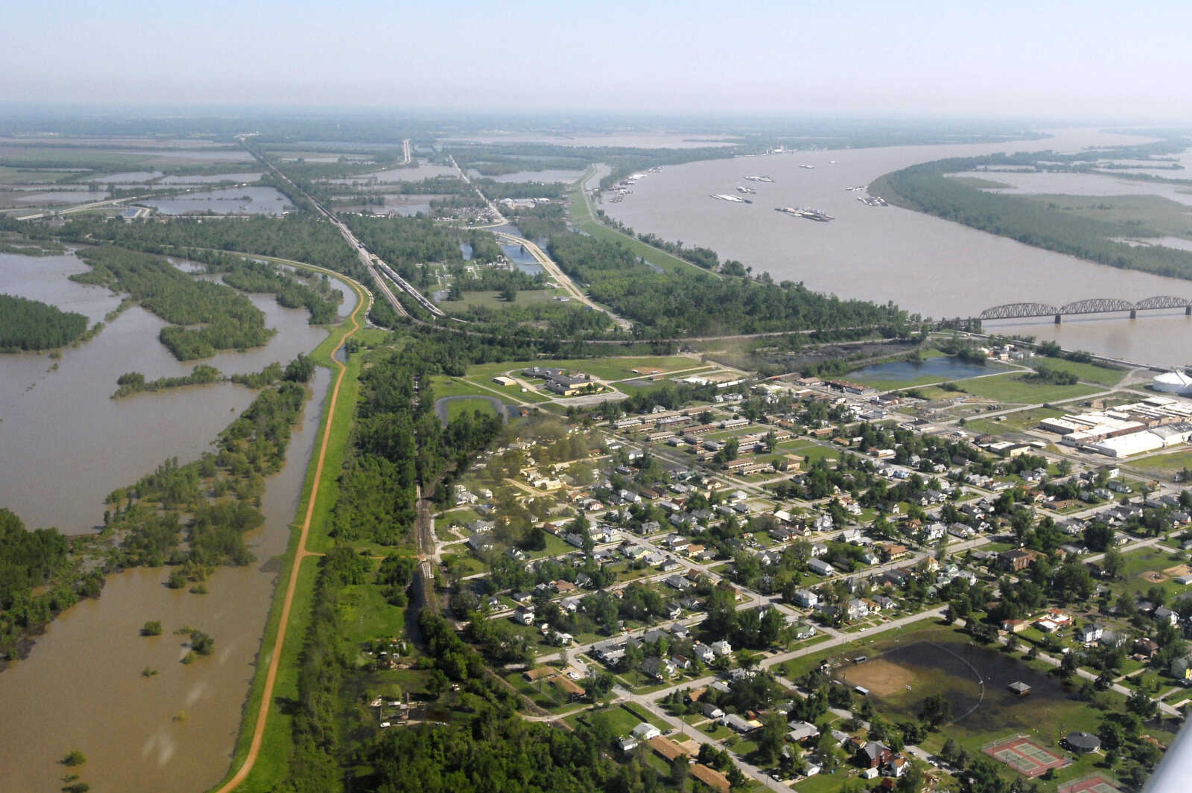
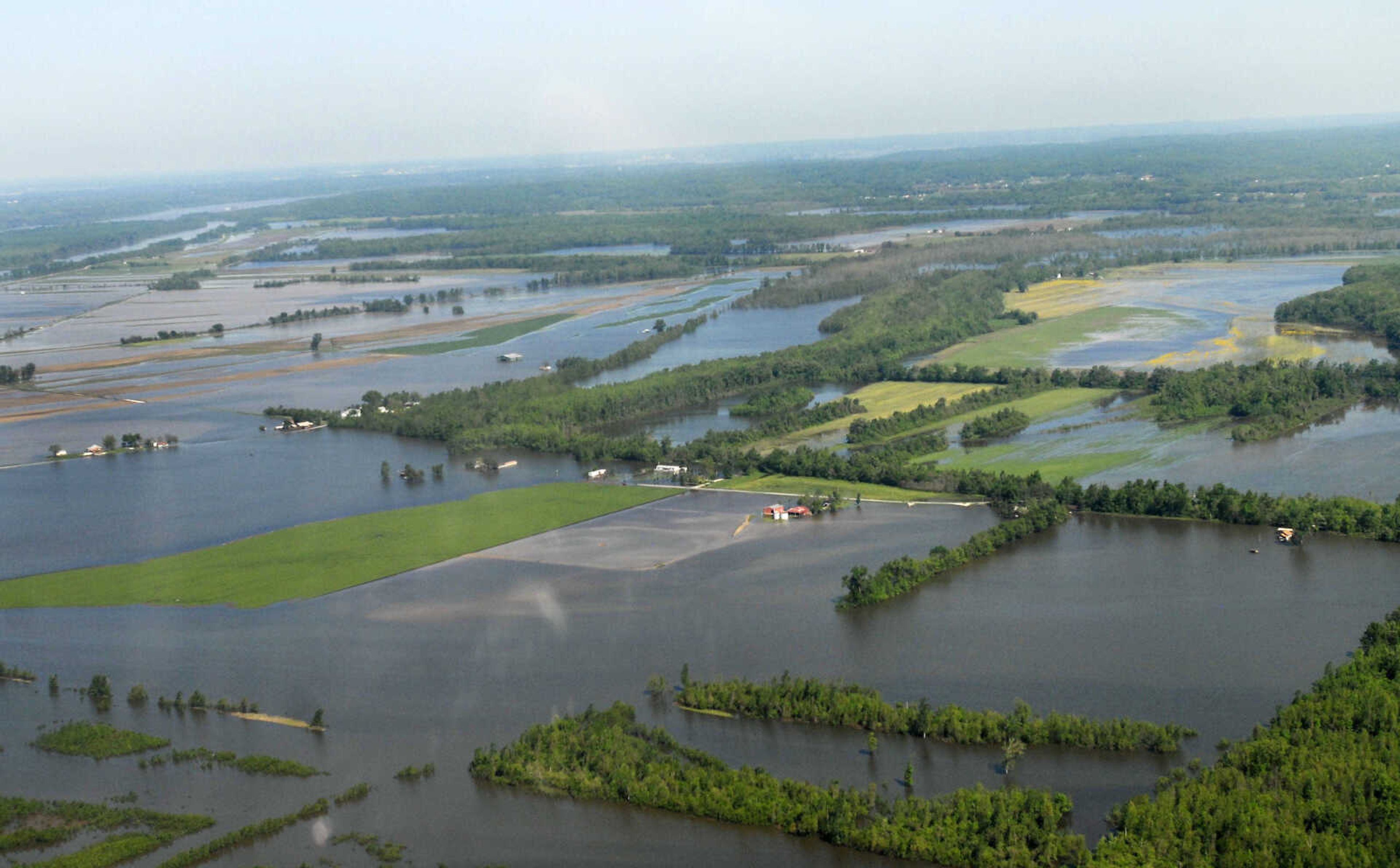
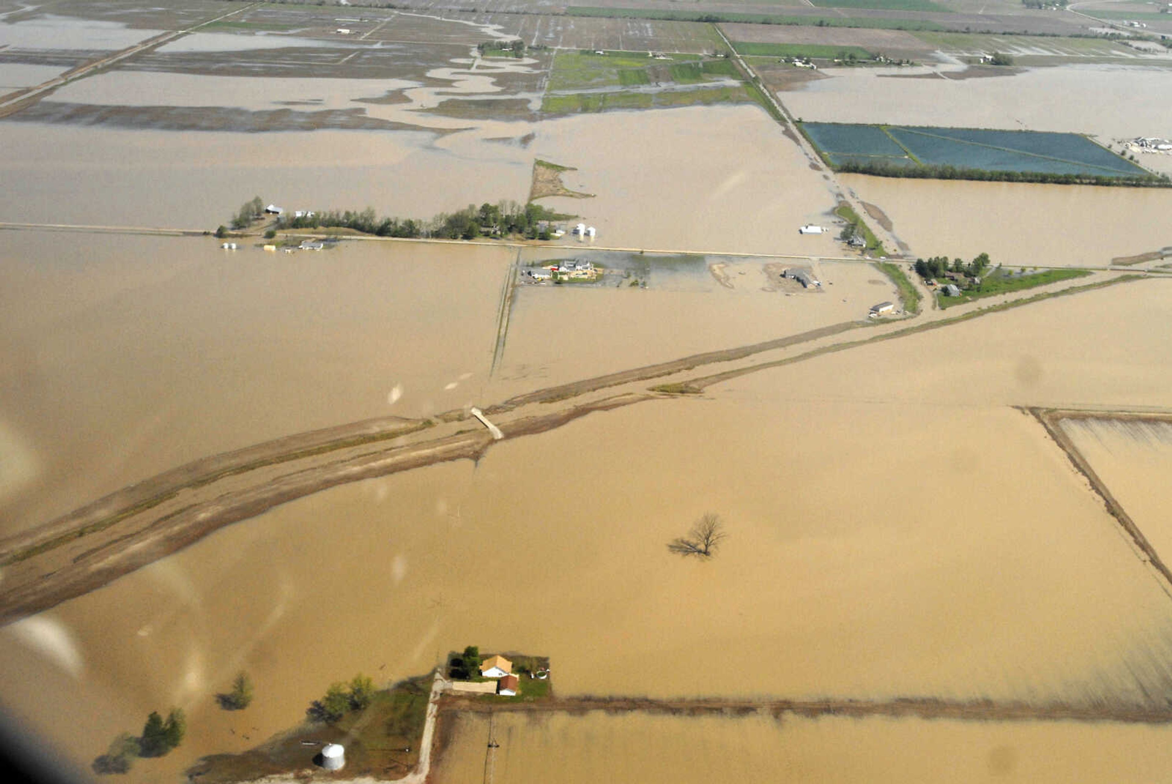
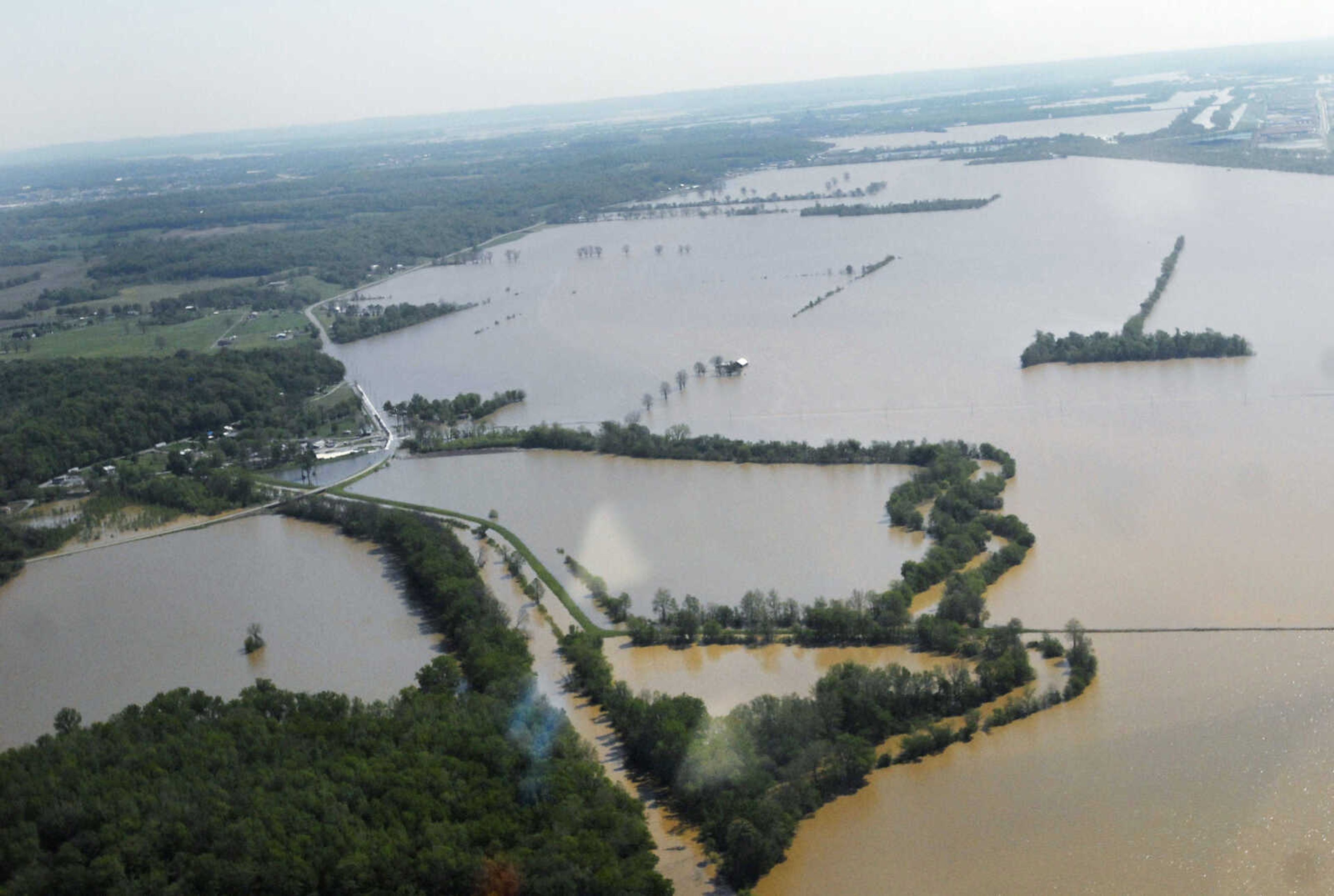
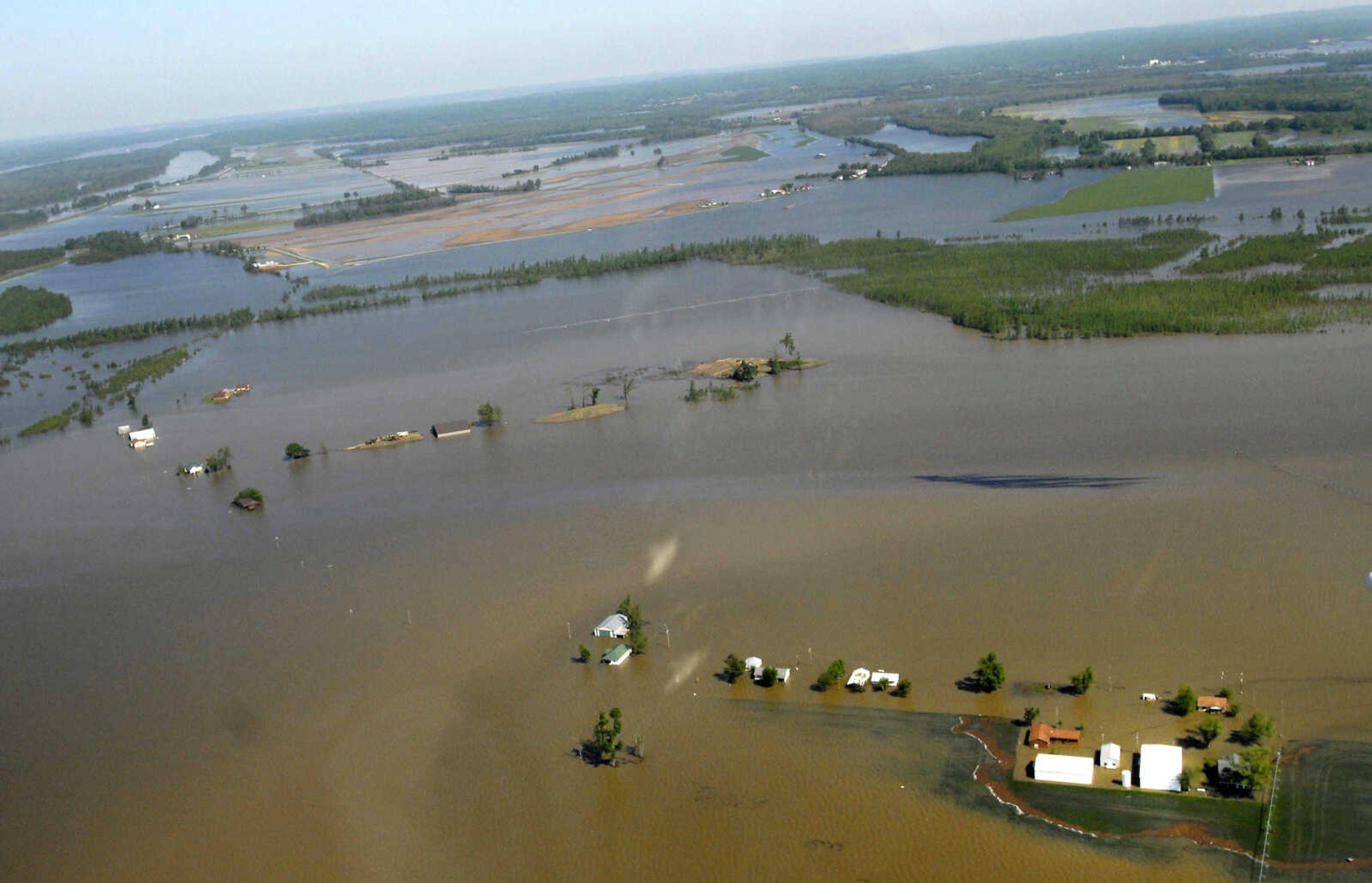
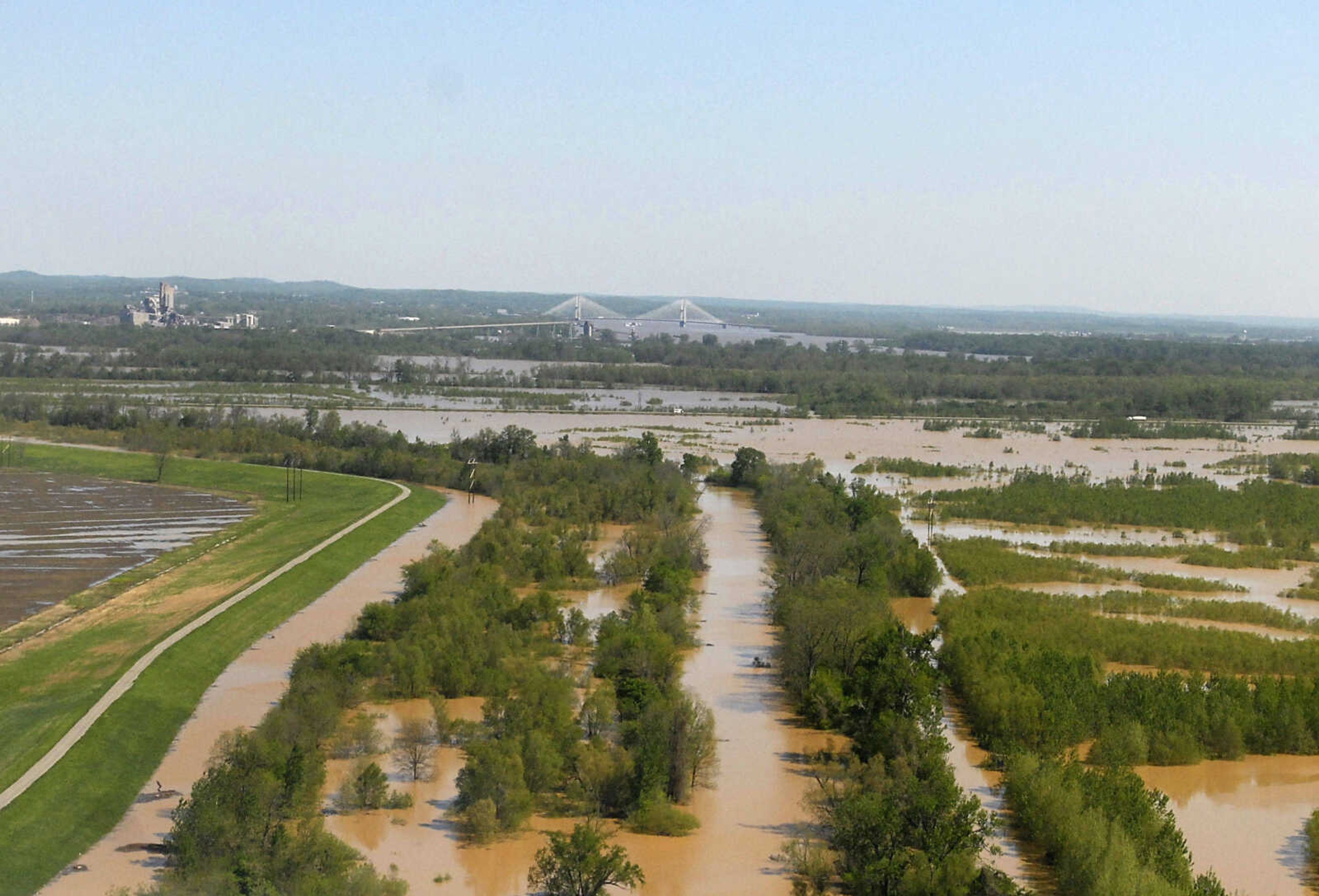
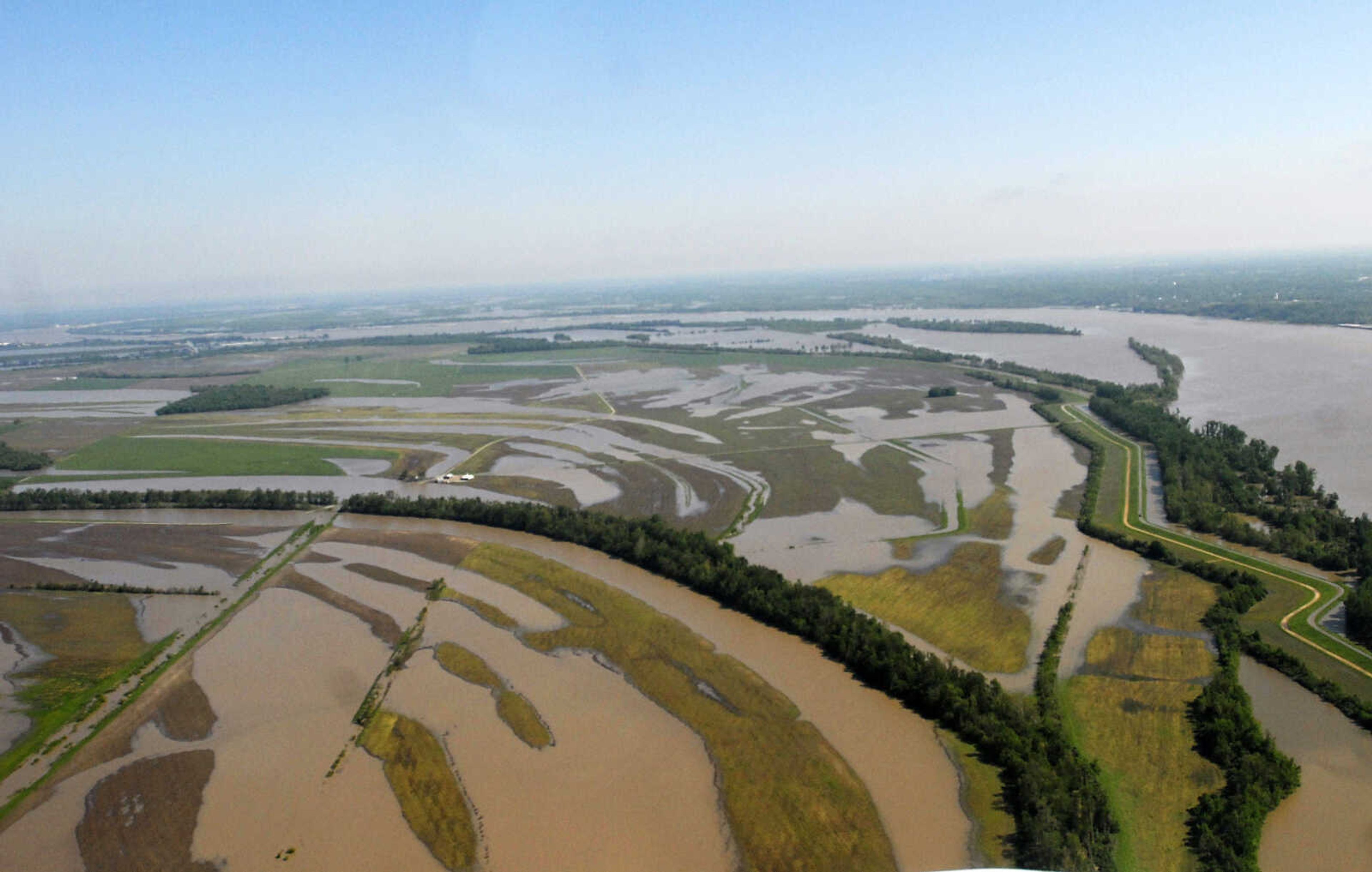
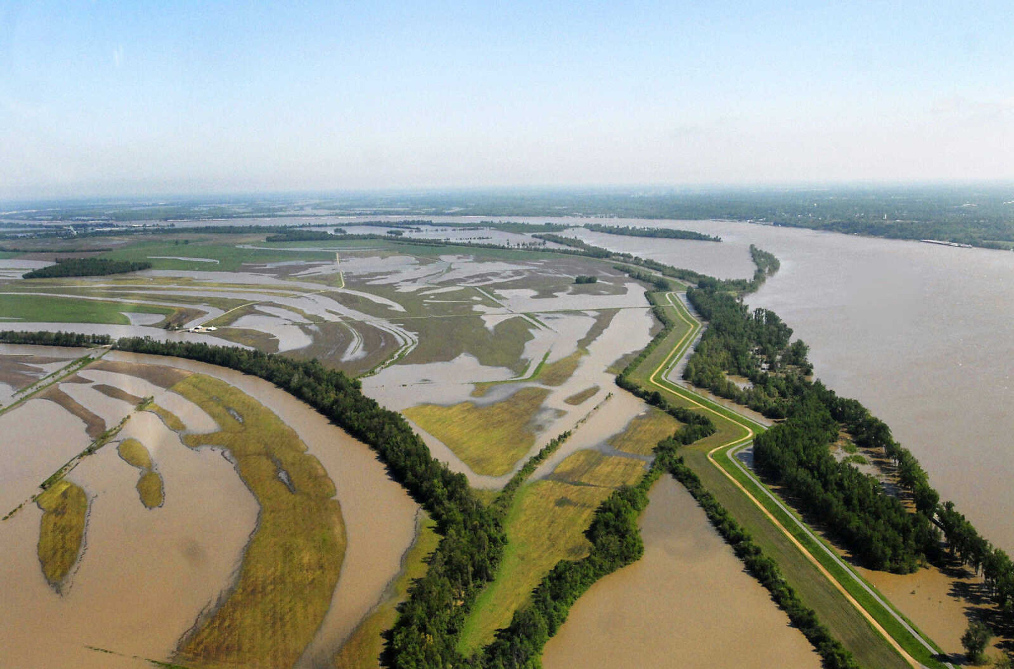
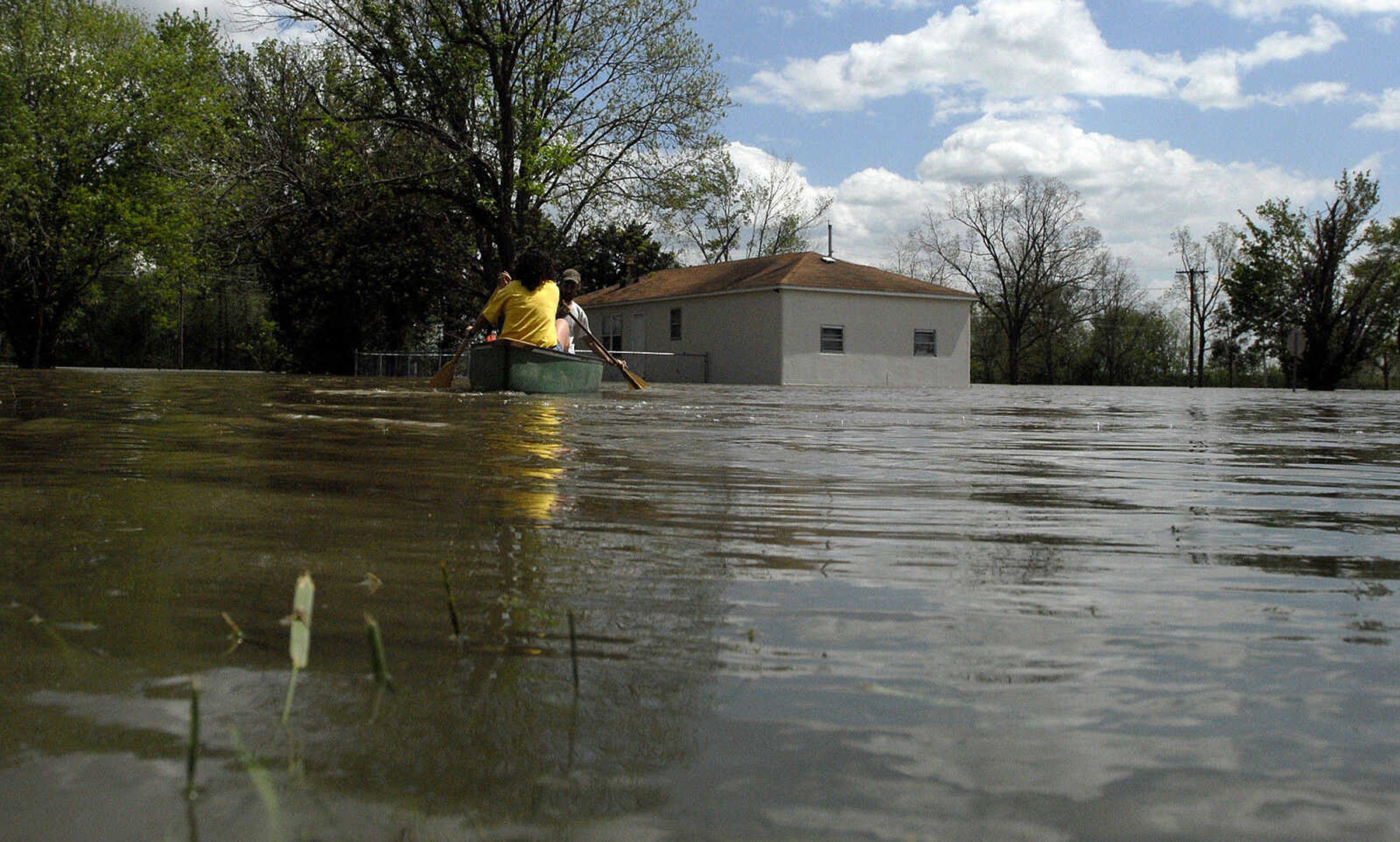
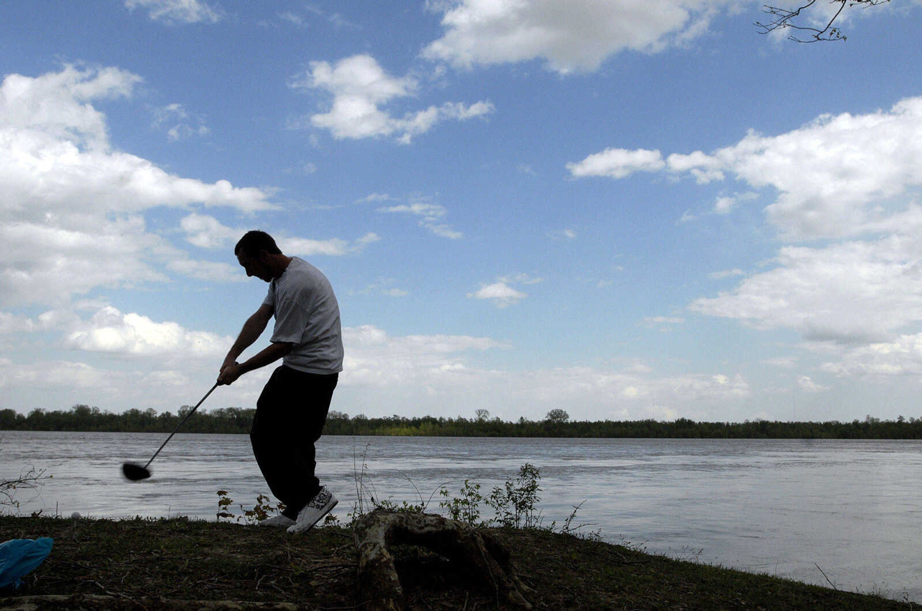
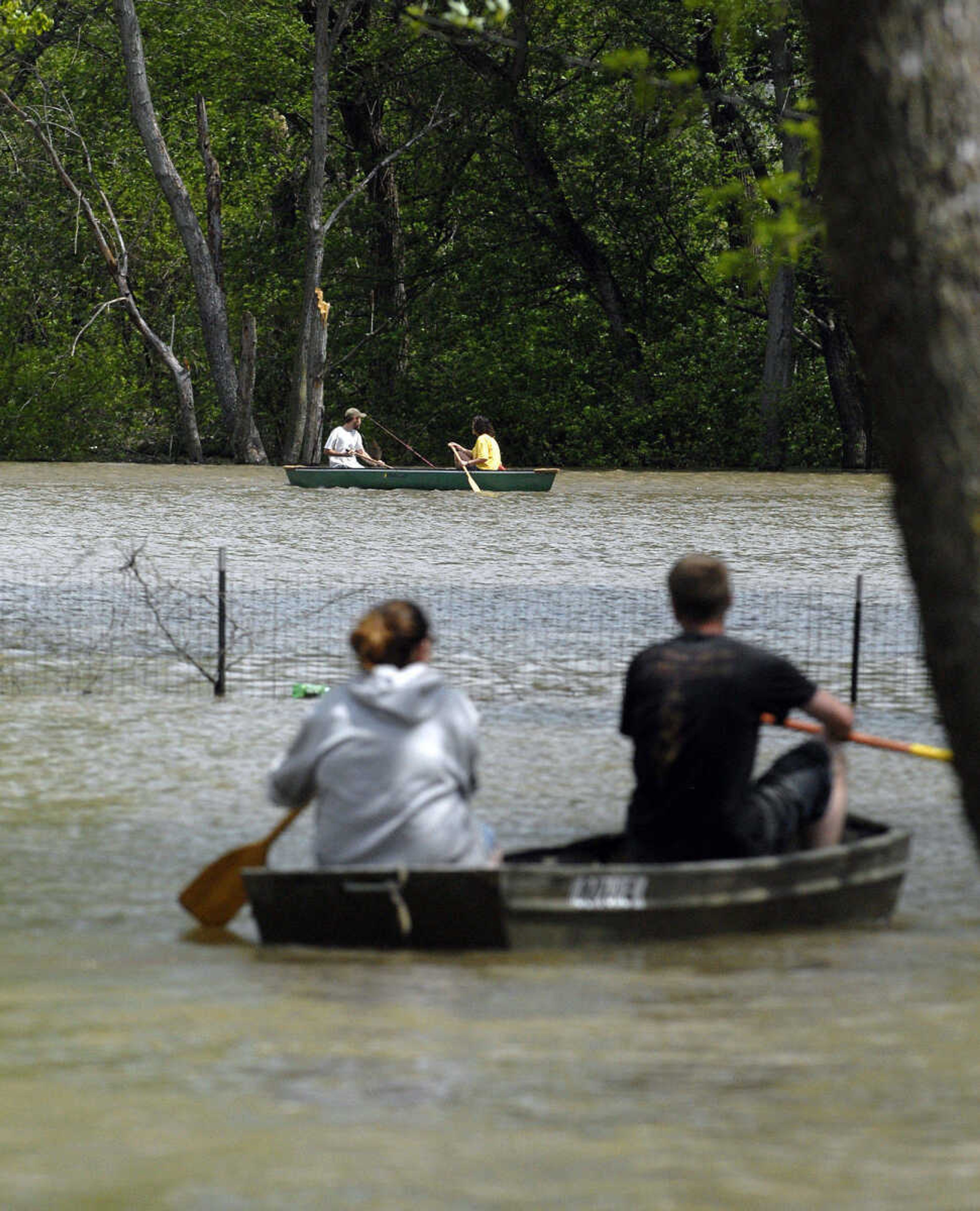
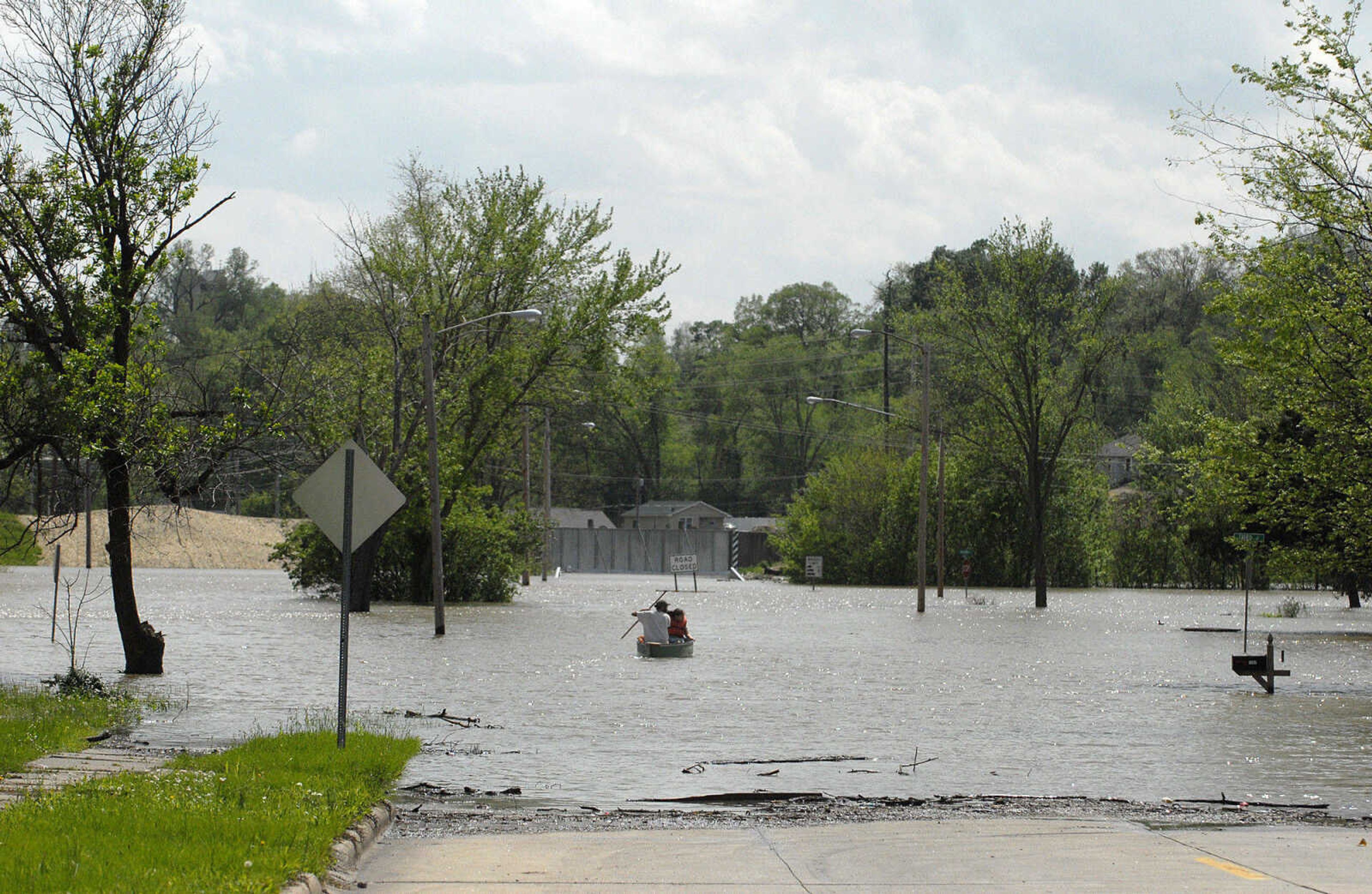
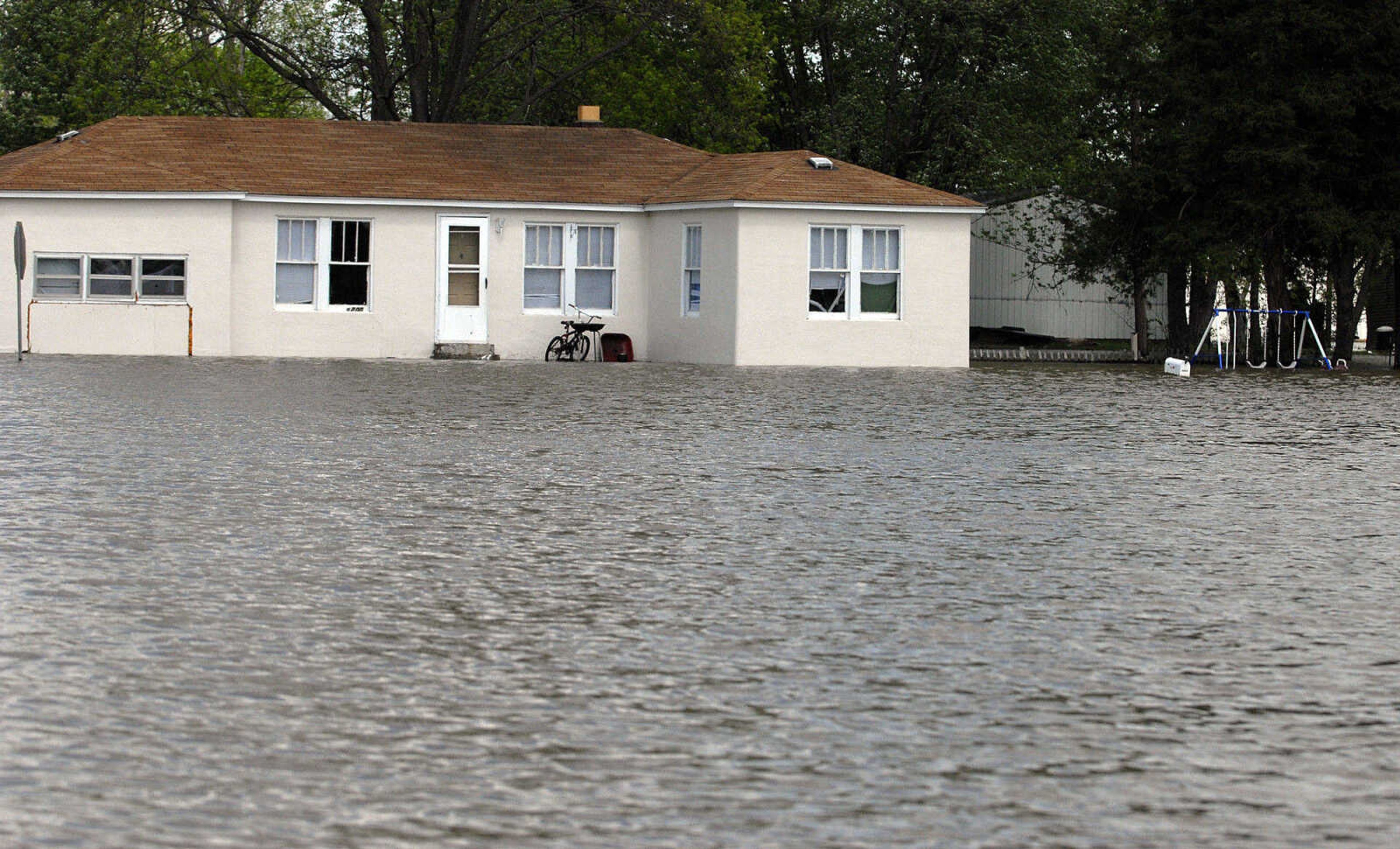
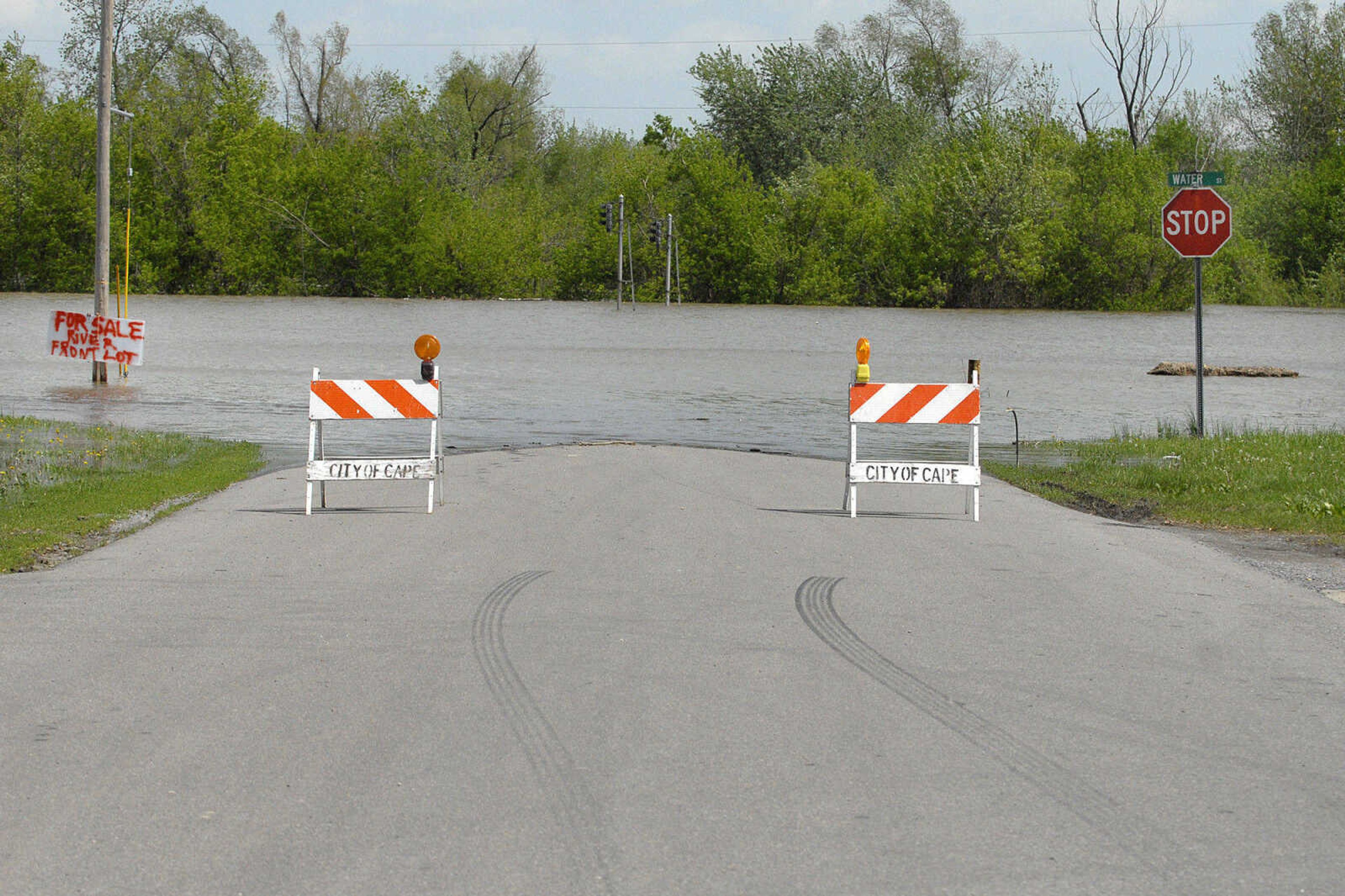
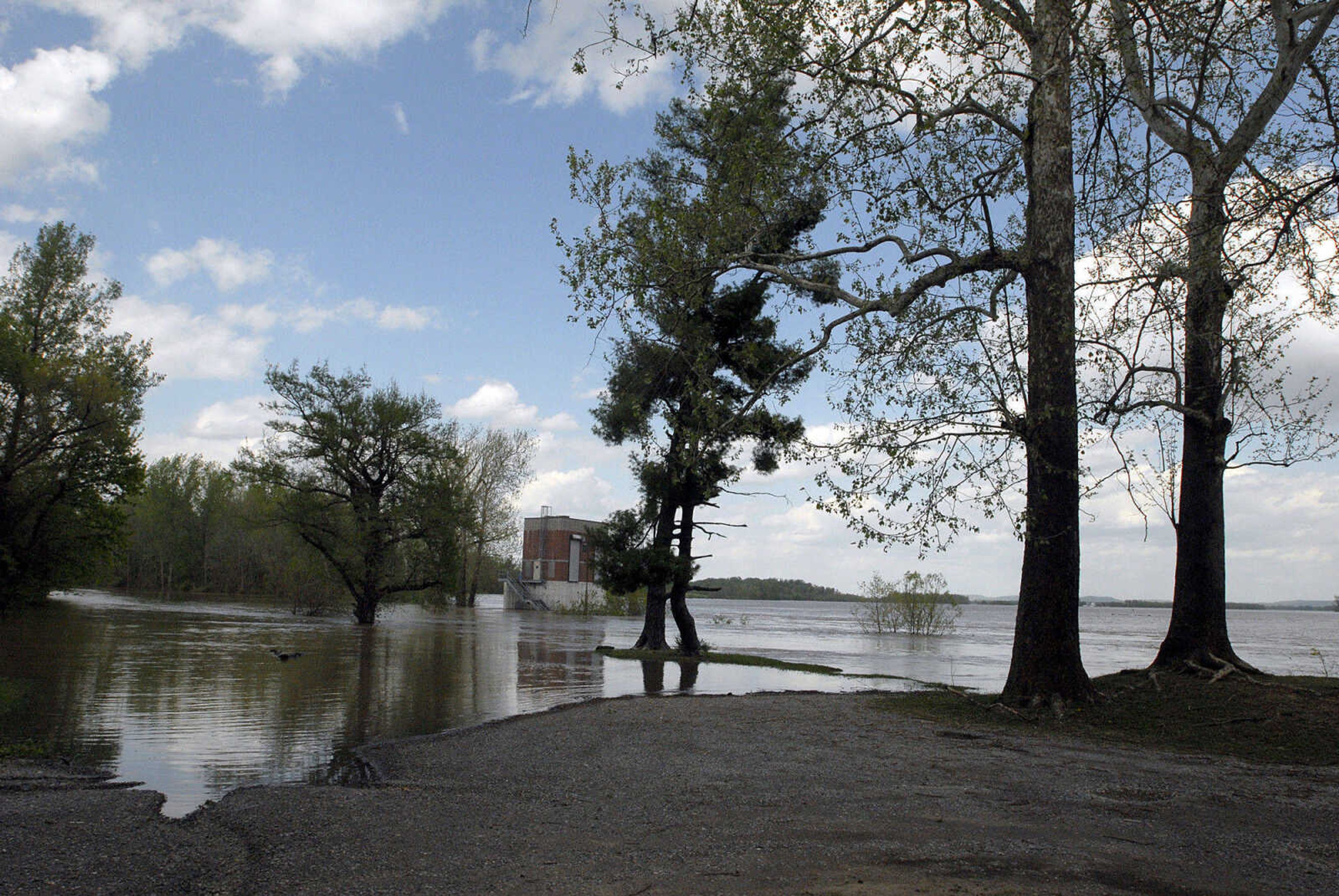
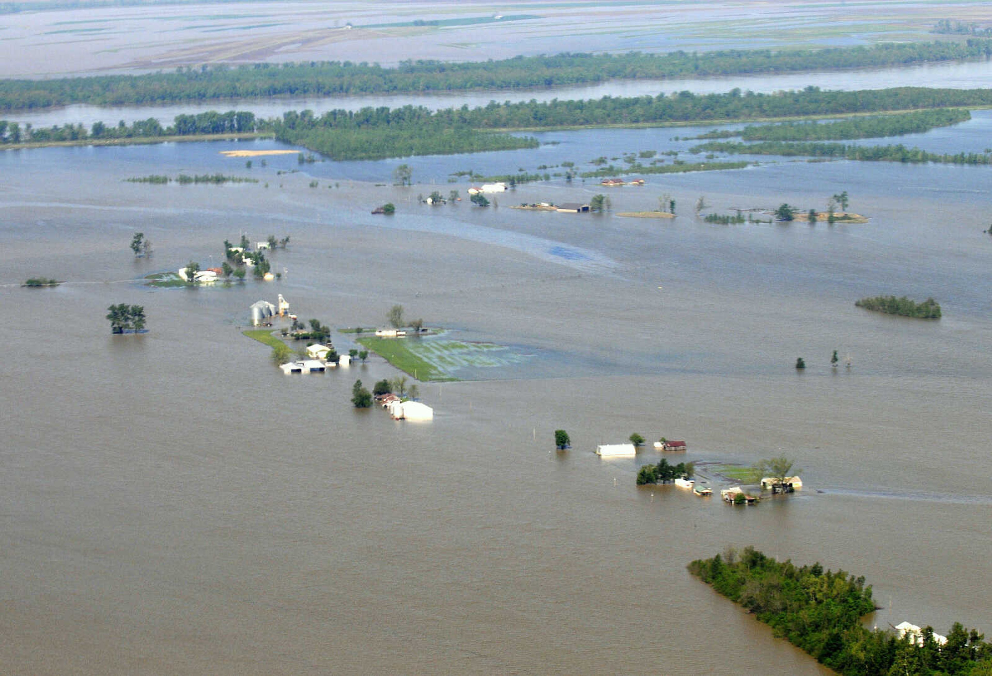
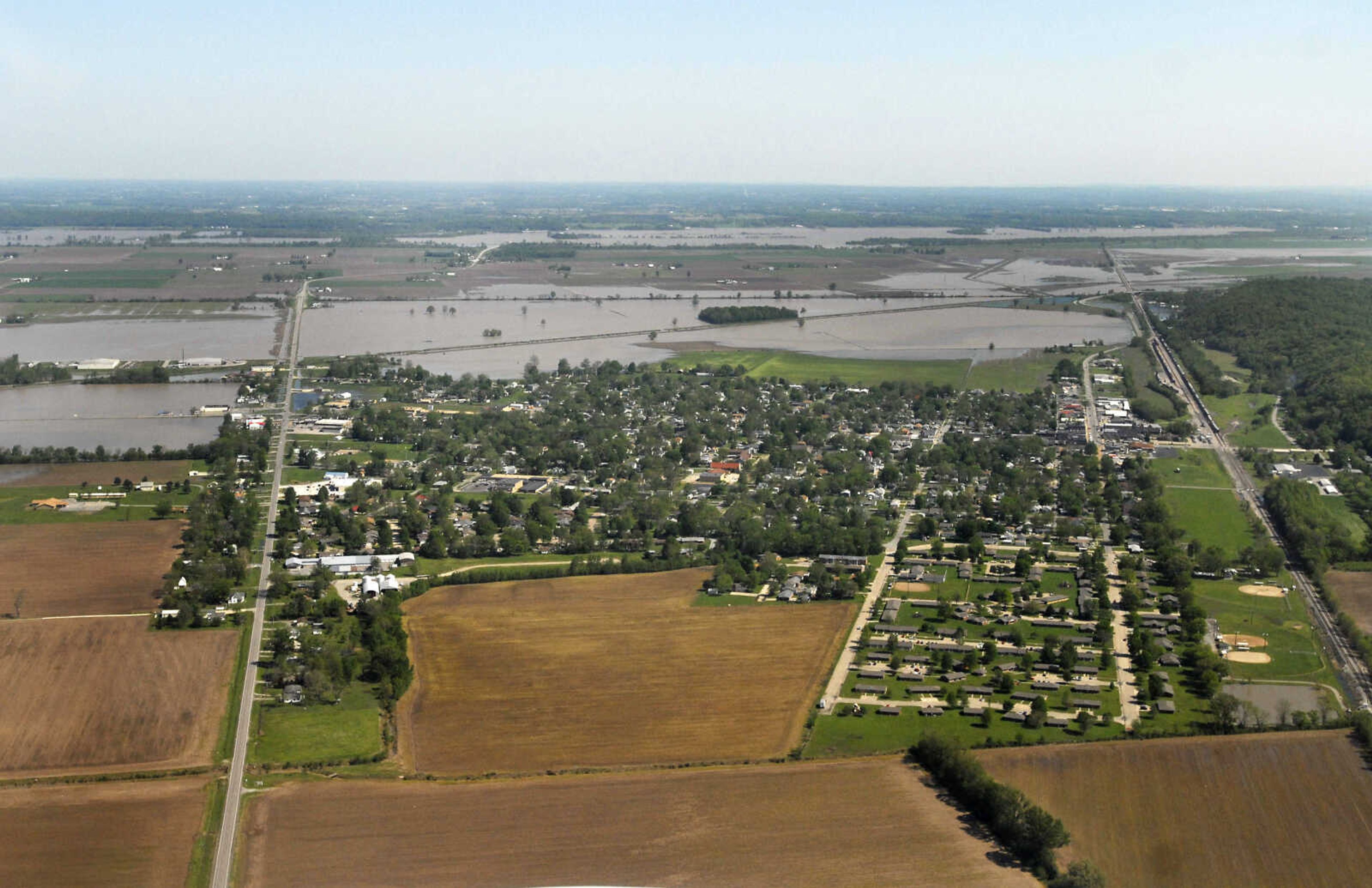
NewsApril 28, 2011
KRISTIN EBERTS ~ keberts@semissourian.com

A barge passes under the US-60/62 bridge at Cairo, Ill., on Thursday, April 28, 2011. In the background, barges head up the Ohio River.
KRISTIN EBERTS ~ keberts@semissourian.com A barge passes under the US-60/62 bridge at Cairo, Ill., on Thursday, April 28, 2011. In the background, barges head up the Ohio River.
KRISTIN EBERTS ~ keberts@semissourian.com

Floodwater drowns the farmland south of Horseshoe Lake near Willard, Ill., on Thursday, April 28, 2011.
KRISTIN EBERTS ~ keberts@semissourian.com Floodwater drowns the farmland south of Horseshoe Lake near Willard, Ill., on Thursday, April 28, 2011.
KRISTIN EBERTS ~ keberts@semissourian.com

Floodwater drowns the farmland south of Horseshoe Lake near Willard, Ill., on Thursday, April 28, 2011.
KRISTIN EBERTS ~ keberts@semissourian.com Floodwater drowns the farmland south of Horseshoe Lake near Willard, Ill., on Thursday, April 28, 2011.
KRISTIN EBERTS ~ keberts@semissourian.com

Floodwater drowns the area south of Horseshoe Lake near Willard, Ill., on Thursday, April 28, 2011.
KRISTIN EBERTS ~ keberts@semissourian.com Floodwater drowns the area south of Horseshoe Lake near Willard, Ill., on Thursday, April 28, 2011.
KRISTIN EBERTS ~ keberts@semissourian.com

The city of Cairo, Ill., is dwarfed by the surrounding floodwater from the Ohio and Mississippi Rivers on Thursday, April 28, 2011.
KRISTIN EBERTS ~ keberts@semissourian.com The city of Cairo, Ill., is dwarfed by the surrounding floodwater from the Ohio and Mississippi Rivers on Thursday, April 28, 2011.
KRISTIN EBERTS ~ keberts@semissourian.com

Flooding along the Mississippi River looking south near Commerce, Mo., on Thursday, April 28, 2011.
KRISTIN EBERTS ~ keberts@semissourian.com Flooding along the Mississippi River looking south near Commerce, Mo., on Thursday, April 28, 2011.
KRISTIN EBERTS ~ keberts@semissourian.com

Barges travel north on the Mississippi River toward Scott City, Mo., on Thursday, April 28, 2011.
KRISTIN EBERTS ~ keberts@semissourian.com Barges travel north on the Mississippi River toward Scott City, Mo., on Thursday, April 28, 2011.
KRISTIN EBERTS ~ keberts@semissourian.com

Floodwater drowns the farmland south of Horseshoe Lake near Willard, Ill., on Thursday, April 28, 2011.
KRISTIN EBERTS ~ keberts@semissourian.com Floodwater drowns the farmland south of Horseshoe Lake near Willard, Ill., on Thursday, April 28, 2011.
KRISTIN EBERTS ~ keberts@semissourian.com

Floodwater drowns the farmland south of Horseshoe Lake near Willard, Ill., on Thursday, April 28, 2011.
KRISTIN EBERTS ~ keberts@semissourian.com Floodwater drowns the farmland south of Horseshoe Lake near Willard, Ill., on Thursday, April 28, 2011.
KRISTIN EBERTS ~ keberts@semissourian.com

Farmland is underwater north of Chaffee, Mo., on Thursday, April 28, 2011.
KRISTIN EBERTS ~ keberts@semissourian.com Farmland is underwater north of Chaffee, Mo., on Thursday, April 28, 2011.
KRISTIN EBERTS ~ keberts@semissourian.com

Floodwater encroaches on Dutchtown, Mo., on Thursday, April 28, 2011.
KRISTIN EBERTS ~ keberts@semissourian.com Floodwater encroaches on Dutchtown, Mo., on Thursday, April 28, 2011.
KRISTIN EBERTS ~ keberts@semissourian.com

The city of Cairo, Ill., is dwarfed by the surrounding floodwater from the Ohio and Mississippi Rivers on Thursday, April 28, 2011.
KRISTIN EBERTS ~ keberts@semissourian.com The city of Cairo, Ill., is dwarfed by the surrounding floodwater from the Ohio and Mississippi Rivers on Thursday, April 28, 2011.
KRISTIN EBERTS ~ keberts@semissourian.com

Floodwater fills the fields inside the Mississippi river-bend northwest of Cairo on Thursday, April 28, 2011.
KRISTIN EBERTS ~ keberts@semissourian.com Floodwater fills the fields inside the Mississippi river-bend northwest of Cairo on Thursday, April 28, 2011.
KRISTIN EBERTS ~ keberts@semissourian.com

Floodwater encroaches on Dutchtown, Mo., seen on the left, on Thursday, April 28, 2011.
KRISTIN EBERTS ~ keberts@semissourian.com Floodwater encroaches on Dutchtown, Mo., seen on the left, on Thursday, April 28, 2011.
KRISTIN EBERTS ~ keberts@semissourian.com

Floodwater drowns the farmland south of Horseshoe Lake near Willard, Ill., on Thursday, April 28, 2011.
KRISTIN EBERTS ~ keberts@semissourian.com Floodwater drowns the farmland south of Horseshoe Lake near Willard, Ill., on Thursday, April 28, 2011.
KRISTIN EBERTS ~ keberts@semissourian.com

A view toward the Bill Emerson Memorial Bridge from the south in Cape Girardeau, Mo., on Thursday, April 28, 2011.
KRISTIN EBERTS ~ keberts@semissourian.com A view toward the Bill Emerson Memorial Bridge from the south in Cape Girardeau, Mo., on Thursday, April 28, 2011.
KRISTIN EBERTS ~ keberts@semissourian.com

A barge passes under the US-60/62 bridge at Cairo, Ill., on Thursday, April 28, 2011. In the background, barges head up the Ohio River.
KRISTIN EBERTS ~ keberts@semissourian.com A barge passes under the US-60/62 bridge at Cairo, Ill., on Thursday, April 28, 2011. In the background, barges head up the Ohio River.
KRISTIN EBERTS ~ keberts@semissourian.com

The city of Cairo, Ill., is dwarfed by the surrounding floodwater from the Ohio and Mississippi Rivers on Thursday, April 28, 2011.
KRISTIN EBERTS ~ keberts@semissourian.com The city of Cairo, Ill., is dwarfed by the surrounding floodwater from the Ohio and Mississippi Rivers on Thursday, April 28, 2011.
KRISTIN EBERTS ~ keberts@semissourian.com

Floodwater fills the fields inside the Mississippi river-bend northwest of Cairo on Thursday, April 28, 2011. Photo taken south of Horseshoe Lake, looking south toward Cairo, Ill.
KRISTIN EBERTS ~ keberts@semissourian.com Floodwater fills the fields inside the Mississippi river-bend northwest of Cairo on Thursday, April 28, 2011. Photo taken south of Horseshoe Lake, looking south toward Cairo, Ill.
KRISTIN EBERTS ~ keberts@semissourian.com

Birds Point levee runs along the Mississippi River outside of Wyatt, Mo., on Thursday, April 28, 2011. A levee breach would flood over 100,000 acres of farmland in Southeast Missouri.
KRISTIN EBERTS ~ keberts@semissourian.com Birds Point levee runs along the Mississippi River outside of Wyatt, Mo., on Thursday, April 28, 2011. A levee breach would flood over 100,000 acres of farmland in Southeast Missouri.
KRISTIN EBERTS ~ keberts@semissourian.com

Gabriel Yanes, left, and Joshua Robertson, right, use a canoe to paddle up North Main Street toward the home of Bill Sandquist on Thursday, April 28, 2011, in Cape Girardeau, Mo.
KRISTIN EBERTS ~ keberts@semissourian.com Gabriel Yanes, left, and Joshua Robertson, right, use a canoe to paddle up North Main Street toward the home of Bill Sandquist on Thursday, April 28, 2011, in Cape Girardeau, Mo.
KRISTIN EBERTS ~ keberts@semissourian.com

The area near the intersection of North Main and Third Streets is under several feet of water on Thursday, April 28, 2011, in Cape Girardeau, Mo.
KRISTIN EBERTS ~ keberts@semissourian.com The area near the intersection of North Main and Third Streets is under several feet of water on Thursday, April 28, 2011, in Cape Girardeau, Mo.
KRISTIN EBERTS ~ keberts@semissourian.com

Birds Point levee runs along the Mississippi River outside of Wyatt, Mo., on Thursday, April 28, 2011. A levee breach would flood over 100,000 acres of farmland in Southeast Missouri.
KRISTIN EBERTS ~ keberts@semissourian.com Birds Point levee runs along the Mississippi River outside of Wyatt, Mo., on Thursday, April 28, 2011. A levee breach would flood over 100,000 acres of farmland in Southeast Missouri.
LAURA SIMON~lsimon@semissourian.com
The Mississippi River floods the Red Star district Thursday, April 28, 2011 in Cape Girardeau.
LAURA SIMON~lsimon@semissourian.com The Mississippi River floods the Red Star district Thursday, April 28, 2011 in Cape Girardeau.
LAURA SIMON~lsimon@semissourian.com
Mississippi River floodwater threatens a home on Main Street Thursday, April 28, 2011 in Cape Girardeau.
LAURA SIMON~lsimon@semissourian.com Mississippi River floodwater threatens a home on Main Street Thursday, April 28, 2011 in Cape Girardeau.
LAURA SIMON~lsimon@semissourian.com
Sandbags are stacked up in a doorway to Red Star Baptist Church off of  Main Street Thursday, April 28, 2011 in Cape Girardeau.
LAURA SIMON~lsimon@semissourian.com Sandbags are stacked up in a doorway to Red Star Baptist Church off of Main Street Thursday, April 28, 2011 in Cape Girardeau.
LAURA SIMON~lsimon@semissourian.com
The Mississippi River floods the Red Star district Thursday, April 28, 2011 in Cape Girardeau.
LAURA SIMON~lsimon@semissourian.com The Mississippi River floods the Red Star district Thursday, April 28, 2011 in Cape Girardeau.
LAURA SIMON~lsimon@semissourian.com
Bill Sandquist casts his fishing line into the Mississippi River floodwater from his front yard Thursday, April 28, 2011 in Cape Girardeau.
LAURA SIMON~lsimon@semissourian.com Bill Sandquist casts his fishing line into the Mississippi River floodwater from his front yard Thursday, April 28, 2011 in Cape Girardeau.
LAURA SIMON~lsimon@semissourian.com
Dandelions and blades of grass peak out from the Mississippi River floodwater Thursday, April 28, 2011 in Cape Girardeau.
LAURA SIMON~lsimon@semissourian.com Dandelions and blades of grass peak out from the Mississippi River floodwater Thursday, April 28, 2011 in Cape Girardeau.
LAURA SIMON~lsimon@semissourian.com
Aaron Laughlin paddles out into the Mississippi River floodwater covering the Red Star district Thursday, April 28, 2011 in Cape Girardeau.
LAURA SIMON~lsimon@semissourian.com Aaron Laughlin paddles out into the Mississippi River floodwater covering the Red Star district Thursday, April 28, 2011 in Cape Girardeau.
LAURA SIMON~lsimon@semissourian.com
Jason Gipson hits golf balls into the flooded Mississippi River from the area below Cape Rock in Cape Girardeau Thursday, April 28, 2011.
LAURA SIMON~lsimon@semissourian.com Jason Gipson hits golf balls into the flooded Mississippi River from the area below Cape Rock in Cape Girardeau Thursday, April 28, 2011.
LAURA SIMON~lsimon@semissourian.com
Aaron Laughlin paddles out into the Mississippi River floodwater covering the Red Star district alongside Joshua Robertson, left, and Gabriel Yanes Thursday, April 28, 2011 in Cape Girardeau.
LAURA SIMON~lsimon@semissourian.com Aaron Laughlin paddles out into the Mississippi River floodwater covering the Red Star district alongside Joshua Robertson, left, and Gabriel Yanes Thursday, April 28, 2011 in Cape Girardeau.
LAURA SIMON~lsimon@semissourian.com
Joshua Robertson and Char Miller paddle out in a canoe to fish in the flooded Mississippi River as Peggy Benaivdz and John Gamage watch Thursday, April 28, 2011 in Cape Girardeau.
LAURA SIMON~lsimon@semissourian.com Joshua Robertson and Char Miller paddle out in a canoe to fish in the flooded Mississippi River as Peggy Benaivdz and John Gamage watch Thursday, April 28, 2011 in Cape Girardeau.
KRISTIN EBERTS ~ keberts@semissourian.com

Farmland is underwater north of Chaffee, Mo., on Thursday, April 28, 2011.
KRISTIN EBERTS ~ keberts@semissourian.com Farmland is underwater north of Chaffee, Mo., on Thursday, April 28, 2011.
LAURA SIMON~lsimon@semissourian.com
Floodwater from the Mississippi River threatens a home on Main Street Thursday, April 28, 2011 in Cape Girardeau.
LAURA SIMON~lsimon@semissourian.com Floodwater from the Mississippi River threatens a home on Main Street Thursday, April 28, 2011 in Cape Girardeau.
LAURA SIMON~lsimon@semissourian.com
The Mississippi River floods the Red Star district Thursday, April 28, 2011 in Cape Girardeau.
LAURA SIMON~lsimon@semissourian.com The Mississippi River floods the Red Star district Thursday, April 28, 2011 in Cape Girardeau.
LAURA SIMON~lsimon@semissourian.com
Bill Sanquist checks his water pump outside his home on Main Street Thursday, April 28, 2011 in Cape Girardeau.
LAURA SIMON~lsimon@semissourian.com Bill Sanquist checks his water pump outside his home on Main Street Thursday, April 28, 2011 in Cape Girardeau.
LAURA SIMON~lsimon@semissourian.com
The Mississippi River floods the area below Cape Rock in Cape Girardeau Thursday, April 28, 2011.
LAURA SIMON~lsimon@semissourian.com The Mississippi River floods the area below Cape Rock in Cape Girardeau Thursday, April 28, 2011.
LAURA SIMON~lsimon@semissourian.com
The Red Star district of Cape Girardeau lays under the flooded Mississippi River Thursday, April 28, 2011.
LAURA SIMON~lsimon@semissourian.com The Red Star district of Cape Girardeau lays under the flooded Mississippi River Thursday, April 28, 2011.
LAURA SIMON~lsimon@semissourian.com
The Mississippi River floods the Red Star district Thursday, April 28, 2011 in Cape Girardeau.
LAURA SIMON~lsimon@semissourian.com The Mississippi River floods the Red Star district Thursday, April 28, 2011 in Cape Girardeau.
LAURA SIMON~lsimon@semissourian.com
A honey bee goes to work on a dandelion that is peaking out of Mississippi River floodwater Thursday, April 28, 2011 in Cape Girardeau.
LAURA SIMON~lsimon@semissourian.com A honey bee goes to work on a dandelion that is peaking out of Mississippi River floodwater Thursday, April 28, 2011 in Cape Girardeau.
LAURA SIMON~lsimon@semissourian.com
Water Street in Cape Girardeau is hidden under the Mississippi River Thursday, April 28, 2011.
LAURA SIMON~lsimon@semissourian.com Water Street in Cape Girardeau is hidden under the Mississippi River Thursday, April 28, 2011.
LAURA SIMON~lsimon@semissourian.com
Joshua Robertson gets his fishing pole ready to cast into the Mississippi River floodwater cover Main Street Thursday, April 28, 2011 in Cape Girardeau. Also pictured are Char Miller, left, homeowner Laura Sandquist and Loveta Miller with her puppy Prince.
LAURA SIMON~lsimon@semissourian.com Joshua Robertson gets his fishing pole ready to cast into the Mississippi River floodwater cover Main Street Thursday, April 28, 2011 in Cape Girardeau. Also pictured are Char Miller, left, homeowner Laura Sandquist and Loveta Miller with her puppy Prince.
LAURA SIMON~lsimon@semissourian.com
Joshua Robertson, left, and Gabriel Yanes canoe next to a welcome sign as the Mississippi River floods the Red Star district Thursday, April 28, 2011 in Cape Girardeau.
LAURA SIMON~lsimon@semissourian.com Joshua Robertson, left, and Gabriel Yanes canoe next to a welcome sign as the Mississippi River floods the Red Star district Thursday, April 28, 2011 in Cape Girardeau.
KRISTIN EBERTS ~ keberts@semissourian.com

Floodwater drowns the farmland south of Horseshoe Lake near Willard, Ill., on Thursday, April 28, 2011.
KRISTIN EBERTS ~ keberts@semissourian.com Floodwater drowns the farmland south of Horseshoe Lake near Willard, Ill., on Thursday, April 28, 2011.
LAURA SIMON~lsimon@semissourian.com
Floodwater from the Mississippi River covers Highway 177 just north of Cape Girardeau Thursday, April 28, 2011.
LAURA SIMON~lsimon@semissourian.com Floodwater from the Mississippi River covers Highway 177 just north of Cape Girardeau Thursday, April 28, 2011.
LAURA SIMON~lsimon@semissourian.com
The Mississippi River floods the area below Cape Rock in Cape Girardeau Thursday, April 28, 2011.
LAURA SIMON~lsimon@semissourian.com The Mississippi River floods the area below Cape Rock in Cape Girardeau Thursday, April 28, 2011.
LAURA SIMON~lsimon@semissourian.com
Barges sit on the flooded Mississippi near River Cape Rock in Cape Girardeau Thursday, April 28, 2011.
LAURA SIMON~lsimon@semissourian.com Barges sit on the flooded Mississippi near River Cape Rock in Cape Girardeau Thursday, April 28, 2011.
LAURA SIMON~lsimon@semissourian.com
A barge heads north up the flooded Mississippi near River Cape Rock in Cape Girardeau Thursday, April 28, 2011.
LAURA SIMON~lsimon@semissourian.com A barge heads north up the flooded Mississippi near River Cape Rock in Cape Girardeau Thursday, April 28, 2011.
LAURA SIMON~lsimon@semissourian.com
The Mississippi River floods the Red Star district Thursday, April 28, 2011 in Cape Girardeau.
LAURA SIMON~lsimon@semissourian.com The Mississippi River floods the Red Star district Thursday, April 28, 2011 in Cape Girardeau.
LAURA SIMON~lsimon@semissourian.com
Jason Gipson hits golf balls into the flooded Mississippi River from the area below Cape Rock in Cape Girardeau Thursday, April 28, 2011.
LAURA SIMON~lsimon@semissourian.com Jason Gipson hits golf balls into the flooded Mississippi River from the area below Cape Rock in Cape Girardeau Thursday, April 28, 2011.
LAURA SIMON~lsimon@semissourian.com
Loveta Miller, left, Bo Miller, and nine-month-old Jasmine Gamage watch their friends paddle into the floodwaters from a home on Main Street Thursday, April 28, 2011 in Cape Girardeau.
LAURA SIMON~lsimon@semissourian.com Loveta Miller, left, Bo Miller, and nine-month-old Jasmine Gamage watch their friends paddle into the floodwaters from a home on Main Street Thursday, April 28, 2011 in Cape Girardeau.
M.D. Kittle ~ mkittle@semissourian.com

Col. Vernie L. Reichling, commander of the U.S. Army Corps of Engineers, points to a map of a large area outside of the the Birds Point New Madrid Floodway, a region that could be hit hard by an uncontrolled breach of the levee. At a news conference in Sikeston, Mo., Thursday afternoon, Reichling briefed the media on the corps' efforts to hold back the raging waters, a campaign that received some much-needed assistance from upstream and Mother Nature.
M.D. Kittle ~ mkittle@semissourian.com Col. Vernie L. Reichling, commander of the U.S. Army Corps of Engineers, points to a map of a large area outside of the the Birds Point New Madrid Floodway, a region that could be hit hard by an uncontrolled breach of the levee. At a news conference in Sikeston, Mo., Thursday afternoon, Reichling briefed the media on the corps' efforts to hold back the raging waters, a campaign that received some much-needed assistance from upstream and Mother Nature.
KRISTIN EBERTS ~ keberts@semissourian.com

Floodwater drowns the farmland south of Horseshoe Lake near Willard, Ill., on Thursday, April 28, 2011.
KRISTIN EBERTS ~ keberts@semissourian.com Floodwater drowns the farmland south of Horseshoe Lake near Willard, Ill., on Thursday, April 28, 2011.
KRISTIN EBERTS ~ keberts@semissourian.com

Traffic moves along the Interstate 57 bridge and the Illinois Highway 3 interchange north of Cairo, Ill., on Thursday, April 28, 2011.
KRISTIN EBERTS ~ keberts@semissourian.com Traffic moves along the Interstate 57 bridge and the Illinois Highway 3 interchange north of Cairo, Ill., on Thursday, April 28, 2011.
KRISTIN EBERTS ~ keberts@semissourian.com

A view of Chaffee, Mo., looking north toward the Diversion Channel and Dutchtown on Thursday, April 28, 2011.
KRISTIN EBERTS ~ keberts@semissourian.com A view of Chaffee, Mo., looking north toward the Diversion Channel and Dutchtown on Thursday, April 28, 2011.
KRISTIN EBERTS ~ keberts@semissourian.com

Floodwater fills the fields inside the Mississippi river-bend northwest of Cairo on Thursday, April 28, 2011.
KRISTIN EBERTS ~ keberts@semissourian.com Floodwater fills the fields inside the Mississippi river-bend northwest of Cairo on Thursday, April 28, 2011.
Receive Daily Headlines FREESign up today!

Story Tags

Connect with the Southeast Missourian Newsroom:

For corrections to this story or other insights for the editor, click here. To submit a letter to the editor, click here. To learn about the Southeast Missourian’s AI Policy, click here.

Advertisement
Receive Daily Headlines FREESign up today!