NewsAugust 22, 2020
Approaching storms pose double threat to Gulf Coast
Two tropical systems could become nearly simultaneous threats to the U.S. Gulf Coast early next week. They could even get sucked into an odd dance around each other. Or they could fall apart as they soak the Caribbean and Mexico this weekend. Newly formed Tropical Storm Laura and a depression that is likely to become Tropical Storm Marco have such bad and good environments ahead of them that their futures were not clear Friday. ...By SETH BORENSTEIN ~ Associated Press
Two tropical systems could become nearly simultaneous threats to the U.S. Gulf Coast early next week. They could even get sucked into an odd dance around each other. Or they could fall apart as they soak the Caribbean and Mexico this weekend.
Newly formed Tropical Storm Laura and a depression that is likely to become Tropical Storm Marco have such bad and good environments ahead of them that their futures were not clear Friday. Computer forecast models varied so much that some saw Laura becoming a major hurricane nearing the U.S., while others saw it dissipating.
If both storms survive the weekend, Laura was forecast to head toward the Florida and Alabama end of the Gulf Coast while the other one aimed at the Texas and Louisiana region.
"A lot of people are going to be impacted by rainfall and storm surge in the Gulf of Mexico," said National Weather Service Tropical Program Coordinator Joel Cline. "Since you simply don't know you really need to make precautions."
Two hurricanes have never appeared in the Gulf of Mexico at the same time, according to records going back to at least 1900, said Colorado State University hurricane researcher Phil Klotzbach. The last time two tropical storms were in the Gulf together was in 1959, he said.
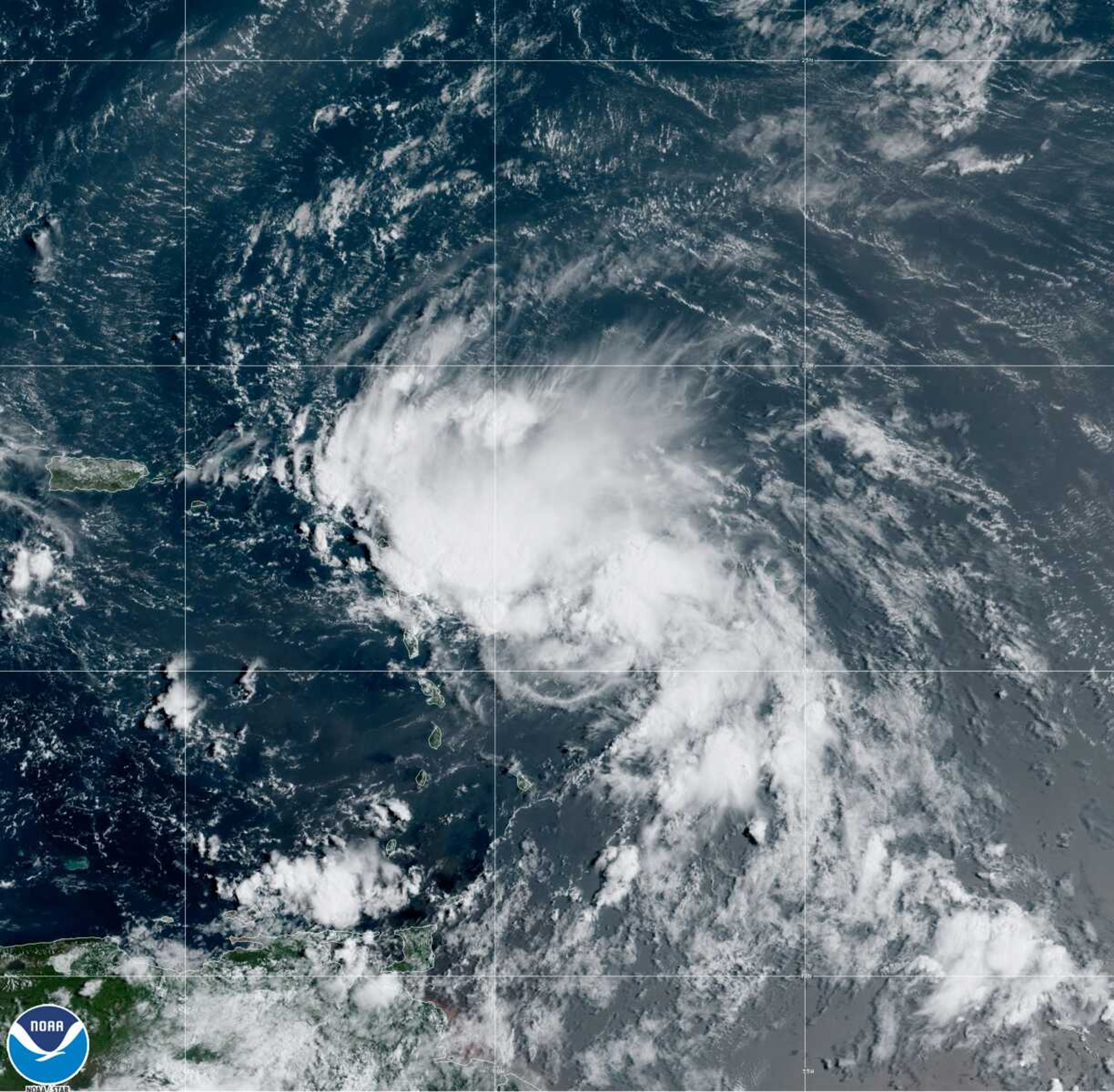
The National Hurricane Center on Friday issued tropical storm warnings for the Northern Leeward Islands and Puerto Rico. Laura was forecast to smack Puerto Rico on Saturday morning, go over or near the Dominican Republic and Haiti late Saturday and Cuba on Sunday.
Laura, which set a record for the earliest 12th named storm of a season, was centered Friday afternoon about 175 miles east-southeast of the northern Leeward Islands, with maximum sustained winds of 45 mph. It was heading west at 18 mph.
The hurricane center also issued a tropical storm warning and hurricane watch for part of Mexico's Yucatan Peninsula because the other storm system, called Tropical Depression 14, was predicted to strengthen.
On Friday afternoon, it was centered about 180 miles east of the Honduran resort island of Roatan, with 35 mph winds. It was headed northwest at 14 mph.
Receive Daily Headlines FREESign up today!
If the two storms make it, they could be in opposite ends of the Gulf of Mexico at the same time Tuesday and Wednesday. That would leave open some weird possibilities, including the storms rotating around each other in a tropical two-step or flinging each other in different directions to smack the coasts or -- far less likely -- merging.
The last time two storms made landfall in the United States within 24 hours of each other was in 1933, Klotzbach said.
It seems fitting for 2020 to have this type of twin threats, said University of Miami hurricane researcher Brian McNoldy.
"Of course, we have to have two simultaneously landfalling hurricanes," McNoldy said. "It's best not to ask what's next."
On Friday morning, a hurricane-hunting airplane found Laura's center to be dozens of miles further south and better formed than satellite images showed. That triggered a shift in forecast track putting Caribbean islands more at risk and an upgrade to tropical storm status.
If Laura goes over land, Puerto Rico and the mountains of Haiti, the Dominican Republic and Cuba could tear it apart and not make it much of a threat to the mainland United States, meteorologists said. But if it misses or skirts land, it could head into warm waters conducive to strengthening as it approaches Florida, meteorologists said.
With competing scenarios, the hurricane center is forecasting a middle range for Laura of a weak hurricane heading into the eastern Gulf of Mexico.
Officials in the Florida Keys, which Laura may pass over on its route into the Gulf, declared a local state of emergency Friday and issued a mandatory evacuation order for anyone living on boats, in mobile homes and in campers. Tourists staying in hotels should be aware of hazardous weather conditions and consider altering their plans starting on Sunday, Monroe County officials said in a news release.
Meteorologists said Tropical Depression 14 has a better chance of surviving its early land encounter, then strengthening to a minimal hurricane over warm water, but the hurricane center was forecasting it to weaken before it reaches the U.S. Gulf Coast because of decapitating high winds.
Story Tags
Advertisement
Connect with the Southeast Missourian Newsroom:
For corrections to this story or other insights for the editor, click here. To submit a letter to the editor, click here. To learn about the Southeast Missourian’s AI Policy, click here.


Advertisement
Receive Daily Headlines FREESign up today!
