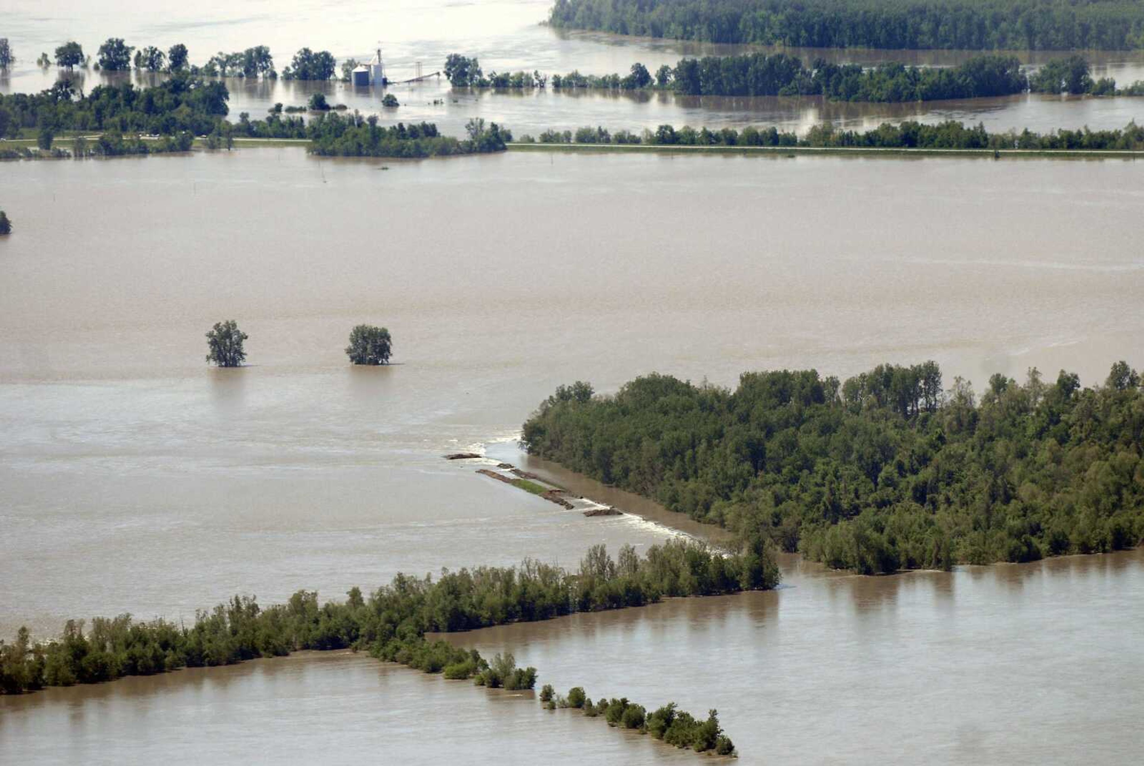
Corps again delays third levee breach; will blast at 1 p.m. today
The final blast in the U.S. Army Corps of Engineers plan to breach the Birds Point-New Madrid Floodway will happen at 1 p.m. today, the corps announced Wednesday night.
The final blast in the U.S. Army Corps of Engineers plan to breach the Birds Point-New Madrid Floodway will happen at 1 p.m. today, the corps announced Wednesday night.
The announcement came shortly after it was learned the third and final blast was being delayed again, this time due to "logistical challenges," corps spokesman Jim Pogue said Wednesday afternoon.
"It looks like the timeline is getting pushed out a little further," Pogue said at about 5:30 p.m. Wednesday. "But the smart money says it ain't going to happen tonight."
Shortly after 9 p.m., the corps made the announcement about the today's blast.
The corps had already twice delayed this third controlled breaching, which would create a second 5,500-foot outflow hole for Mississippi River waters to escape the 200-square-mile floodway. After the corps activated the plan Monday night by blowing a 11,000-foot inflow break, it intended to blow the second and third holes near New Madrid, Mo., on Tuesday.
But the corps encountered lightning in the overnight hours Tuesday morning, which caused it to delay the second and third detonations. Tuesday afternoon the corps detonated the second phase for outflow at the southern end of the floodway near New Madrid, Mo. Then, during a news conference Tuesday evening, corps officers announced they were unable to follow through with plans for the third because they and did not have enough explosives for the third breach.
"It's just taking longer," Pogue said. "We're into some stuff that hasn't necessarily been rehearsed before. It's logistical challenges."
The corps had acquired additional explosives from a vendor in Marion, Ill., Wednesday.
The corps activated the floodway, inundating the 130,000 acres of Southeast Missouri farmland, in an effort to lower floodwaters in communities in Missouri, Illinois and Kentucky.
The Ohio River at Cairo, Ill., was at 59.71 feet at 10 p.m. Wednesday, down from its historic crest of 61.72 feet at 10 p.m. Monday, before the effects of the first levee blast were felt. The Mississippi River at Cape Girardeau was at 43.64 as of 10 p.m. Wednesday, down from its crest of 46.28 feet Monday. The record at Cape Girardeau is 48.5 feet.
As the corps continues to work toward completing the floodway's activation, more information surfaced Wednesday about how much the breaching could cost Mississippi County. According to estimates from the Center for Economic and Business Research at Southeast Missouri State University, the intentional breaching of the levee could cost Mississippi County 522 jobs this year alone.
Dr. Bruce Domazlicky, director of the center, used the IMPLAN model to estimate the economic impact of 130,000 acres of farmland underwater. The value of the land, about half of Mississippi County's total cultivated farmland, is estimated at $300 million by the Missouri Department of Agriculture.
Net cash income from farming in Mississippi County was $39 million in the last agricultural census in 2007.
Anticipating a one-half reduction in agricultural production in Mississippi County, to $19.5 million, yields an employment decline of 522 jobs in 2011, according to Domazlicky's calculations. This represents almost 9 percent of total full-time equivalent employment in Mississippi County.
Labor income is estimated to fall by about $12 million, about 9 percent of the county's total labor income.
Total revenue/sales in the county will decline by $93,457,000 or 14.4 percent.
The figures are estimated just for 2011 using the IMPLAN model which looks at the direct, indirect and the induced effects of an economic change.
"If it is several years until the flooded acres become usable again, we can expect similar impacts to continue into the future," Domazlicky said.
smoyers@semissourian.com
388-3642
mmiller@semissourian.com
388-3646
Pertinent address:
New Madrid, MO
Connect with the Southeast Missourian Newsroom:
For corrections to this story or other insights for the editor, click here. To submit a letter to the editor, click here. To learn about the Southeast Missourian’s AI Policy, click here.


