NewsNovember 30, 2022
Parson extends drought alert; much of Southeast Missouri 'severe'
Much of Southeast Missouri continues to be classified as drought-stricken, according to the latest Drought Monitor map released by U.S. Department of Agriculture and partnering agencies. In response, Gov. Mike Parson, in a statement released Monday, Nov. 28, has extended the state's drought alert until March 1 because of what he called Missouri's "abnormally dry conditions."...
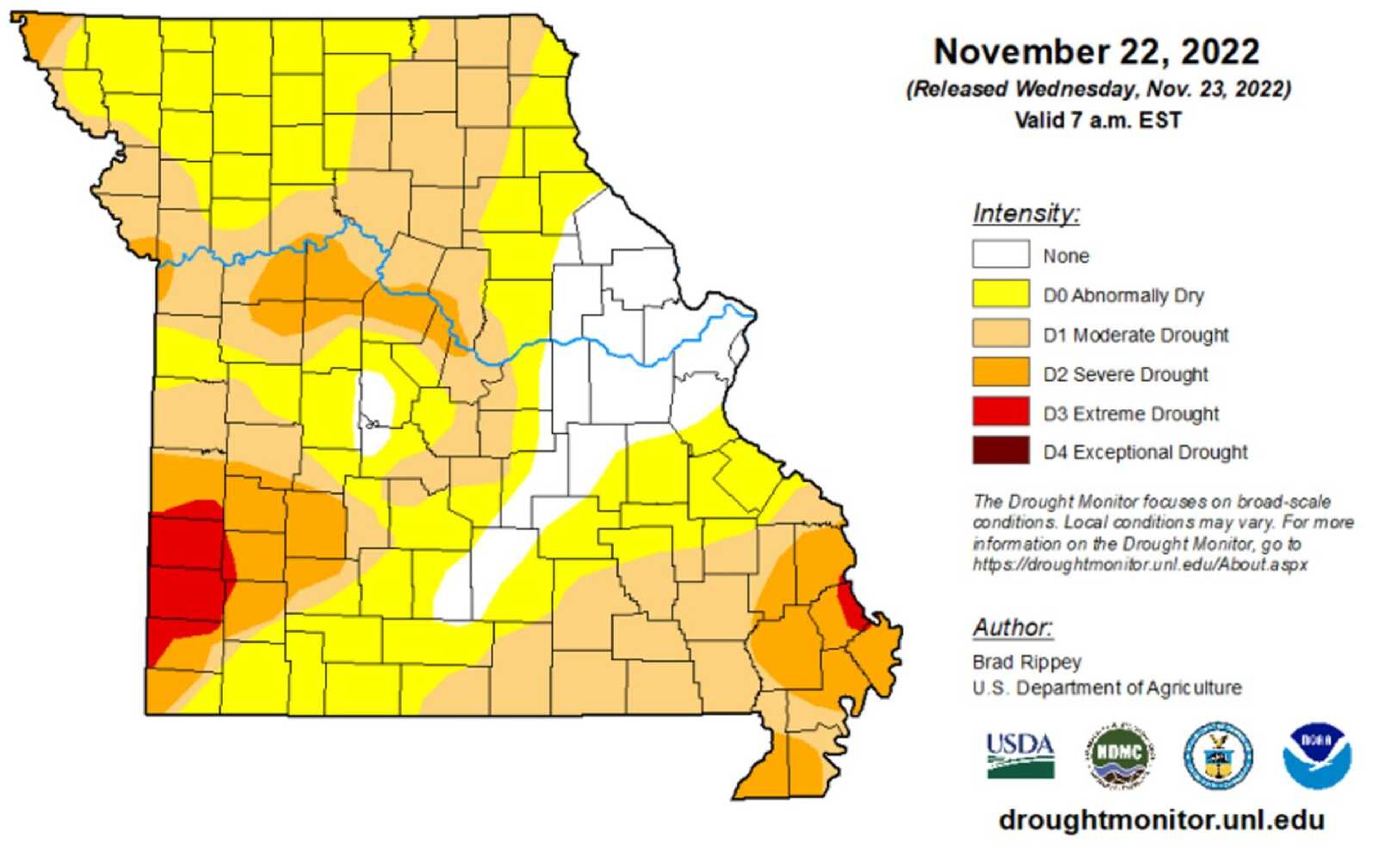
Much of Southeast Missouri continues to be classified as drought-stricken, according to the latest Drought Monitor map released by U.S. Department of Agriculture and partnering agencies.
In response, Gov. Mike Parson, in a statement released Monday, Nov. 28, has extended the state's drought alert until March 1 because of what he called Missouri's "abnormally dry conditions."
Forecasts, he said, indicate no substantial improvement coming over the winter months with 87% of the state's 114 counties now affected.
Parson's original alert, issued as an executive order July 21, was to have expired Thursday, Dec. 1.
Locally
- Perry County is experiencing "moderate" drought with the county's northwest section classified with the less serious "abnormally dry" designation.
- Cape Girardeau County is mostly classified as in a "severe" drought condition, with only the northwestern tip of the county denoted as in "moderate" drought.
- Scott County is in "severe" drought save for a stretch of its eastern border, which is classified as in an "extreme" condition.
Water conservation
"It will take a lot of precipitation to help Missouri recover from the current water deficit," Parson said in a statement. "Water for livestock is just as important in the winter as it is the summer, and we want to ensure resources are available to our farmers and ranchers that may need them. Additionally, with navigational challenges forming on Missouri's rivers affecting barge traffic, extending our Executive Order is necessary to support continued mitigation efforts."
Receive Daily Headlines FREESign up today!
Cairo
Included in supporting data accompanying the latest drought monitor map is information on how the remnants of Hurricane Nicole have impacted the Ohio River at Cairo, Illinois.
The peak gauge reading of 18.62 feet recorded Nov. 18 was nearly 14 feet higher than the low water mark recorded in October.
On Tuesday, Nov. 29, the gauge had dropped to just over 10 feet, according to www.waterdata.usgs.gov.
Last month, the Ohio River at Cairo had dropped to its lowest level since November 1901.
Information
For more about Missouri's drought conditions or the state's Drought Assessment Committee, visit www.dnr.mo.gov/drought.
The U.S. Drought Monitor is produced through a partnership among the National Drought Mitigation Center at the University of Nebraska-Lincoln, the United States Department of Agriculture and the National Oceanic and Atmospheric Administration.
Story Tags
Advertisement
Connect with the Southeast Missourian Newsroom:
For corrections to this story or other insights for the editor, click here. To submit a letter to the editor, click here. To learn about the Southeast Missourian’s AI Policy, click here.


Advertisement
Receive Daily Headlines FREESign up today!
