NewsJuly 1, 2007
Rain causes some flooding, accidents in SE Kansas and SW Missouri
SPRINGFIELD, Mo. -- Storms packing more rain and rough weather hit southwest Missouri and southeast Kansas on Saturday, sparking flash flooding and evacuations, officials said. Besides the rain, tornadoes or funnel clouds were reported in several southwest Missouri counties, including Polk, Greene, Webster, Dallas and Christian...
The Associated Press
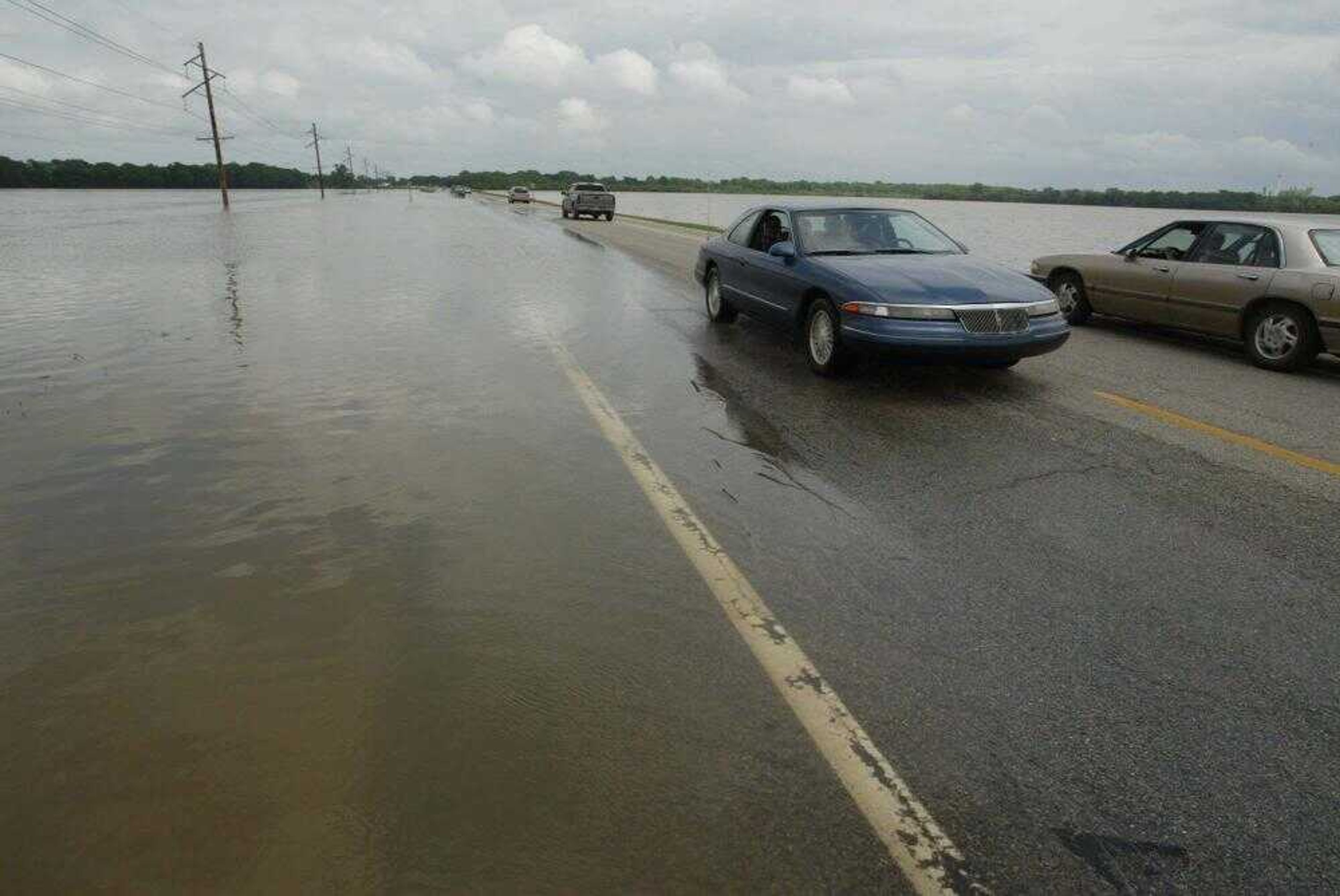
SPRINGFIELD, Mo. -- Storms packing more rain and rough weather hit southwest Missouri and southeast Kansas on Saturday, sparking flash flooding and evacuations, officials said.
Besides the rain, tornadoes or funnel clouds were reported in several southwest Missouri counties, including Polk, Greene, Webster, Dallas and Christian.
"We did have a report of a barn destroyed in Polk County, and we are still awaiting any other potential damage reports," said John Campbell, an operations officer for the State Emergency Management.
Voluntary evacuations were underway Saturday in Iola, Kan., said Corey Schinstock, assistant city administrator.
"Various sections in the south of town are under water, and the water is climbing," Schinstock said. "We have had over 15 inches of rain the last three days. ...All the creeks are flooding."
He said the city also disconnected power to several homes in the town of about 6,000 as a safety precaution. There were no reports of injuries, he said.
In Kansas, Gov. Kathleen Sebelius declared a state of disaster emergency in 12 counties.
The declaration covers Anderson, Butler, Bourbon, Coffey, Cowley, Chautaqua, Linn, Montgomery, Neosho, Osage, Wilson and Woodson counties, all in southeast Kansas.
These counties will be added to an earlier state declaration for the storm period, beginning May 21. The state will seek to have all affected counties included in a federal disaster declaration.
And Missouri emergency officials say the full extent of the weekend's storms could take days to play out, with rain-swollen rivers in western Missouri continuing to rise into next week.
Several of those are in Vernon County.
Campbell said the National Weather Service had forecast additional rain in areas of west-central Missouri south of U.S. 50 and west of U.S. 65.
He said the Little Osage River and the Marmaton River are both forecast to crest ten feet above flood stage on Monday. If the rivers go up another foot beyond that, it could affect U.S. 71, a major north-south highway between Kansas City and Joplin.
The Marais des Cygnes in Bates County is expected to crest at ten and one half feet above flood stage, also on Monday.
Receive Daily Headlines FREESign up today!
And Campbell said the Osage River at Shell City is expected to crest at 13 feet above flood stage on Thursday, although that could change as other rivers feed into the Osage.
Officials already were monitoring reports of high water in Bates, Johnson, Cass and Henry counties, Campbell said. He said Bates County officials had evacuated six people whose homes were threatened.
"We aren't receiving reports of water in homes, at least not on a widespread basis," Campbell said.
The storms followed at least two days of rainfall in the region. The heaviest rainfall came in Butler, Cowley, Chautauqua and Elk counties in southeast Kansas, where the weather service reported about 7 inches of rain Friday.
The Springfield, Mo., area saw as much as 2 inches of rain in an hour Friday, said Doug Cramer, a meteorologist with the weather service.
"It doesn't take much of a storm to produce flash flooding in the Ozarks because of the way the terrain is," he said.
The weather service also issued flood watches and warnings Saturday for much of southeast Kansas and said excess runoff from the heavy rainfall could cause more flooding along creeks and streams.
The Crawford County Sheriff's Department said emergency workers used ropes and a harness to rescue two teenagers from the top of a pickup truck after the truck became wedged against a tree at a low-water crossing in Crawford State Park in southeast Kansas.
Lt. Chuck Yokley of the Kansas Highway Patrol said some homes and businesses in Neodosha, Kan., were damaged from flooding along the Fall and the Verdigris rivers. He also said residents were being told to boil their drinking water.
"Neodesha has limited power, and their water supply is contaminated," Yokley said.
Routes in and out of the Neodesha were also limited Saturday to one county road after high water forced the closure of U.S. 400 and U.S. 75, he said.
At least two homes were evacuated in Dexter, Kan., on Friday, and volunteers were sandbagging to keep floodwaters from reaching a care home, said Mayor Steve Joyce. No injuries had been reported.
Elsewhere in southeast Kansas, Cowley County authorities closed at least 14 roads, including a short stretch of K-15 about 1 miles north of Dexter, said Brian Stone, the county's emergency manager.
In Sumner County, dispatchers said at least 10 roads were closed.
The rain has likely played a role in several accidents throughout the area, said Lt. Phil Bostian of the Kansas Highway Patrol.
Story Tags
Connect with the Southeast Missourian Newsroom:
For corrections to this story or other insights for the editor, click here. To submit a letter to the editor, click here. To learn about the Southeast Missourian’s AI Policy, click here.
Related


Advertisement
Receive Daily Headlines FREESign up today!
