NewsApril 10, 2008
Weather service says severe weather could still hit Southeast Missouri
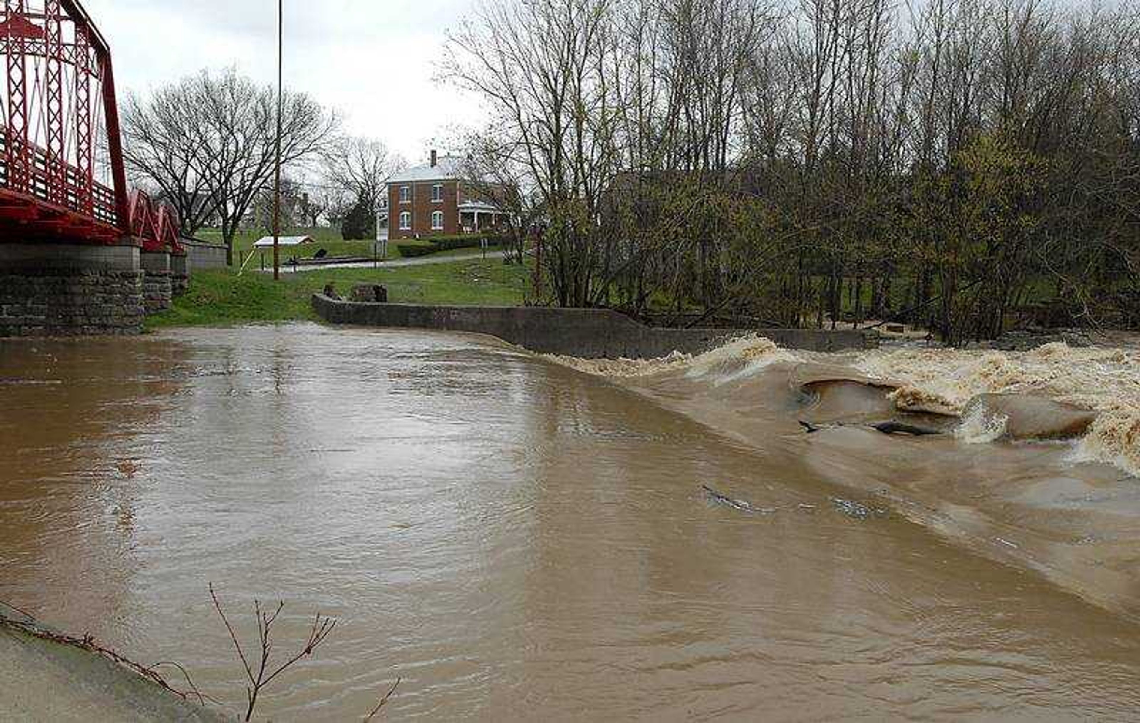
County emergency management directors shrugged off Thursday's rain as typical for Southeast Missouri. But a meteorologist from the National Weather Service's office in Paducah, Ky., said the worse weather is ahead. "We're making preparations, if need be, for the river crest, but that would be it," said Dick Knaup, Cape Girardeau County's emergency manager, in a phone interview during a lull in the rain. ...
County emergency management directors shrugged off Thursday's rain as typical for Southeast Missouri.
But a meteorologist from the National Weather Service's office in Paducah, Ky., said the worse weather is ahead.
"We're making preparations, if need be, for the river crest, but that would be it," said Dick Knaup, Cape Girardeau County's emergency manager, in a phone interview during a lull in the rain. "This is just typical summertime showers. We had a 13-inch rain and now we have three-inch rains and people think the sky is falling. This is what Southeast Missourians have had to live with year after year after year."
Jim Bollinger who does double duty as Bollinger County's emergency management coordinator and Marble Hill fire chief, was following weather reports while in Indianapolis, Ind., for the Fire Department Instructors Conference. He expressed concern about tornado predictions.
"It's a moderate risk. There's a lot of wind shear developing," Bollinger said.
Kenny Simmons, Marble Hill battalion chief, said Crooked Creek was rising Thursday afternoon, but "it wasn't out of the banks."
Flood warnings have been issued by the National Weather Service, but he said "it just depends on what we get this evening. If it's only light showers, slagging off in between, it'll be OK. But it it's a big steady shower, we may see flooding."
Receive Daily Headlines FREESign up today!
Bollinger said the people most at risk were farmers with low-lying fields — more rain will further delay their ability to start spring planting.
NOAA's National Weather Service meteorologist Ryan Presley said the storm systems are behaving as predicted.
"The main threat for severe weather is not anticipated until later this afternoon or early evening," he said. "Things will gradually destabilize. We do have very strong upper-level winds. We see a line of thunderstorm systems from Ripley County to northeast Arkansas that will likely strengthen over the next couple hours, as it heads into the Bootheel and into Southern Illinois and western Kentucky."
He said the storms carry the potential for damaging hail and tornadoes, primarily between the hours of 5 to 9 p.m.
Up to an inch of rain per hour is possible; a wind advisory is in effect through midnight. Cape Girardeau, eastern Perry and eastern Bollinger counties are under stream flood warnings until 8 p.m.
Southeast Missouri counties including Bollinger, Cape Girardeau, Perry, Scott and Stoddard are under a tornado watch until 5 p.m.
Susie Stonner, spokeswoman for the State Emergency Management Agency said "some of the areas flooded before will be flooded again" but forecasters can't make more specific flooding predictions "until the water falls."
Story Tags
Connect with the Southeast Missourian Newsroom:
For corrections to this story or other insights for the editor, click here. To submit a letter to the editor, click here. To learn about the Southeast Missourian’s AI Policy, click here.
Related


Advertisement
Receive Daily Headlines FREESign up today!
