NewsApril 29, 2011
Corps still waiting to decide on blowing levee; Cairo residents urged to leave
With the rivers still swelling and more rain expected, the U.S. Army Corps of Engineers stayed in a "holding pattern" Friday as the mayor of Cairo, Ill., issued his strongest warning yet for residents of the Southern Illinois town to seek higher ground...
With the rivers still swelling and more rain expected, the U.S. Army Corps of Engineers stayed in a "holding pattern" Friday as the mayor of Cairo, Ill., issued his strongest warning yet for residents of the Southern Illinois town to seek higher ground.
Corps officials said Friday afternoon that they'd wait until a conference call Saturday morning to decide again whether to blow the levee at Birds Point, activating the New Madrid floodway, or postpone the decision.
If the decision is made to breach the levee, Corps officials say it will take about 21-24 hours to get the levee ready.
U.S. District Judge Stephen Limbaugh issued his ruling Friday morning giving the Corps the go-ahead to blow a hole in the Birds Point levee in Mississippi County, but a spokeswoman for the Corps said a decision has yet to be reached.
"We're still in a holding pattern," said Mary Statum, a spokeswoman for the Corps of Engineers Memphis District. "We're still watching and waiting."
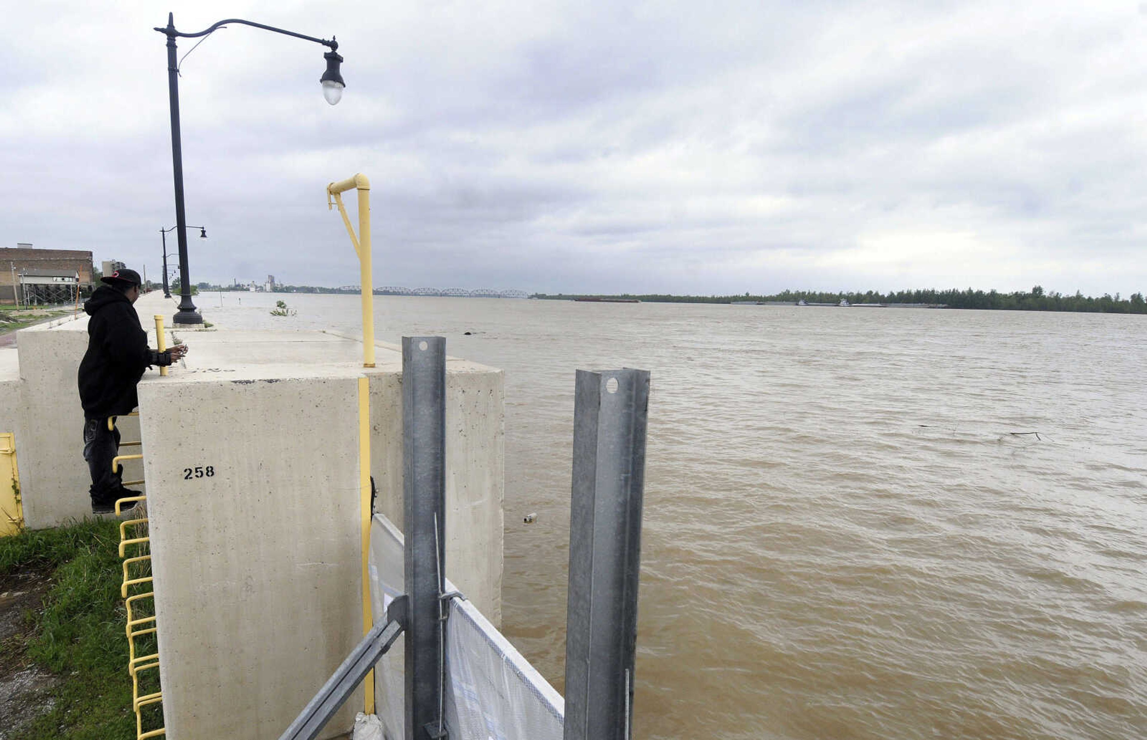
The river gauge at Cairo hit 59 feet Friday morning at 9 a.m., she said, with the plan for detonating the levee set for when the river gauge reads 61. Forecasts call for Southeast Missouri to get another 1 to 3 inches of rain dumped on it, according to David Humphrey, the lead forecaster with the National Weather Service in Paducah, Ky.
A crest of 60.5 is still predicted for the Cairo gauge Sunday morning, Humphrey said, and Cape Girardeau is expected to crest at 46 Sunday morning.
Meanwhile, Cairo mayor Judson Childs issued a release Friday morning "strongly urging" all senior citizens, people with medical conditions or special needs and families with children that live in single-story homes to evacuate within the next 24 hours.
As the river reaches record levels on the Cairo gauge, sand boils are continuing to develop inside Cairo and the North Cairo Drainage District, the release says. Childs worries that the sand boils will compromise the integrity of the levee system.
"This is the strongest warning short of mandatory evacuation," Childs said in the release. "I strongly encourage this evacuation order to be followed."
Receive Daily Headlines FREESign up today!
Community leaders in Cairo are among the strongest proponents of breaching the levee, which would divert floodwaters to about 130,000 acres of private and public property within the spillway, most of which is in Mississippi County. In his ruling, Limbaugh ruled against the State of Missouri and with the Corps of Engineers and the states of Illinois and Kentucky, which maintained the Corps had the authority to blow the levee.
The plan was authorized by Congress by the Flood Control Act of 1928 in response to devastation created by the Great Mississippi River Flood of 1927. The project was designed to protect against other floods, while also safeguarding navigation in the Mississippi River.
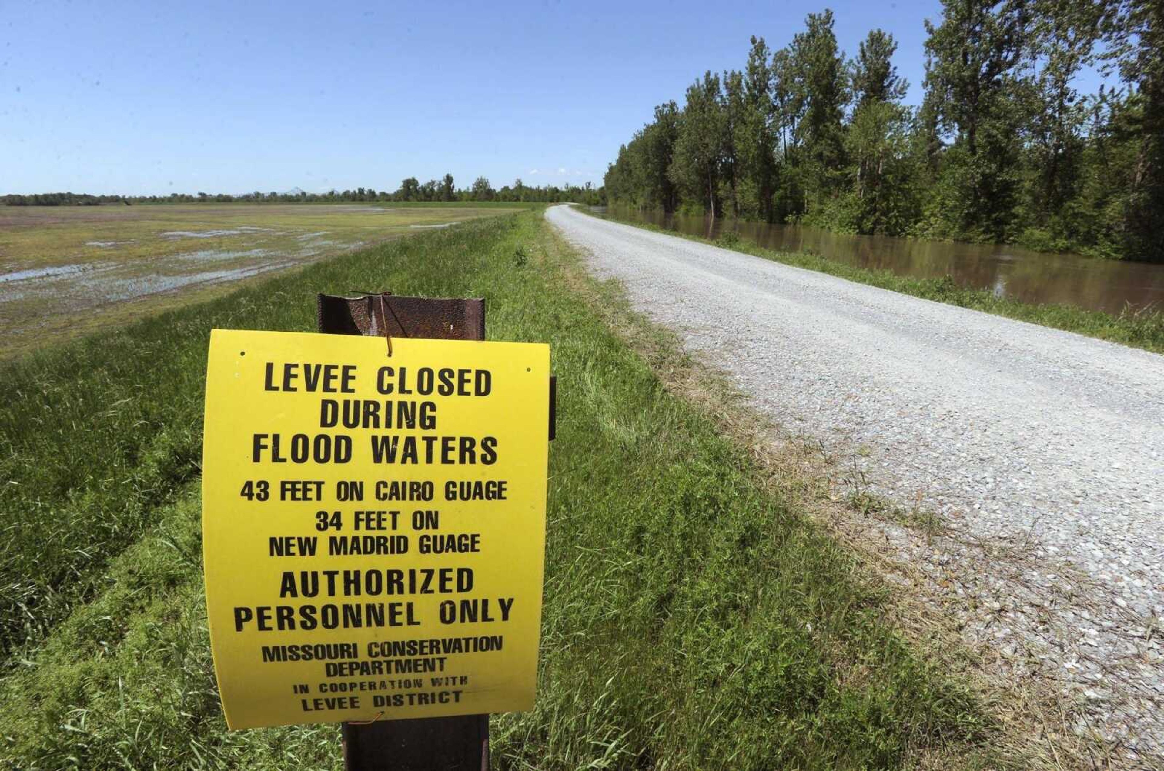
The heart of the project is a 3,787-mile levee system, part of which is the Birds Point-New Madrid floodway. The floodway is just below the confluence of the Ohio and Mississippi rivers and is bounded by two levees. According to testimony Thursday, almost 60 percent of the spillway is already covered by backwater, flooding that occurs when the river downstream backs up to a 1,500-foot gap in the levee on the southern edge of the floodway.
The Corps has sent a barge containing the necessary explosives upriver from Memphis, Tenn., to Hickman, Ky. The president of the Mississippi River Commission, Maj. Gen. Michael J. Walsh, has yet to decide whether to artificially crevasse the levee.
Landowners, largely farmers, within the spillway have said they stand to lose millions if the levee is breached. But the area that encompasses the floodway is subject to 80,892 acres of flowage easements, which means decades ago the landowners released "and held harmless" the U.S. government for any and all damages that occur as the result of the flooding.
smoyers@semissourian.com
388-3642
Pertinent address:
Wyatt, MO
Cairo, IL
Story Tags
Connect with the Southeast Missourian Newsroom:
For corrections to this story or other insights for the editor, click here. To submit a letter to the editor, click here. To learn about the Southeast Missourian’s AI Policy, click here.
Related


Advertisement
Receive Daily Headlines FREESign up today!
