BusinessOctober 31, 2011
Illinois looking for consulting company to do study of I-66 route from Paducah to Cape Girardeau
Although $3.6 million in funding was approved by the U.S. Department of Transportation in August to evaluate the most feasible route for a new road between Paducah, Ky., and Cape Girardeau, the study won't begin until next summer. The funds will be available to the Illinois Department of Transportation in its next fiscal year, beginning July 1, said Carrie Nelsen, IDOT District 9 program development engineer in Carbondale, Ill...

Although $3.6 million in funding was approved by the U.S. Department of Transportation in August to evaluate the most feasible route for a new road between Paducah, Ky., and Cape Girardeau, the study won't begin until next summer.
The funds will be available to the Illinois Department of Transportation in its next fiscal year, beginning July 1, said Carrie Nelsen, IDOT District 9 program development engineer in Carbondale, Ill.
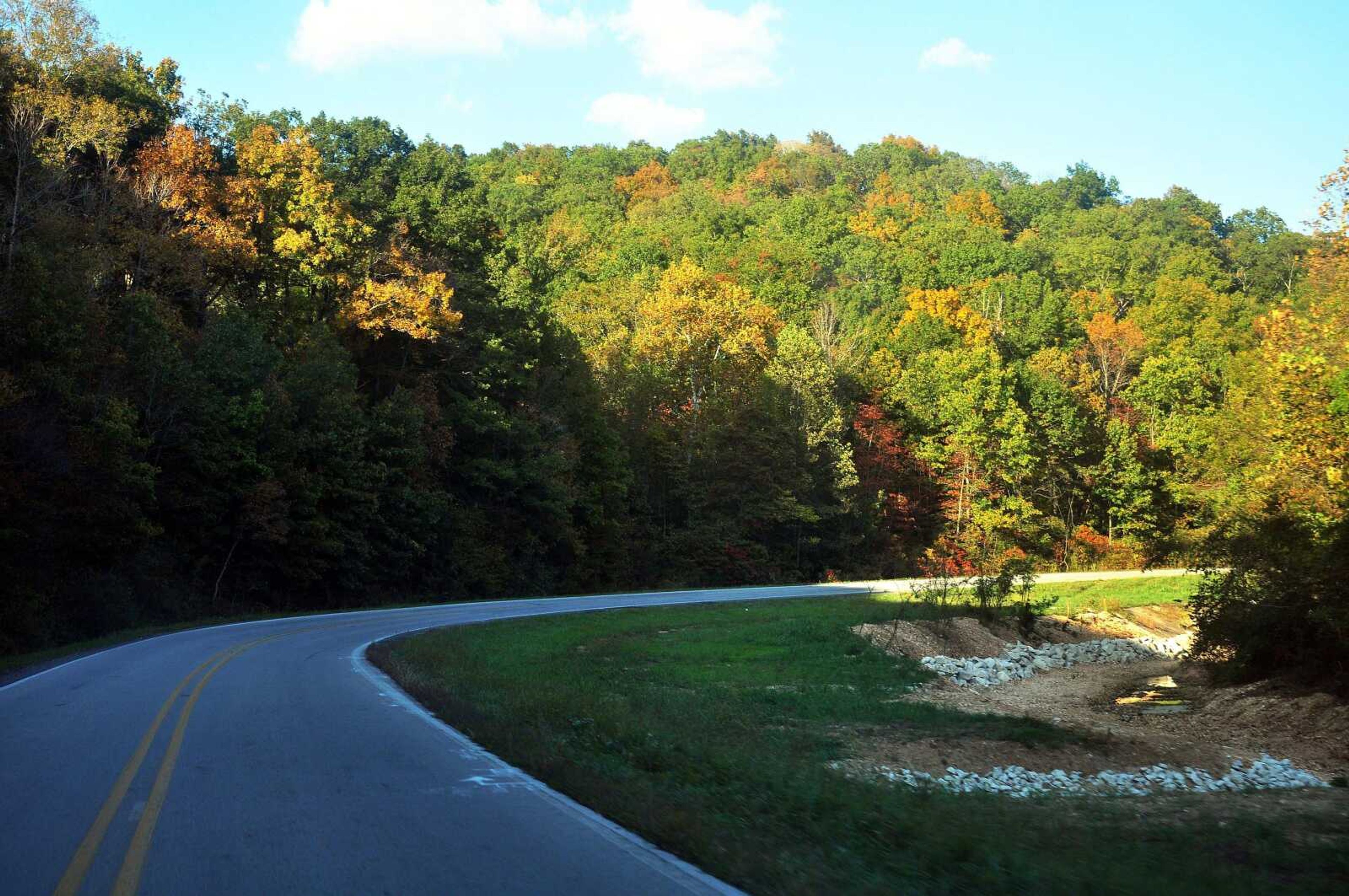
In the meantime, Nelsen said, IDOT is moving forward with finding a consulting company to conduct the phase one study for the new road to be known as Interstate 66. Interstate 66 is estimated to cut the time it takes to get from I-55 to I-24 in Paducah down to about 45 minutes. The trip from Cape Girardeau to Paducah currently can take more than an hour and a half.
"In January we plan to select a consultant, meet with them on getting the scope of services and our plan of attack for this project all together and have the contract documents and everything ready to be executed in July so they can begin working on the project in July," Nelsen said.
It's estimated the phase one study, which includes an environmental evaluation of five Southern Illinois counties the new roadway could pass through, will take three years to complete. Counties in the study are Alexander, Union, Polaski, Massac and Johnson.
"There are a lot of sensitive environmental resources through Southern Illinois and the project area," Nelsen said.
Those resources include wetlands along the Cache River Basin and bluffs along the Mississippi River that may be home to both endangered plant and animal species.
"There will be environmental groups that watch this project very closely," Nelsen said.
The phase one study will fulfill the requirements under the National Environmental Policy Act. NEPA's basic policy is to assure that all branches of government give proper consideration to the environment before undertaking any major federal action that could significantly affect it, according to the EPA's website.

Several public meetings will also be part of the phase one study, and Nelsen said Illinois will be seeking input from Missouri and Kentucky.
"We will have a large public involvement effort to help us really reach out to the stakeholders in Kentucky and Missouri and through Southern Illinois to help us in the decision making process evaluate the alternatives," Nelsen said.
Receive Daily Headlines FREESign up today!
This winter, IDOT and the U.S. Army Corps of Engineers are working on a joint project to complete a LIDAR (light detection and ranging) survey of Southern Illinois.
"It will give us very accurate elevations and topography of all five counties," Nelsen said. LIDAR surveys are conducted by airplanes that bounce laser beams off the ground to produce a high resolution digital terrain model. That data will be used as base data for hydrologic modeling and engineering location studies required in the phase one study, she said.
By the time the study is completed, the environmental effects will be assessed as well as potential routes for the new roadway.
"You'll either have a build alternative or a no-build alternative. If you have a build alternative, you'll have the authority to move forward, to begin to purchase land and design the facility," Nelsen said.
The I-66 project is part of the East-West Transamerica Corridor, a national transportation plan first studied in the 1980s that would start in San Diego and end in the Norfolk, Va., area. The 2,400-mile route would cross 11 states.
Cape Girardeau leaders have long championed the I-66 cause to provide a shorter, more efficient route for local manufacturers to truck their goods to the East.
As it is now, they have to go 100 miles out of their way, said Jeff Glenn, a consultant to the city on the I-66 project.
At this time, there is no further funding for I-66 past the initial route study, and there is a lot of uncertainty about future federal highway funding. The last federal highway bill was approved by Congress in 2005 and expired in 2010. Since then, state departments of transportation have been operating under continuing resolutions.
Glenn said supporters of the Transamerica corridor will continue to seek funding for the I-66 project.
mmiller@semissourian.com
388-3646
Pertinent address:
Paducah, Ky.
Story Tags
Connect with the Southeast Missourian Newsroom:
For corrections to this story or other insights for the editor, click here. To submit a letter to the editor, click here. To learn about the Southeast Missourian’s AI Policy, click here.
Related


BusinessOct. 11


Advertisement
Receive Daily Headlines FREESign up today!
