NewsApril 24, 2013
Farmers left to wait, worry as flood waters rise
Farmers in Southeast Missouri are watching the water -- in the Mississippi River, in the St. Johns Bayou Basin and in the labyrinth of ditches that drain their fields. As the forecast threatens flooding, crops that recently have been planted and that need to be seeded are at risk...
Farmers in Southeast Missouri are watching the water -- in the Mississippi River, in the St. Johns Bayou Basin and in the labyrinth of ditches that drain their fields. As the forecast threatens flooding, crops that recently have been planted and that need to be seeded are at risk.
"It makes for some sleepless nights," said David Eddy, who farms land in the St. Johns Bayou Basin near New Madrid, Mo. Flood gates there have been closed to protect against rising river levels, but the area is in danger of water backing up into the basin and regional drainage ditches.
Delays have derailed a plan made in the 1950s to provide pumps to alleviate backwater flooding as part of the St. Johns Bayou and New Madrid Floodway project. Most recently, the project has been stalled since 2008 awaiting a federal environmental impact statement.
When the river reaches its expected crest in the Cape Girardeau area Thursday, about 100,000 local acres will be flooded, much of that farmland, according to the National Weather Service.
Eddy said he needs to plant his rice crop "pretty soon." If flooding keeps the ground under water or too wet to plant, he will have to replace the rice with soybeans, which can be planted later in the season, he said. Land he farms in the watershed just outside the bayou was planted last week with corn, but if the drainage ditches can't operate properly, that crop could be wiped out.
"It won't take much water to get over it and destroy it," Eddy said.
Newly-sprouted seeds need oxygen and can only survive under water a short time, said Anthony Ohmes, regional agronomist with the University of Missouri Extension in Jackson. In current, cool conditions, there is about a 48-hour window during which crops can be submerged before oxygen levels begin to rapidly decline. When the temperature is above 77 degrees, the window of time narrows, he said.
Rice and corn have a similar planting schedule, Ohmes said. If planting occurs after May 10, yields likely will be reduced. Soybeans can be planted later and still produce, but ideally should not be planted after mid-June, he said.
The levee that flanks the Diversion Channel near Nash Road is being monitored as part of the U.S. Army Corps of Engineers "Phase 1 flood fight," according to Kevin J. Woods, emergency manager for the corps' Memphis District. Water is touching the earthen levee and an official from the corps' Caruthersville, Mo., field office has reported normal levels of seepage and no sand boils, he said. No other areas have been reported to the corps as being in imminent danger, he said.
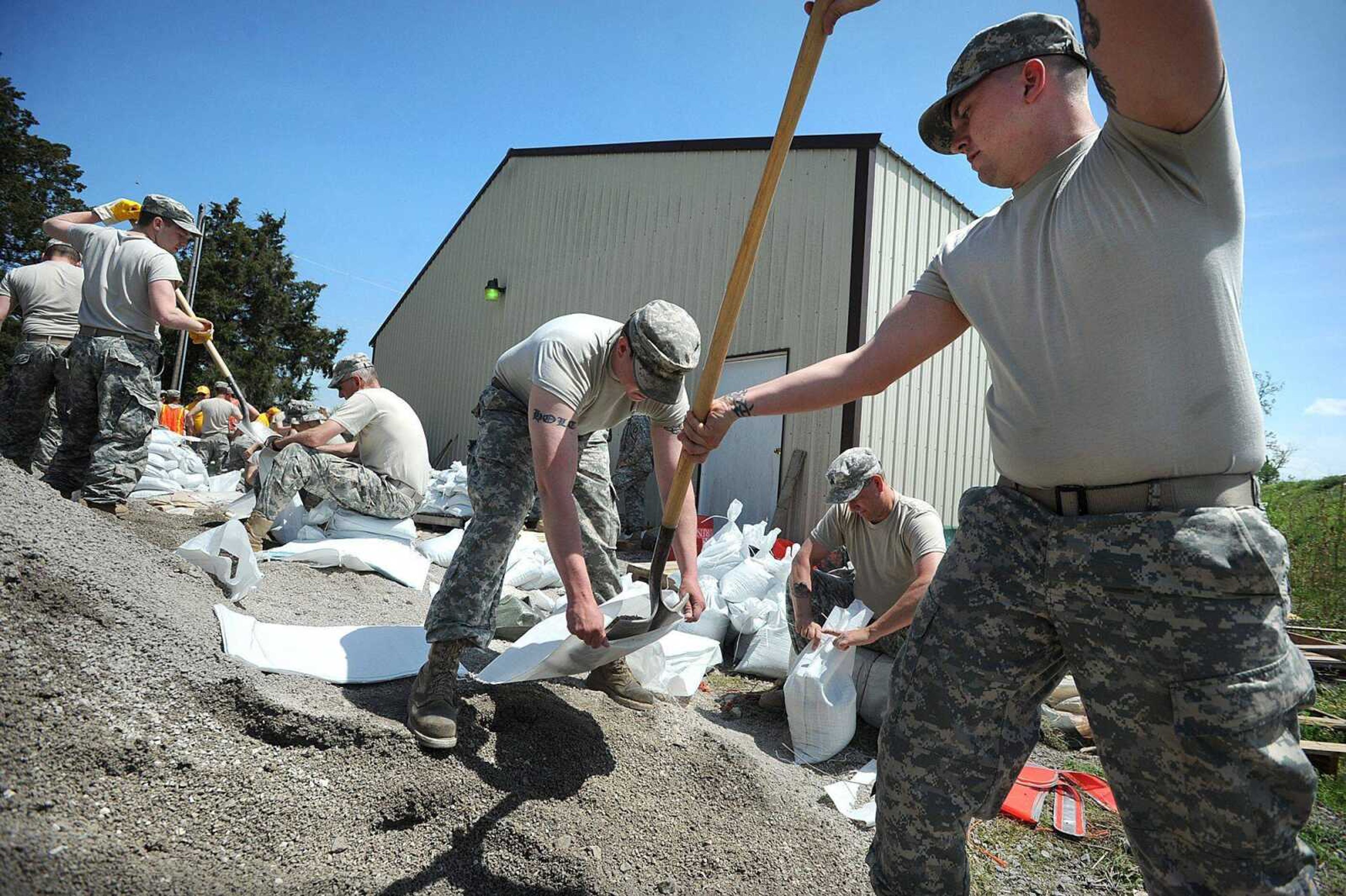
Gov. Jay Nixon on Friday declared a state of emergency and activated the Missouri National Guard and the corps to set up an emergency operations center in St. Louis to send sandbags and flood relief supplies to affected areas.
Receive Daily Headlines FREESign up today!
About 50 soldiers of the Cape Girardeau-based 1140th Engineer Battalion and the Perryville, Mo.-based 880th Engineer Team -- both part of the 35th Engineer Brigade, based at Fort Leonard Wood -- helped with sandbagging operations Monday and Tuesday in Dutchtown to prepare for potential floodwaters.
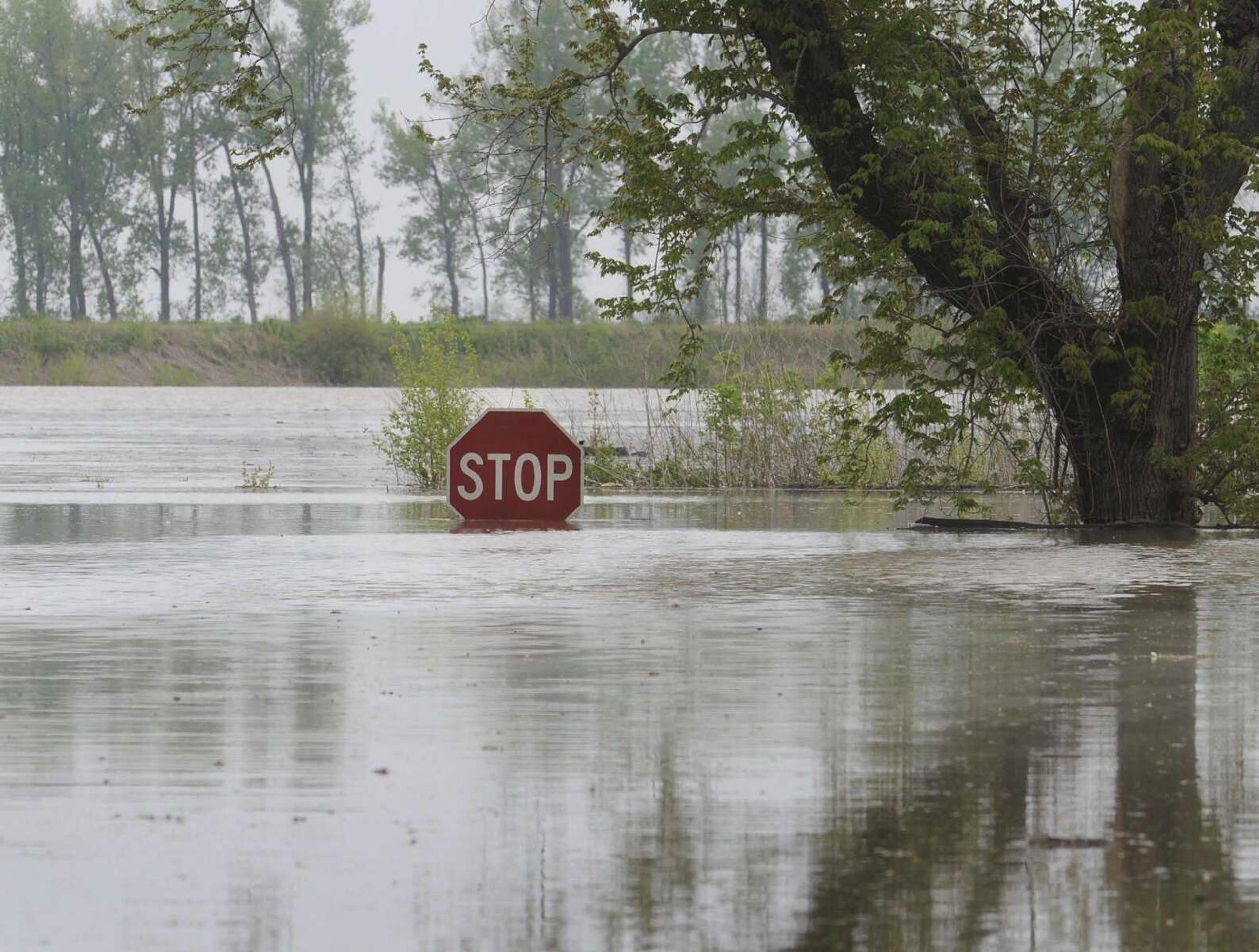
Floodgates in downtown Cape Girardeau, where flood stage is 32 feet, closed Friday. The term "flood stage." according to the NWS, is the "established gage height for a given location above which a rise in water surface level begins to create a hazard to lives, property, or commerce." At 10:30 a.m. Tuesday, the reading at Cape Girardeau was 40.17 feet.
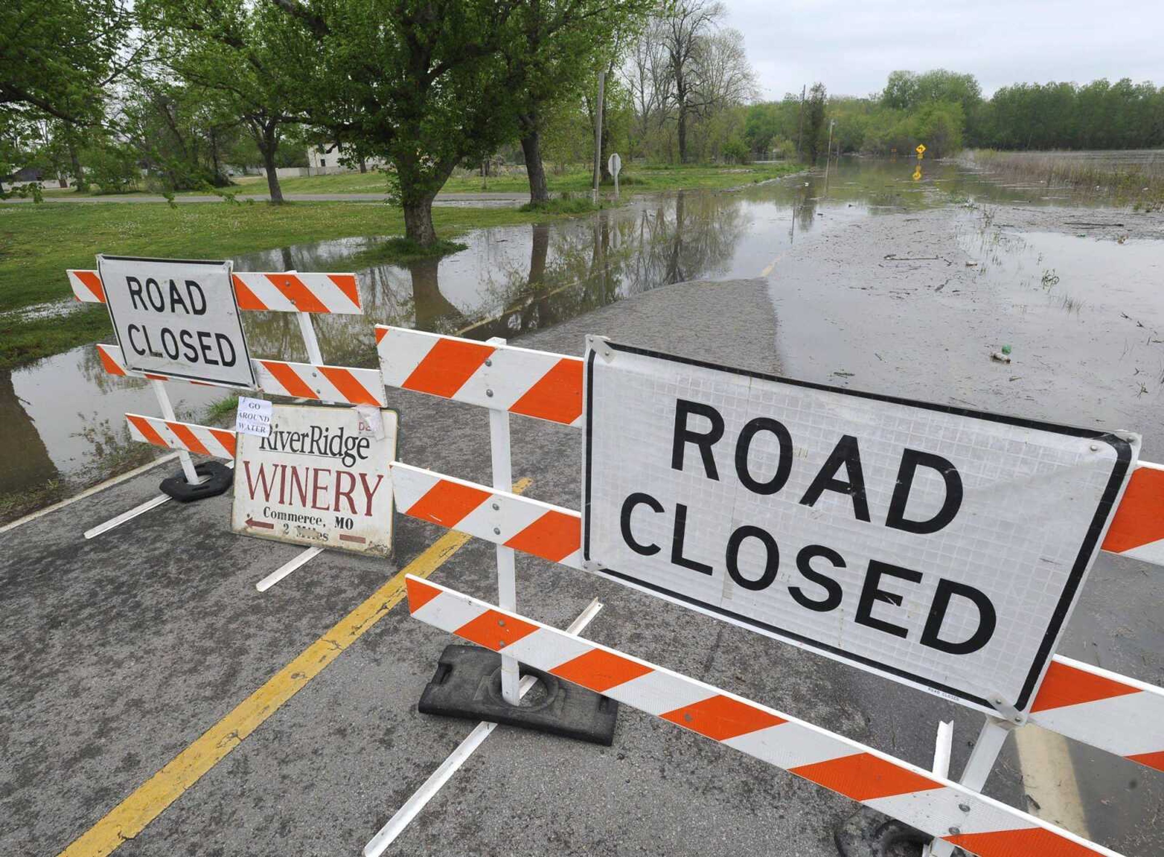
Thanks to buyouts, the flooding won't affect many homes in the Cape Girardeau area. But the swollen Mississippi and its tributaries had closed a few state roads in Southeast Missouri -- Route A in southern Perry County, routes E and C in northern Perry County, Route E in Scott County near Commerce and Route E in northern Stoddard County among them.
Showers and thunderstorms began drenching the region Tuesday, exacerbating the flooding problem. The river was expected to reach 42 feet on the gauge at Cape Girardeau by Thursday, then begin to fall.
In St. Louis, crews scrambled to stem the flow of millions of gallons of raw sewage that has been pouring into the river since two of three pumps failed at a treatment plant two days earlier.
The plant processes some 110 million gallons of sewage a day; about half of that was being discharged into the river untreated. Many communities downriver draw their drinking water from the Mississippi. Cape Girardeau, however, ended its dependence on the river for drinking water last year, when it switched to getting all its water from wells.
The Associated Press contributed to this report.
salderman@semissourian.com
388-3646
Pertinent address:
Cape Girardeau, MO
New Madrid, MO
Nash, MO
Story Tags
Advertisement
Connect with the Southeast Missourian Newsroom:
For corrections to this story or other insights for the editor, click here. To submit a letter to the editor, click here. To learn about the Southeast Missourian’s AI Policy, click here.


Advertisement
Receive Daily Headlines FREESign up today!
