NewsJune 5, 2013
Allenville residents, farmers concerned about floodwaters
The only road to and from Allenville right now is County Road 238, and even that road will be impassable as the water rises, leaving the town inaccessible by vehicle. The Mississippi River reached 42.5 feet at Cape Girardeau on Tuesday afternoon, passing the 41.12-foot crest in April. The river is expected to crest at 45 feet Thursday...
The only road to and from Allenville right now is County Road 238, and even that road will be impassable as the water rises, leaving the town inaccessible by vehicle.
The Mississippi River reached 42.5 feet at Cape Girardeau on Tuesday afternoon, passing the 41.12-foot crest in April. The river is expected to crest at 45 feet Thursday.
Floodwaters sent people this week in Dutchtown scrambling to build sandbag levees to protect their homes, but people in nearby Allenville also are concerned with steadily rising backwater from river tributaries. Farmers are losing crops and others worry about getting stuck in the town with no way in or out.
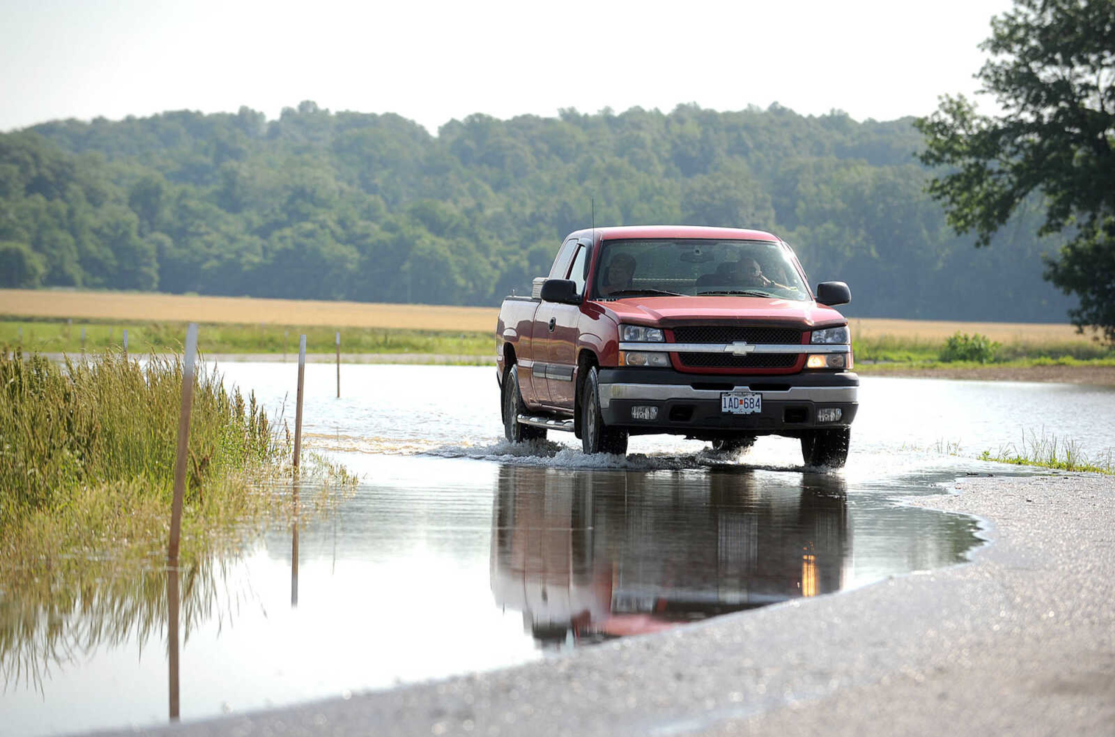
Terry Ross, 65, and his wife drove their red 2004 Chevrolet pickup through water on County Road 241 on Tuesday morning, heading back to Allenville. That road is now impassable.
"Make the water go away," he said. "That's all I have to say. I'm afraid it's going to get bad."
Ross said every time the area has a big flood, there wasn't a big rain to go with it. He dreads when both happen at once, and he is wary of the rain expected this week. Ross said if there's a repeat of the rain from last weekend, Dutchtown and Allenville will be a disaster.
"It'll be 'Good night, Irene,'" he said.
He's also upset about the tearing down of a railroad trestle, which has been the go-to route to get in and out of the small town when all the roads are underwater.
Ross and his wife have bailed out of Allenville over that trestle during flooding several times before, once in an old Chevelle, driving on the tracks.
In the last big flood for the area in 2011, the couple and their dog took a four-wheeler across.
Ross said the trestle was being taken down when the water started rising and parts of the tracks were stripped off. Jackson, Gordonville and Delta Railroad President Robert L. Adams said a contractor had been taking up rail on the south side and probably will be finished sometime in August. Adams said the trestle isn't safe for people to use, even during times of flooding.
Georgia Summers lives with her sister and niece just across the road from fields full of creeping water, but the family isn't worried about flooding in their home. Water sometimes settles in the front of the yard and covers some of the roads, but the house is raised high enough that it's not an issue.
The family hasn't moved out of the house during times of flooding since 2008, the first year they lived in the home. That time, they had to move their things out with a boat. Water hasn't reached the house since, but Summers said she's watching.
Receive Daily Headlines FREESign up today!
Larry Quade, a farmer who has lived in the area his entire life, said the encroaching river water hasn't moved him out of his home, but it's hard on crops.
"It's never got up high enough to get to our house, but it seems to be getting worse and worse," he said.
Rising backwater flooding is overtaking his fields, and it's causing problems. Quade said a lot of seed and machinery had to be moved out. He's lost about 200 acres of wheat so far and anticipates losing about 200 acres of corn. He probably won't plant anymore corn this year, but hopes to plant some soy beans when the water goes down.
Quade said what concerns farmers and residents in the area is when the Diversion Channel sends water from big rains from the north end of the channel. The water backs up into the fields. Quade said when the fields fill up, it's like a flash flood. As time goes on, the channel keeps putting more water in the area.
He plans to get elevation shots with a GPS unit to see how much water the area can hold. The water reached 48 feet in 1993, but there still was 3 feet left on Quade's land.
"We're just trying to see how much water we can take before it really bothers us," he said. "The water starts in at 29.5 feet, 30 feet on our low ground, and then as it comes up, it takes more of our ground and more of our ground and when it gets to 48, there's not much of any of it left."
The flooding is hard on a lot of farmers in the area, but everyone helps each other move seed and equipment out, Quade said.
"I do appreciate that, and it helps," he said. "We all try to work together."
Eric McGowen, Cape Girardeau County emergency management agency public information officer, said if a medical evacuation is necessary in the area, it will be by helicopter or boat. The county has updates for road closings on its website, capecounty.us.
botto@semissourian.com
388-3620
Pertinent address:
Allenville, Mo.
Story Tags
Connect with the Southeast Missourian Newsroom:
For corrections to this story or other insights for the editor, click here. To submit a letter to the editor, click here. To learn about the Southeast Missourian’s AI Policy, click here.
Related


Advertisement
Receive Daily Headlines FREESign up today!
