NewsFebruary 5, 2014
Snow and ice move across region
Cardinals pitchers and catchers are due in Jupiter, Fla., next week. Southeast Missourians might want to hang onto that knowledge, because it's about the only sign of spring on the horizon as another round of snow and ice moves through the area.
Cardinals pitchers and catchers are due in Jupiter, Fla., next week.
Southeast Missourians might want to hang onto that knowledge, because it's about the only sign of spring on the horizon as another round of snow and ice moves through the area.
By Tuesday afternoon, a mixture of snow, sleet and freezing rain was on its way up from Arkansas and Tennessee, and meteorologist Kelly Hooper of the National Weather Service in Paducah, Ky., said it wasn't likely to leave any time soon.
"What falls is going to stay here for a while. ... We're below freezing the whole, entire seven-day forecast right now," Hooper said Tuesday.
Forecasters expected the slippery mixture to extend from Poplar Bluff, Mo., to Cape Girardeau, with more snow than ice anticipated farther north, he said.
"We could see one to two inches easily from Poplar Bluff to Cape Girardeau, tapering off southeastward," Hooper said. "We could see as much as three to four inches, say, from Van Buren up through Perryville. That'll be mostly snow."
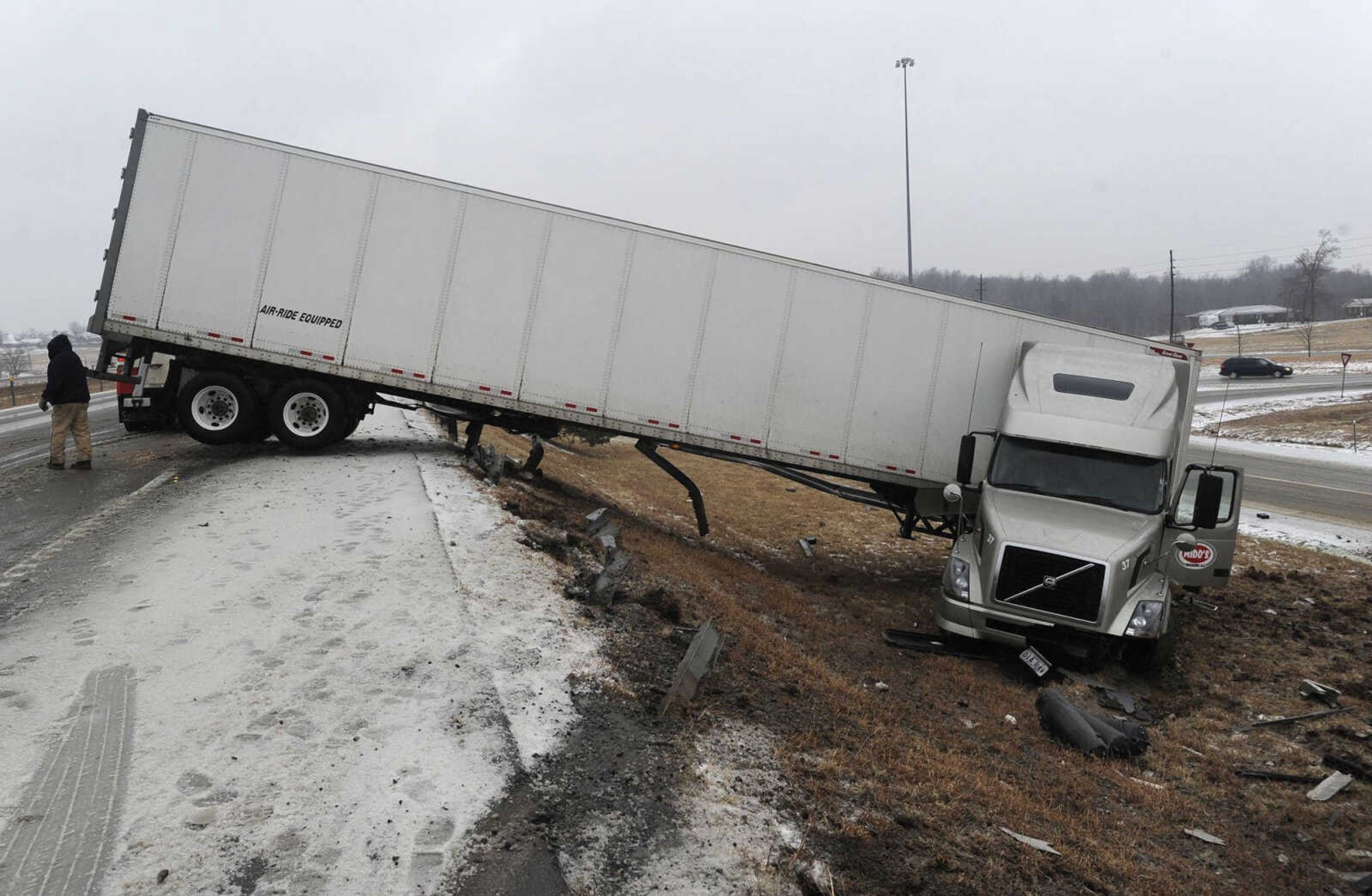
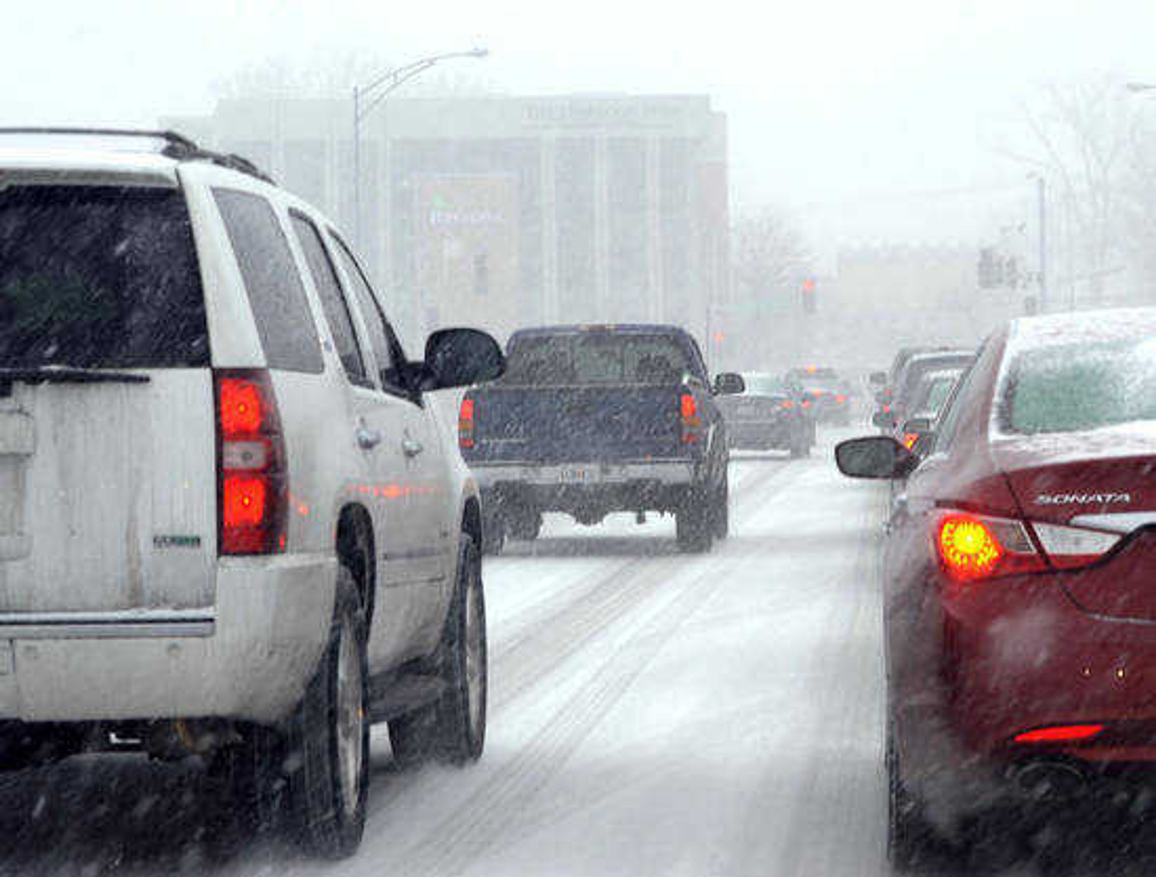
The weather already was causing trouble for drivers early Tuesday afternoon in Cape Girardeau.
Police scanner traffic indicated vehicles were having trouble climbing ice-covered hills, causing traffic to back up in some areas, and first responders stayed busy handling traffic crashes Tuesday evening, including a three-vehicle accident on the bridge over the Diversion Channel near mile marker 95 on Interstate 55.
Meanwhile, a semi blocked the road at mile marker 107, hampering Missouri Department of Transportation crews, and the Missouri State Highway Patrol reported at least two weather-related crashes in Stoddard County, Mo.
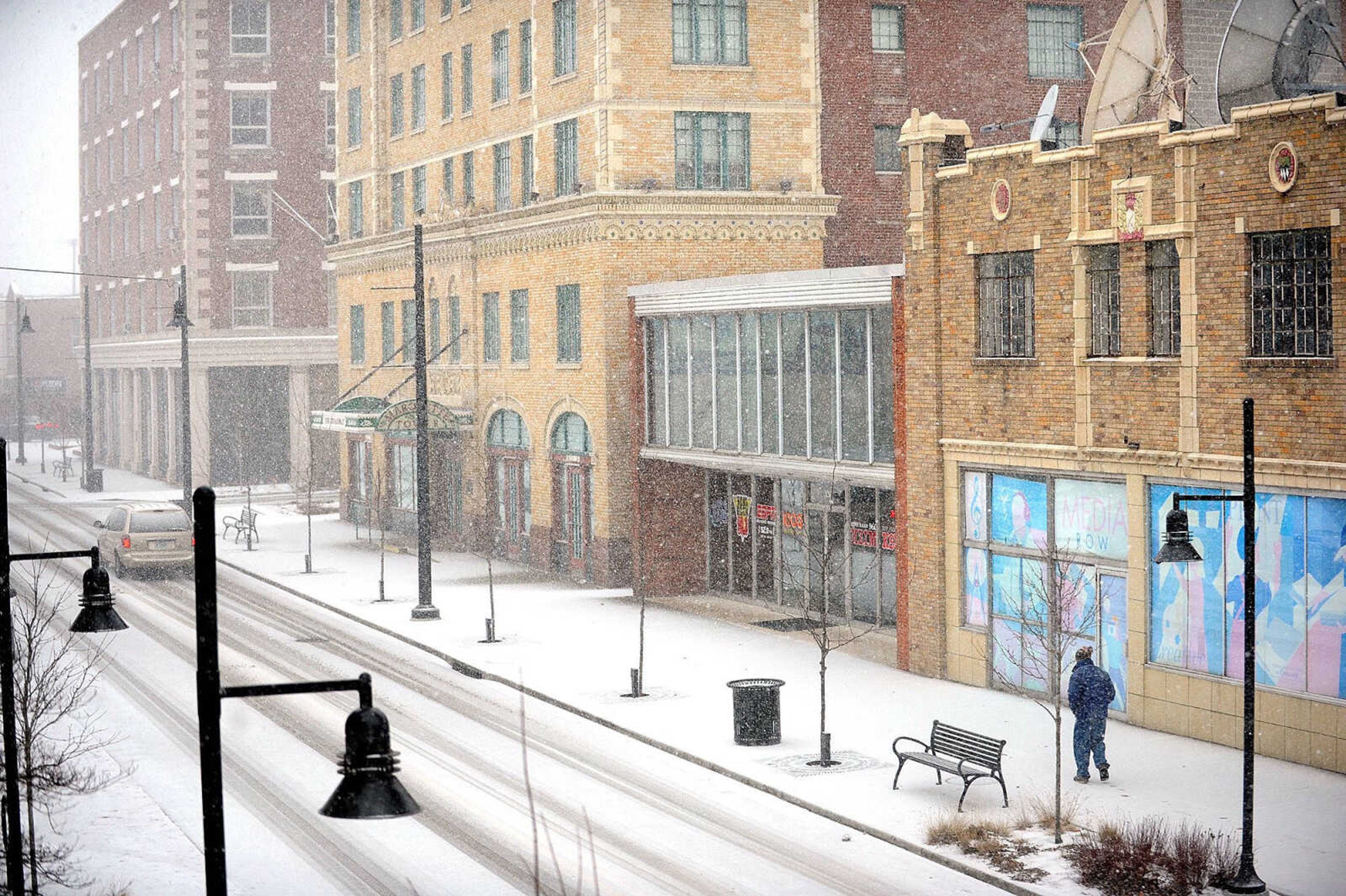
Most of the region was under a winter storm warning Tuesday, including Bollinger, Cape Girardeau, Perry, Scott and Stoddard counties in Missouri and Alexander, Jackson and Union counties in Illinois.
Receive Daily Headlines FREESign up today!
Hooper said the area could see a little more precipitation, possibly Friday night, but the amounts "don't look too impressive."
"Wednesday night, we're going to dip on down into the teens, looking at highs Thursday around 20," Hooper said. " ... Subfreezing would be the right descriptor."
MoDOT's online traveler information map showed nearly every road in the state partly or completely covered with ice and snow Tuesday afternoon and evening, with the exception of interstates 57 and 55 in the Bootheel.
The goods news is that salt will work down to 25 degrees, Hooper said, which should enable road crews to clear the highways.
"What's on the grass and ground, we're not going to get rid of, but sooner or later, they'll get them roads cleared, even if we don't go above freezing," he said.
Hooper advised the following precautions:
* Avoid driving if possible.
* Have a safe alternate heat source in case the power goes out.
* Check on the elderly.
* Avoid prolonged exposure to cold air, especially as temperatures dip into the teens.
"It only takes about 30 minutes or so for frostbite to touch in," Hooper said. "Thirty minutes to an hour. ... Don't have much [skin] exposed. Try to cover stuff."
epriddy@semissourian.com
388-3642
Story Tags
Connect with the Southeast Missourian Newsroom:
For corrections to this story or other insights for the editor, click here. To submit a letter to the editor, click here. To learn about the Southeast Missourian’s AI Policy, click here.
Related


Advertisement
Receive Daily Headlines FREESign up today!
