NewsJune 18, 2015
'Major' river flooding predicted in region
The Mississippi River's predicted crest has risen again. The river now is expected to crest at 43 1/2 feet Tuesday morning, according to the National Weather Service River Forecast Center. At Cape Girardeau, the Themis Street floodgate, which closes when the river reaches 35 feet, was closed Wednesday...
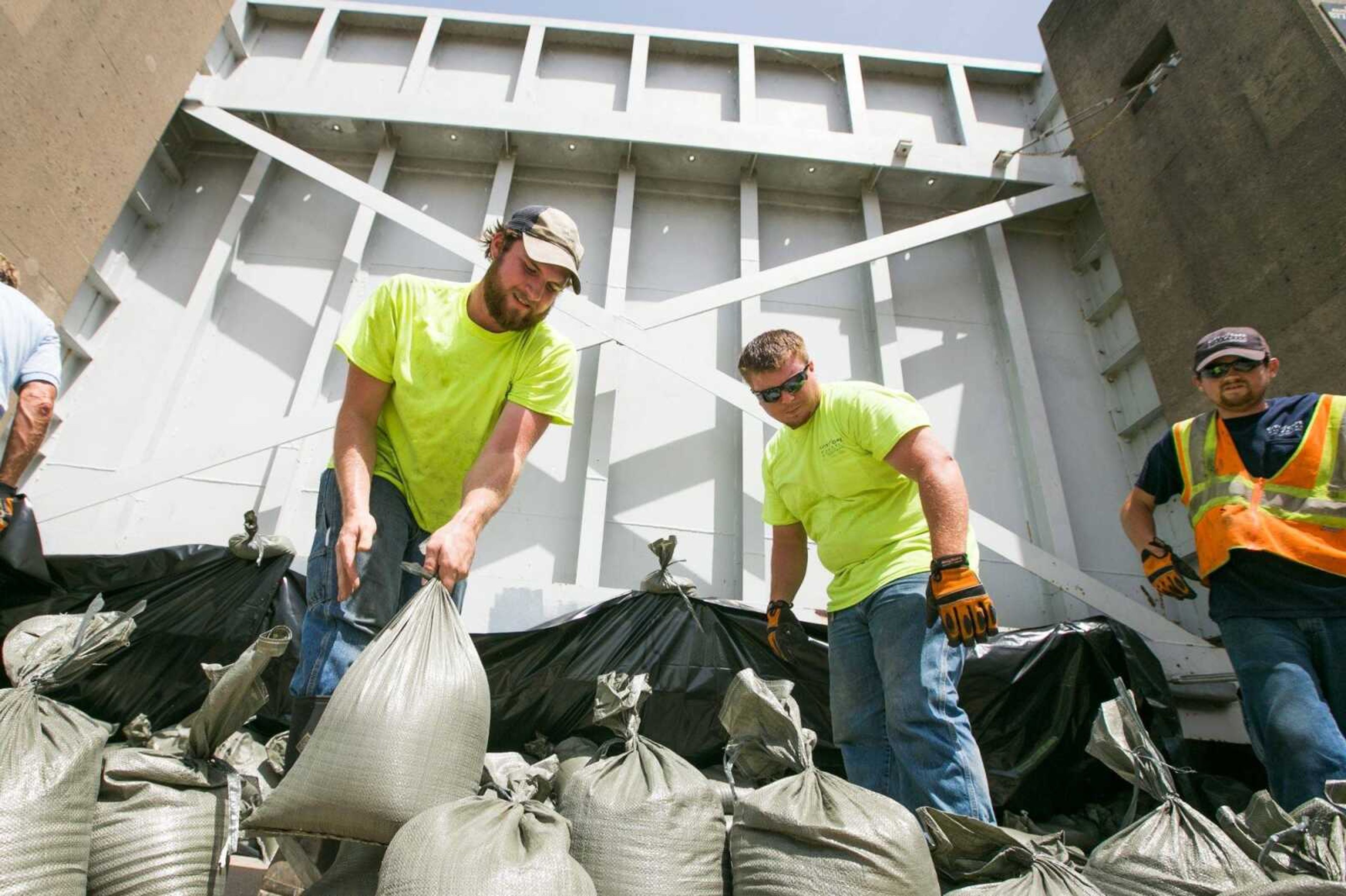
The Mississippi River's predicted crest has risen again.
The river now is expected to crest at 43 1/2 feet Tuesday morning, according to the National Weather Service River Forecast Center.
At Cape Girardeau, the Themis Street floodgate, which closes when the river reaches 35 feet, was closed Wednesday.
The Broadway gate, which is closed when the river hits 37 1/2 feet, is expected to close no later than Friday morning, Cape Girardeau assistant public works director Stan Polivick said earlier this week.
The North Main Street gate also likely will close. City procedure calls for it to be closed at 39.5 feet, and Polivick said the decision will be made after coordinating with the railroad.
The area's flood warning was upgraded from moderate to major severity Wednesday for Cape Girardeau and Thebes, Illinois, according to the National Weather Service. Counties affected are Cape Girardeau, Perry and Scott in Missouri and Alexander, Jackson and Union counties in Illinois.
The warning said heavy expected rainfall in the coming days, plus runoff upstream, "will cause major flooding on the Mississippi River at these locations."
Remnants of Tropical Storm Bill are expected to bring heavy rain to the region Friday and Saturday, with 1 to 3 inches likely, the National Weather Service indicated, and a small chance of thunderstorms remaining Sunday and Monday.
If the river crests at the 43 1/2-foot mark, it will take over the No. 10 spot of historic high-water marks at Cape Girardeau. Holding that position is a crest of 42.40 feet on May 27, 1943, according to water.weather.gov.
The Mississippi last crested July 13 at 34.84 feet.
Dutchtown
Cape Girardeau County emergency management director Richard Knaup said at 42 feet, the river would be at the top of Dutchtown's improvised levee and culvert.
"At 43 1/2, I believe it will be coming through the culvert to the north side of (Highway) 74 and across the 74/25 intersection," Knaup said.
Knaup said he wasn't sure how the town plans to handle the flooding, seeing as how residents are in the middle of a buyout.
"The official stance of Cape Girardeau County is they're an incorporated entity, and the county can't use official county funds" to help Dutchtown residents fight the flood, he said. "It kind of makes it difficult on them."
Last year, the Missouri Department of Economic Development awarded Dutchtown $208,663 in community development block grant funds to help buy properties damaged by flooding in 2011. The Federal Emergency Management Agency approved $797,758 toward the buyout.
Because of the grant, the town's focus is on meeting its required 25 percent grant match instead of sandbagging, Dutchtown emergency management coordinator Doyle Parmer said earlier this week.
Knaup said he's been told a couple of houses in Dutchtown already have been vacated.
"The way I'm understanding, the buyout was offered to 15 parcels, and only 12 property owners took the buyout. Three of them did not," Knaup said, adding the county was not involved in the buyout.
Knaup said residents who come to the county emergency management office for help will be directed to a shelter where they can stay to wait out the flooding.
Receive Daily Headlines FREESign up today!
"I have already had discussions swith the American Red Cross and the Salvation Army, and we are prepared to do that, if necessary."
kwebster@semissourian.com
388-3646
Pertinent address:
Themis and Water streets, Cape Girardeau, MO
Broadway and Water Street, Cape Girardeau, MO
Dutchtown, MO
1 Barton Square, No. 102, Jackson, MO 63755
---
Historic crests at Cape Girardeau
1. 48.49 feet on Aug. 8, 1993
2. 47.00 feet on May 24, 1995
3. 46.90 feet on Aug. 3, 1993
4. 46.28 feet on May 3, 2011
5. 45.70 feet on May 18, 2002
6. 45.50 feet on May 1, 1973
7. 45.35 feet on April 29, 2011
8. 44.53 feet on June 7, 2013
9. 44.10 feet on April 17, 1979
10. 42.40 feet on May 27, 1943
Source: water.weather.gov
Story Tags
Connect with the Southeast Missourian Newsroom:
For corrections to this story or other insights for the editor, click here. To submit a letter to the editor, click here. To learn about the Southeast Missourian’s AI Policy, click here.
Related


Advertisement
Receive Daily Headlines FREESign up today!
