NewsMay 27, 2024
Home, tree damage reported after possible funnel cloud spotted
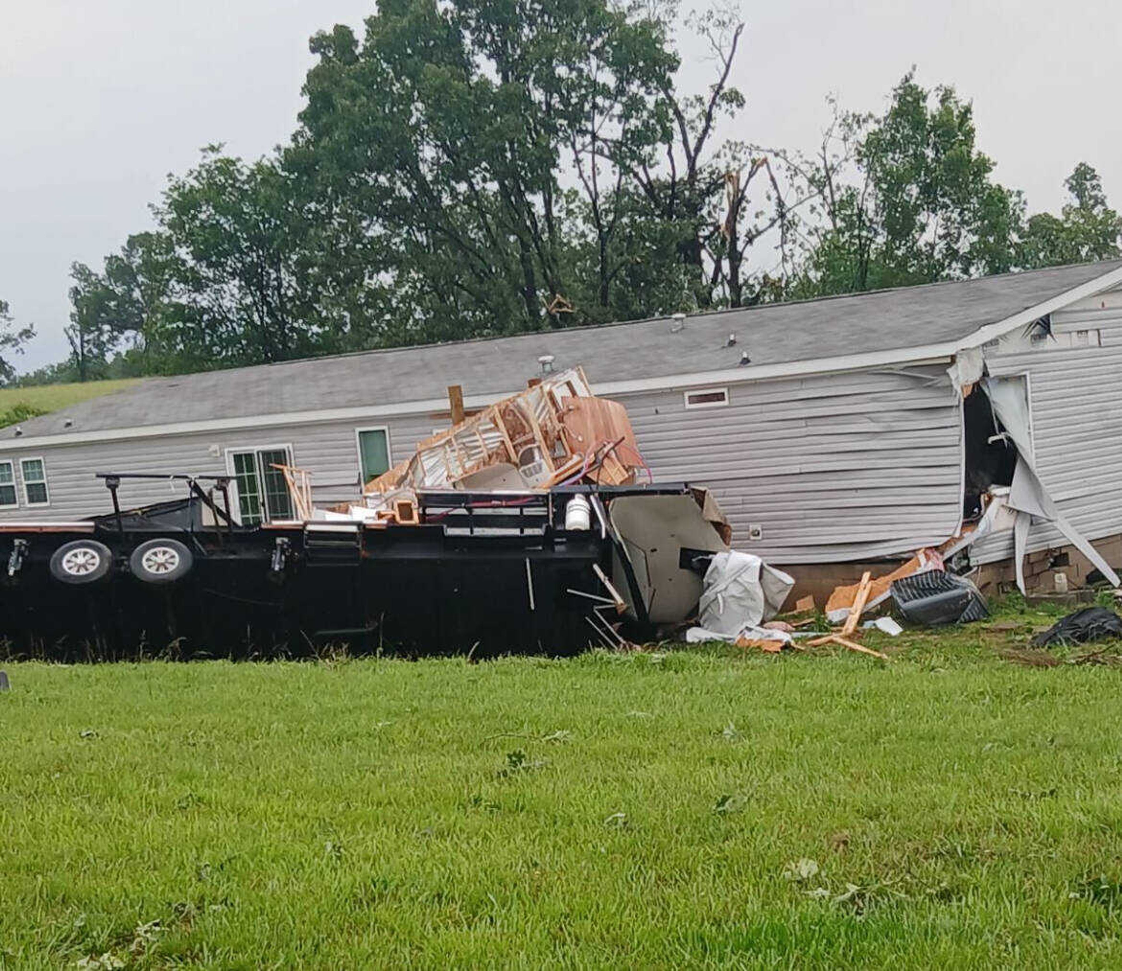
Tree, home and power line damage is being reported across southwest Butler County following a round of severe weather between 6-7 a.m. Sunday. Poplar Bluff Severe Weather Storm Spotters say a possible funnel cloud was spotted around 7 a.m., but no tornado has been confirmed as of 7:30 a.m...
Donna Farley
Tree, home and power line damage is being reported across southwest Butler County following a round of severe weather between 6-7 a.m. Sunday.
Poplar Bluff Severe Weather Storm Spotters say a possible funnel cloud was spotted around 7 a.m., but no tornado has been confirmed as of 7:30 a.m.
No injuries have been reported as of that time, said Craig Meador of the storm spotters.
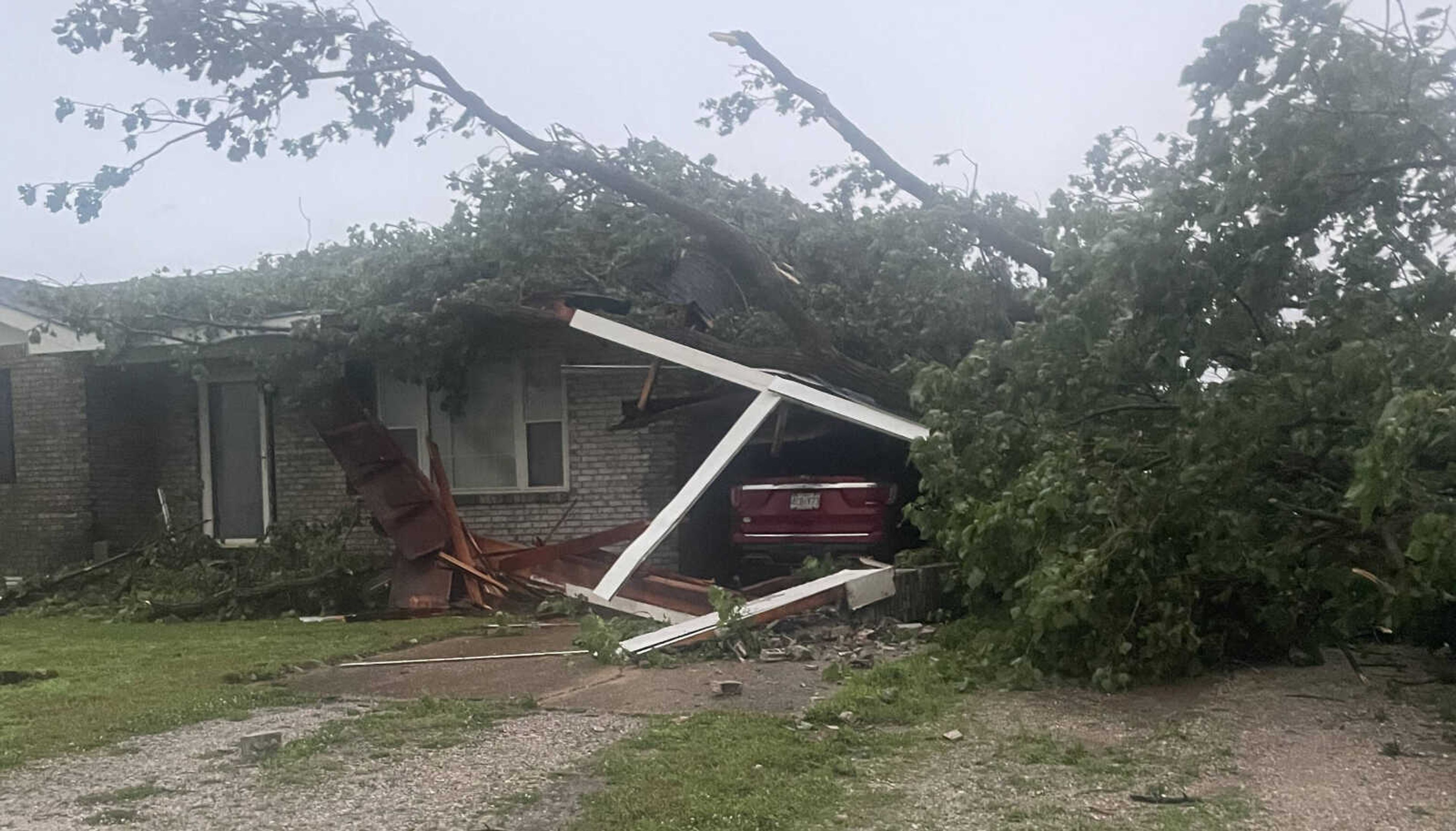
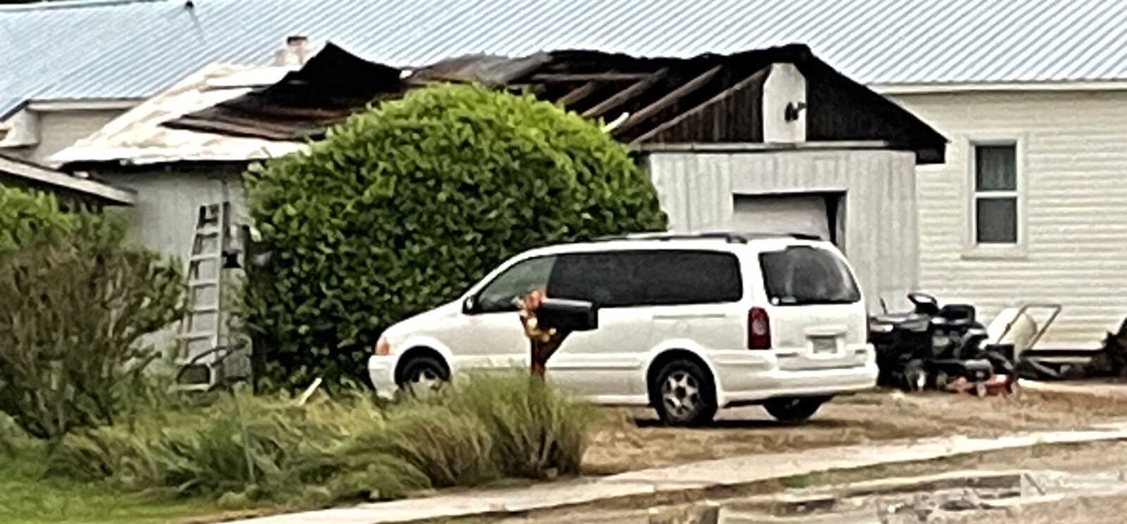
“We never really got a 100 percent confirmation of a tornado on the ground, although spotter Jim Hager did see a funnel aloft at one point near Broseley,” Meador shared. “We have lots of damage in Ripley County, lots of damage in Neelyville. Trees are reported down and power lines.”
A tree has been reported down on a house at Neelyville, he said, as well as on County Road 461.
Receive Daily Headlines FREESign up today!
Large trees are uprooted at County Road 486, near the intersection of 471, with power lines down, Meador said. This is in the area of Westwood Hills Golf Course.
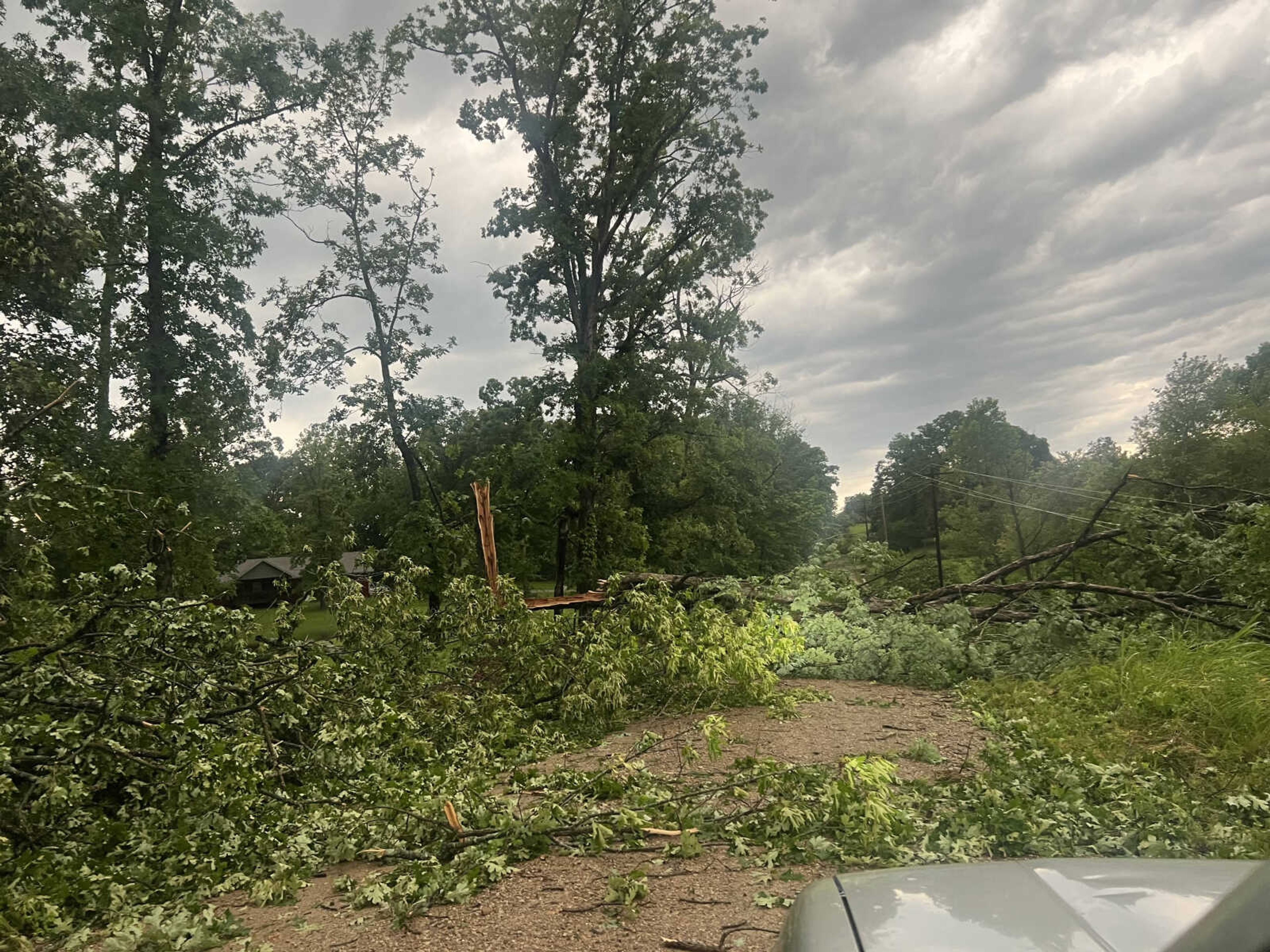
Westwood Hills officials announced Sunday, “Due to excessive high winds and possible tornado the golf course will be closed for the following week. Clean up will probably take longer, but we will notify all members by email or text.”
A semi-truck rollover near Heartland Express was also reported to officials shortly after 7 a.m.
Flash flooding has also been reported, Meador said. He estimated the area got at least 1 inch of raid over a short period of time as the system moved through the area.
“It’s calmed down for us now,” Meador said. “We’re expecting some isolated storms throughout the day and another round this evening.”
Story Tags
Connect with the Southeast Missourian Newsroom:
For corrections to this story or other insights for the editor, click here. To submit a letter to the editor, click here. To learn about the Southeast Missourian’s AI Policy, click here.
Related


Advertisement
Receive Daily Headlines FREESign up today!
