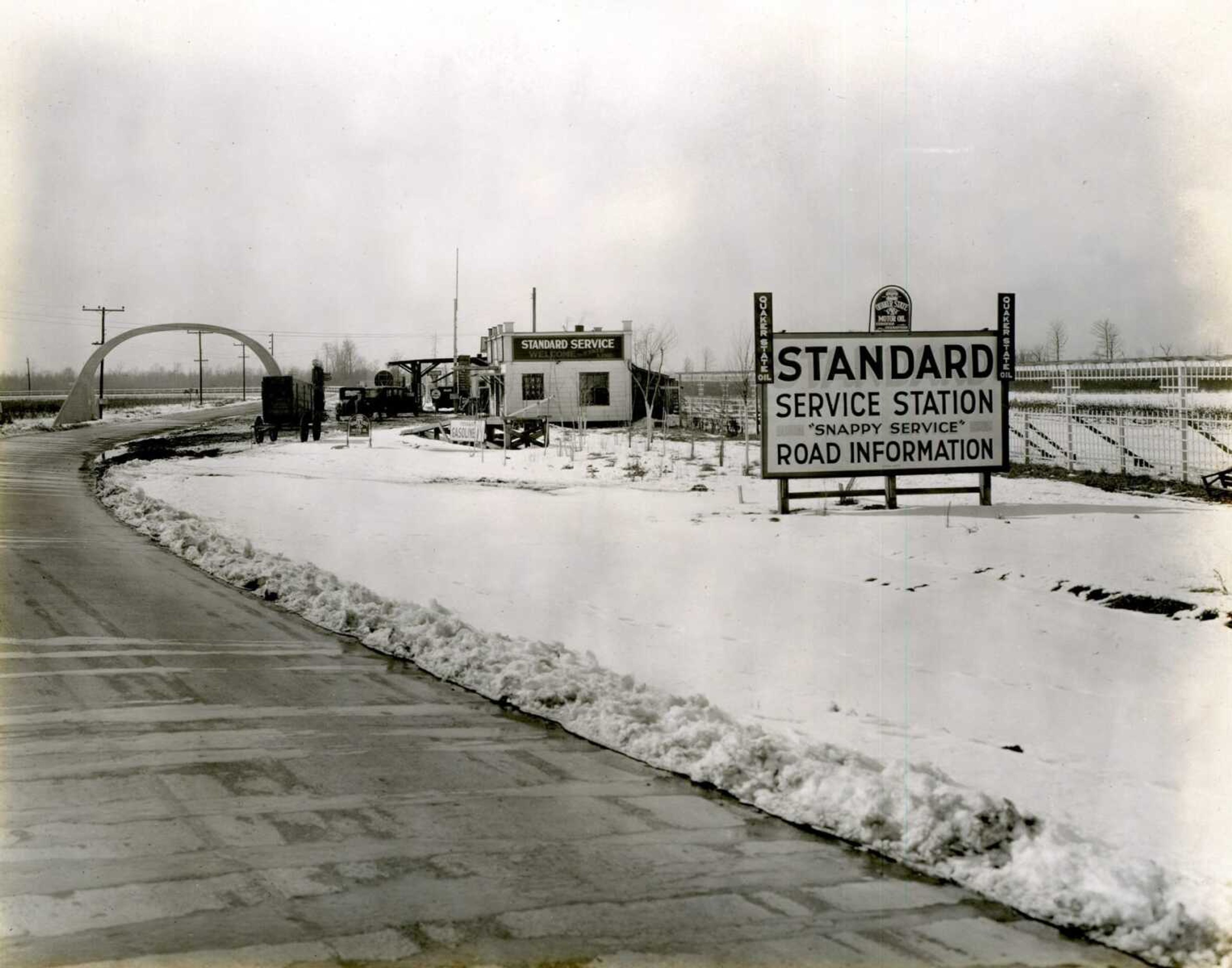
The U.S. 61 arch
EDITOR'S NOTE: This is Garret Wright's final article for the Southeast Missourian. He has written a history column for this newspaper since 2018. The Missourian thanks him for his contributions and wishes him well in the future. Known as the Great River Road or Blues Highway because of its link to the musical genre, United States Highway 61 begins in Wyoming, Minnesota, and terminates in New Orleans. ...
EDITOR'S NOTE: This is Garret Wright's final article for the Southeast Missourian. He has written a history column for this newspaper since 2018. The Missourian thanks him for his contributions and wishes him well in the future.
Known as the Great River Road or Blues Highway because of its link to the musical genre, United States Highway 61 begins in Wyoming, Minnesota, and terminates in New Orleans. In Missouri, the highway spans the entire eastern border of the state. Construction began on the highway in 1926.
Two years earlier, in 1924, commissioners with the Mississippi County Road Improvement District (Arkansas) erected a concrete arch between Steele, Missouri, in Pemiscot County, and Blytheville, Arkansas, to separate the two states' borders. Depending on which direction a driver approaches, they will see "Entering Arkansas" or "Entering Missouri" etched into the top of the arch. The commissioners also constructed a similar arch in Crittenden County, Arkansas, on the Tennessee border near Memphis, but this was removed in the 1950s when the road was widened to accommodate larger vehicles.
The road received funding for paving as part of the Federal Aid Road Act of 1921. To be eligible for federal funding, a state needed to have connected roads, which needed to be 18 feet wide and be maintained by states rather than the federal government. Prior to the paving of the road, the highway was just a dirt road, named the North-South Road, which became highly impassible when it rained.
The arch was designed by H.H. Hall Construction Co., with the concrete being provided by Fischer Lime and Cement Co.
This arch is significant because it is the only remaining arch that separates Arkansas's borders with its neighboring states.
Once the paving occurred, service stations popped up on the Missouri side almost immediately, due to the lower cost of items in Missouri. At its height, 14 service stations dotted the landscape. Also included were night clubs and gambling establishments. The area was known to locals as "Little Chicago."
Construction of Interstate 55 a few miles away in the early 1960s lead to a dramatic decline in vehicular traffic. Travelers wanted a quicker way to get to Arkansas provided by the interstate system. The number of vehicles traveling under the arch declined rapidly. The last service station closed in 1989. The arch is still standing, and because of its proximity to the roadway, expansion of the road is impossible. The arch was listed on the National Register of Historic Places in October 2001.
Connect with the Southeast Missourian Newsroom:
For corrections to this story or other insights for the editor, click here. To submit a letter to the editor, click here. To learn about the Southeast Missourian’s AI Policy, click here.


