WorldOctober 9, 2024
Here's what has made Hurricane Milton so fierce and unusual
With its mighty strength and its dangerous path,
SETH BORENSTEIN, Associated Press


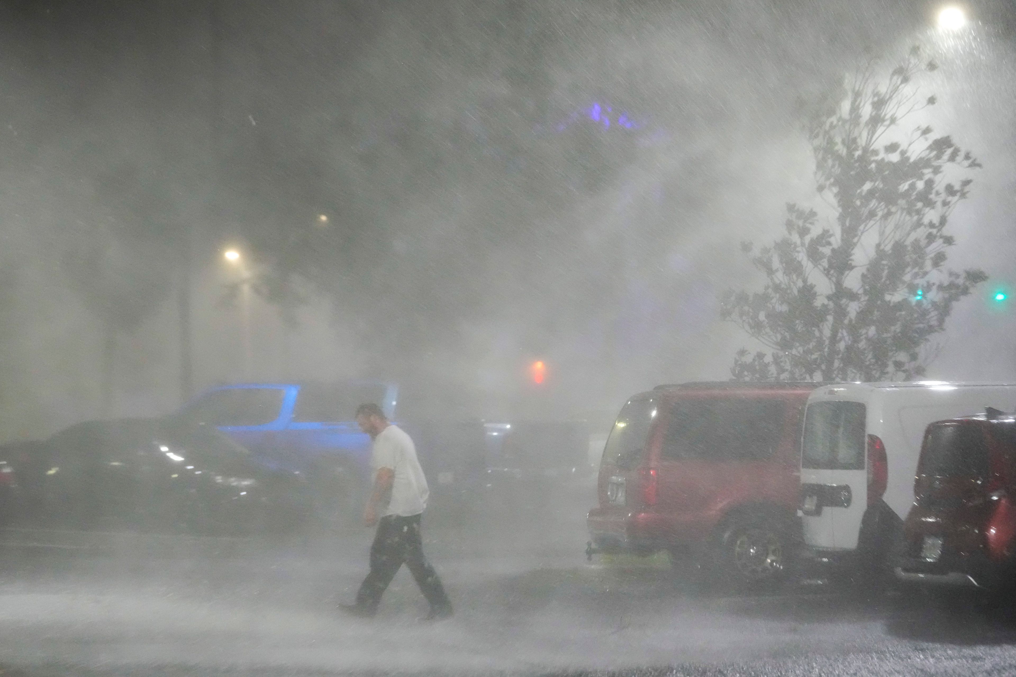
With its mighty strength and its dangerous path, Hurricane Milton powered into a very rare threat flirting with experts' worst fears.
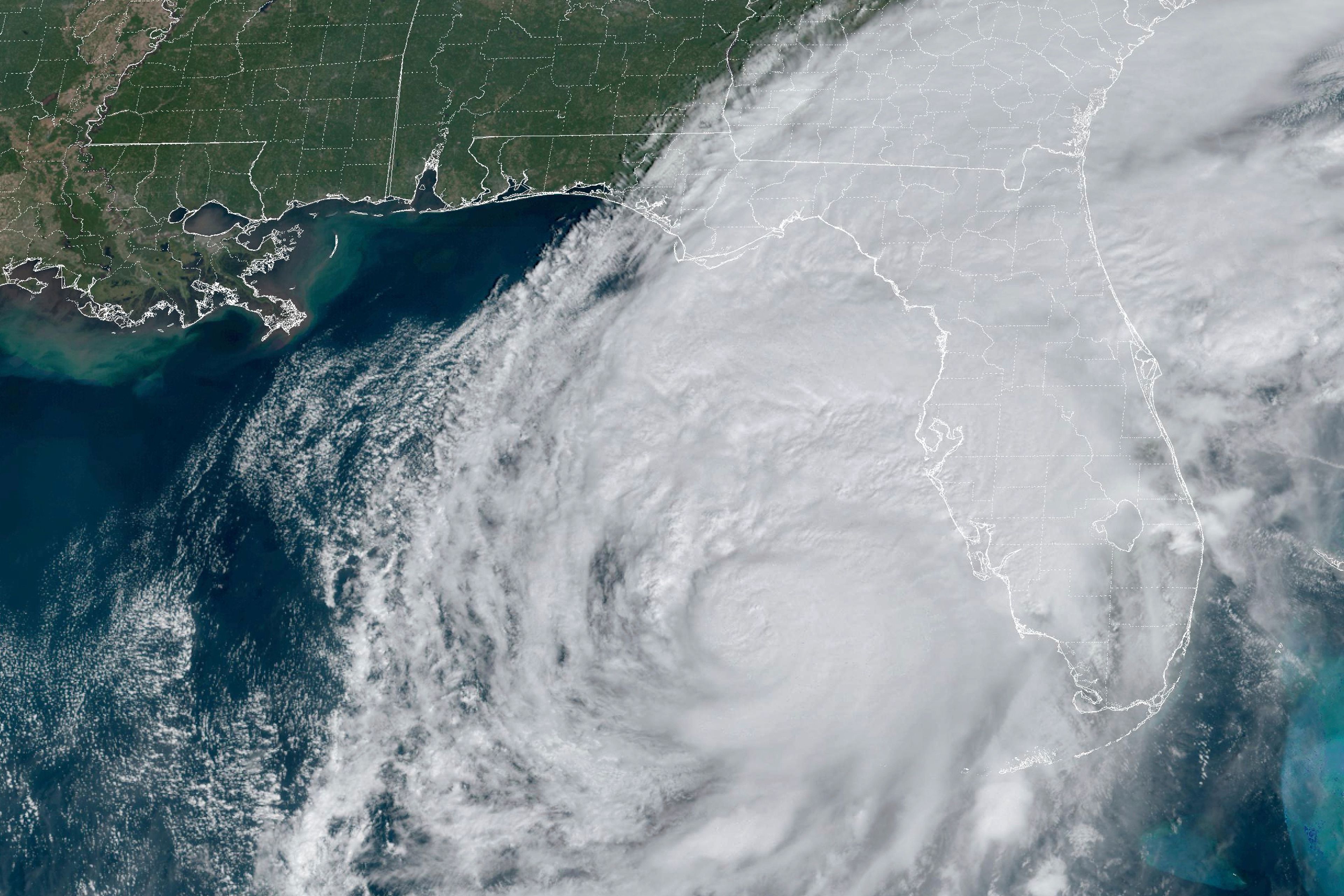
Warm water fueled amazingly rapid intensification that took Milton from a minimal hurricane to a massive Category 5 in less than 10 hours. It weakened, but quickly bounced back, and when its winds briefly reached 180 mph, its barometric pressure, a key measurement for a storm's overall strength, was among the lowest recorded in the Gulf of Mexico this late in the year.
At its most fierce, Milton almost maxed out its potential intensity given the weather factors surrounding it.
“Everything that you would want if you’re looking for a storm to go absolutely berserk is what Milton had,” Colorado State University hurricane researcher Phil Klotzbach said.
That's not all. Milton's eastward path through the Gulf is so infrequent the most recent comparable storm was in 1848. Tampa — the most populous metro area in its general path — hasn't had a direct hit from a major storm in more than 100 years, making this week the worst-case scenario for many experts.
The track “is not unprecedented but it's quite rare,” said University of Miami hurricane researcher Brian McNoldy. “And of those that did that track, this is by far the most intense.”
“It is unusual in a number of ways,” Princeton University climate scientist and hurricane expert Gabriel Vecchi said. “This storm is probably going to be very unlike any storm anyone has experienced on the west coast of Florida.”
But it might be getting less rare, and the U.S. is already on a particularly unlucky streak. When Helene plowed through Florida less than two weeks ago, it was the seventh Category 4 or stronger storm to make landfall in the continental U.S. in eight years. That's more than triple the average annual rate of such monster landfalls in the U.S. since 1950, according to a data analysis by The Associated Press.
If Milton somehow hits as a Category 4 storm at landfall it will be only the second time the nation was struck twice in a year by hurricanes so powerful. This is after an unusual 12-year period when no Category 4 or higher storms hit the mainland between 2005 and 2016.
University of Albany atmospheric scientist and hurricane expert Kristen Corbosiero said Milton’s threat now, compared to that 12-year quiet period, is probably a combination of luck — that those previous big storms didn’t make landfall — and climate change that is steering big storms differently than before.
“With more and stronger storms, the chances of a major hurricane hitting the U.S. increase,” she said.
So much of what makes Milton nasty is rooted in the warmer water of its birth and in human-caused climate change, Vecchi, Corbosiero and others said.
Milton formed in the Bay of Campeche in the southwestern Gulf of Mexico. For awhile, forecasters didn't give the unstable air mass much of a chance to develop into a tropical storm, let alone a monster hurricane. But once it defied the odds, it took off because of warm water and it managed to avoid high-level cross winds that often decapitate storms, especially in autumn. As Milton neared Florida it hit those winds, called shear, which ate away at its strength, as meteorologists had forecasted.
Warm water fuels hurricanes. It's crucial that the surface water be at least 79 degrees (26 degrees Celsius) and it helps incredibly when there's deep warm water.
The water at Milton's birth and along its path was around 87 degrees (30.5 degrees Celsius). That's almost 2 degrees (1 degree Celsius) warmer than normal and near record levels, both on the surface and deep, McNoldy said.
Receive Daily Headlines FREESign up today!
“Part of the reason it was so warm is because of global warming,” Vecchi said, though he added that last year's El Nino — a natural warming of ocean waters that influences weather worldwide — and other natural factors played a role. “Now the storm has a lot more energy to draw on.”
That water became an all-you-can eat buffet for Milton.
Much like an ice skater spinning with her arms close in rather than outstretched, Milton’s small size and pinhole eye — which became as small as 4 miles across — also made it easier to supercharge.
And then there's the track. Corbosiero couldn't think of a similar track for such a powerful storm, especially in October when there are fewer strong storms in the Gulf and the nastiest storms are more in the Caribbean.
Klotzbach found one in 1848, before good records were kept, unearthing a storm other experts weren't quite familiar with.
Usually storms in the Gulf of Mexico start in the east and go west or just go north, but Milton is heading east-northeast, Vecchi said. That's because of a weather system in Canada and the U.S. East Coast that is pushing the westerly winds that are common in mid-latitudes down to where Milton is, where autumn wind from the west is less common.
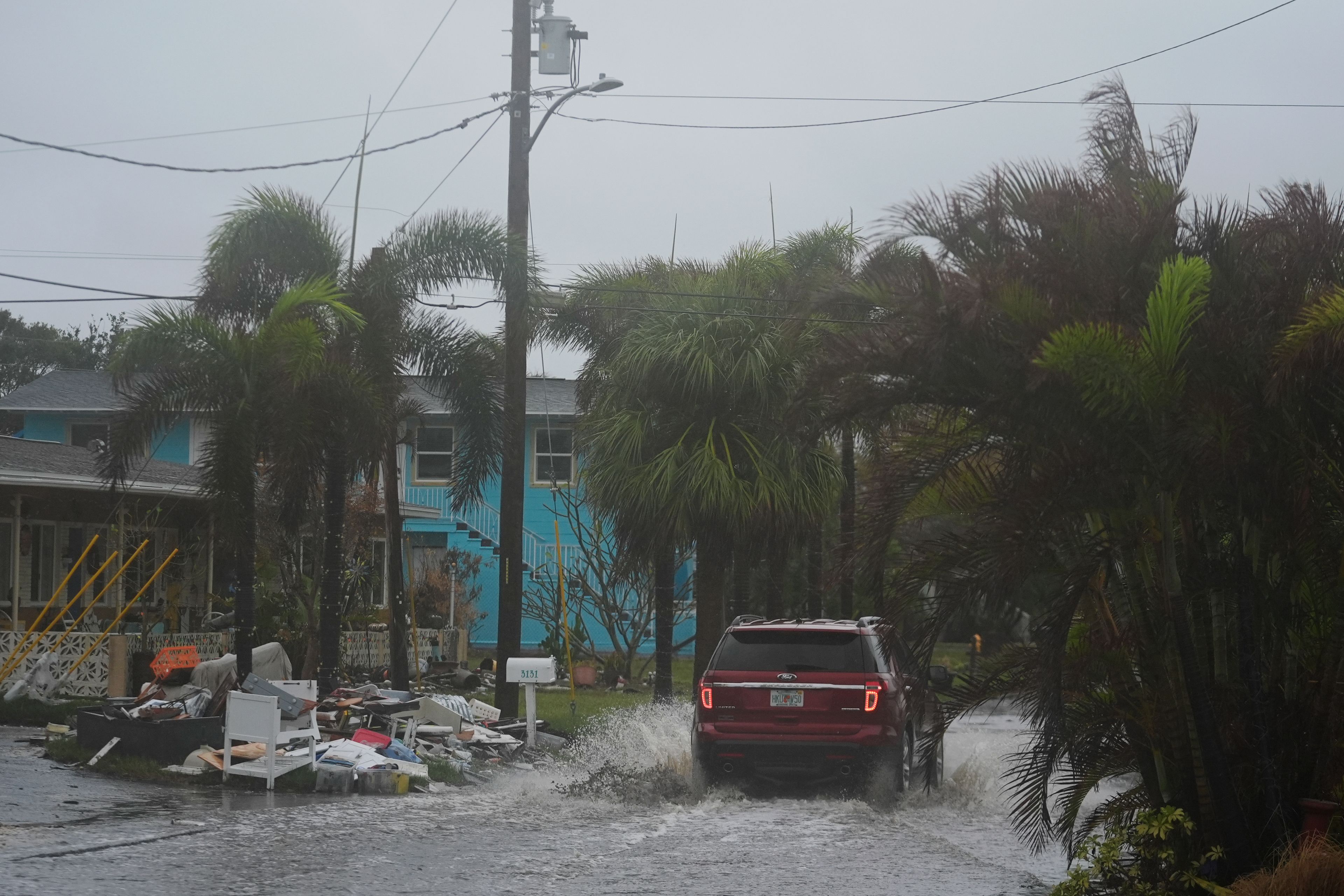
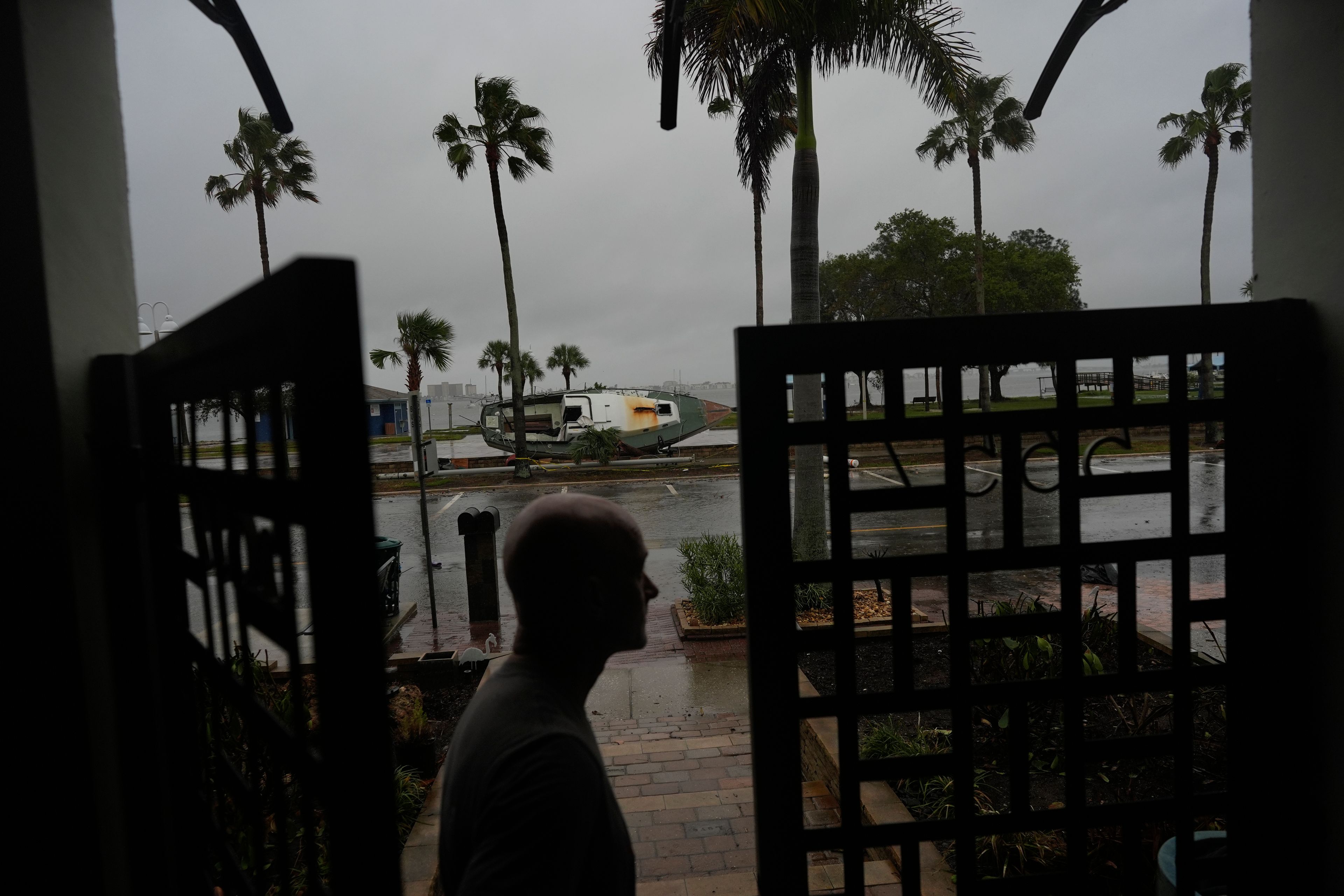
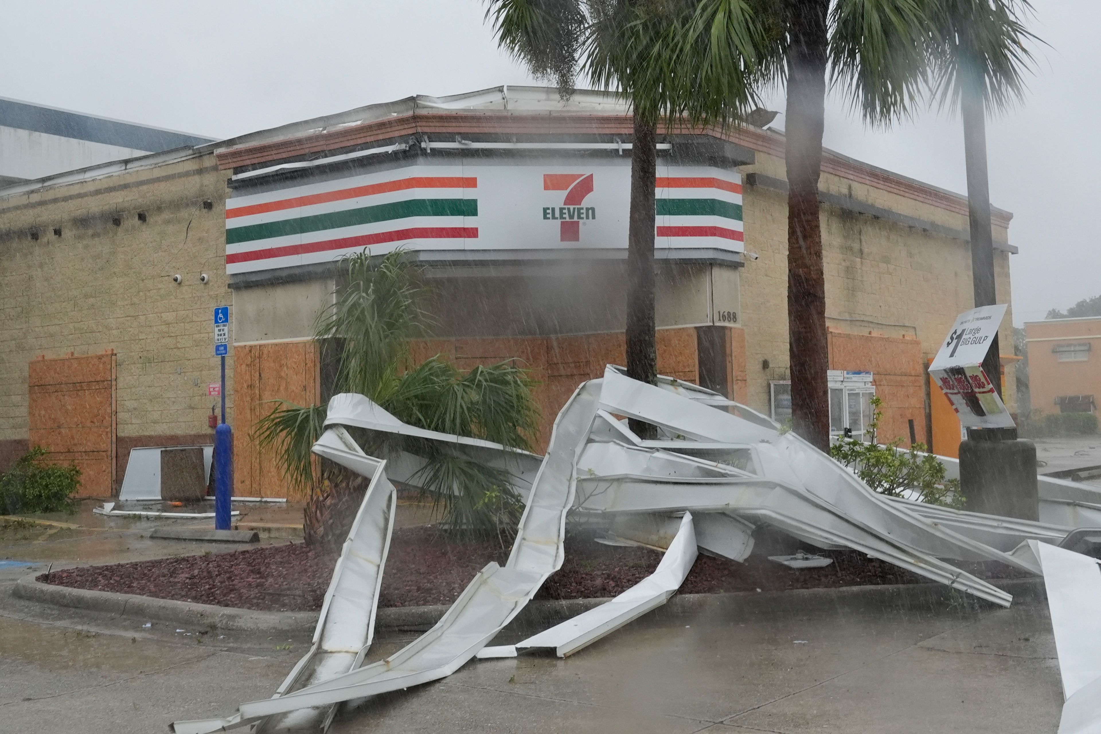
With water piling up with storm surge in this “very, very rare direction," Corbosiero said Milton “has the potential to be a worst-case scenario” if it directly hits Tampa, where the last major hurricane direct hit was in 1921.
“It’s extraordinarily bad,” McNoldy said.
—-
Mary Katherine Wildeman contributed from Hartford, Conn. and Christopher L. Keller contributed from Albuquerque, New Mexico
___
Read more of AP’s climate coverage at http://www.apnews.com/climate-and-environment
___
Follow Seth Borenstein on X at @borenbears
______
The Associated Press’ climate and environmental coverage receives financial support from multiple private foundations. AP is solely responsible for all content. Find AP’s standards for working with philanthropies, a list of supporters and funded coverage areas at AP.org.
Advertisement
Related
Connect with the Southeast Missourian Newsroom:
For corrections to this story or other insights for the editor, click here. To submit a letter to the editor, click here. To learn about the Southeast Missourian’s AI Policy, click here.


Advertisement
Receive Daily Headlines FREESign up today!
